
Berliner Innenstadt in Friedrichshain-Kreuzberg, Germany — Northeast German Plain (The European Plain)
Prinz-Albrecht-Gelände
| — | Geschichtsmeile Wilhelmstraße | — |
Photographed by James Hulse, March 6, 2026
1. Prinz-Albrecht-Gelände Marker

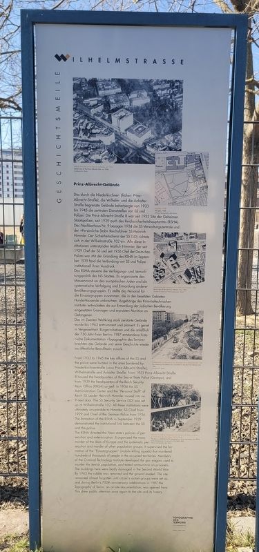
Das RSHA steuerte die Verfolgungs- und Vernichtungspolitik des NS-Staates. Es organisierte den Massenmord an den europäischen Juden und die systematische Verfolgung und Ermordung anderer Bevölkerungsgruppen. Es stellte das Personal für die Einsatzgruppen zusammen, die in den besetzten Gebieten Hunderttausende umbrachten. Angehörige des Kriminaltechnischen Institutes entwickelten die zur Ermordung der jüdischen Bevölkerung eingesetzten Gaswagen und erprobten Munition an Gefangenen.
Das im Zweiten Weltkrieg stark zerstörte Gelände wurde bis 1963 enttrümmert und planiert. Es geriet in Vergessenheit. Bürgerinitiativen und die anläßlich der 750-Jahr-Feier Berlins 1987 entstandene historische Dokumentation »Topographie des Terrors« brachten das Gelände und seine Geschichte wieder ins öffentliche Bewußtsein zurück.
(Bildunterschriften:)
Luftaufnahme des Prinz-Albrecht-Geländes, um 1934, Landesarchiv Berlin
Lageplan, 1938, Stiftung Topographie des Terrors
Luftaufnahme des ehemaligen Prinz-Albrecht-Geländes, 1984, Senator für Bau und Wohnungswesen, Berlin
Freilegung der Fundamente an der ehemaligen Prinz-Albrecht-Straße, 1986, Landesarchiv Berlin
Open-Air Ausstellung »Topographie des Terrors«, Juli 2004. Im Hintergrund die Reste der ehemaligen Berliner Mauer, Stiftung Topographie des Terrors
this page online
The RSHA directed the Nazi state’s policies of persecution and extermination. It organized the mass murder of the Jews of Europe and the systematic persecution and murder of other population groups. It supervised the formation of the “Einsatzgruppen” (mobile killing squads) that murdered hundreds of thousands of people in the occupied territories. Members of the Criminal
Photographed by James Hulse, March 6, 2026
2. Prinz-Albrecht-Gelände Marker (Left Side)
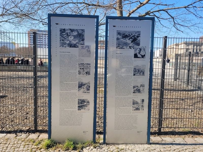
The buildings here were badly damaged in the Second World War. By 1963 the rubble was removed and the ground leveled. The site remained almost forgotten until citizen’s action groups were set up, and during Berlin’s 750th anniversary celebrations in 1987 the Topography of Terror, an on-site documentation, was opened here. This drew public attention once again to the site and its history.
(Captions:)
Aerial view of the Prinz Albrecht Site, ca. 1934, Landesarchiv Berlin
Site plan, 1938, Stiftung Topographie des Terrors
Aerial view of the old Prinz Albrecht Site, 1984, Senator für Bau und Wohnungswesen, Berlin
The remaining foundations are uncovered on the old Prinz Albrecht Site, 1986, Landesarchiv Berlin
The open-air exhibition by the Topography of Terror Foundation, July 2004. In the background is a remnant of the Berlin Wall, Stiftung Topographie des Terrors
Erected by Topographie des Terrors (Topography of Terror Foundation) and Designer Helga Lieser.
Topics. This historical
Photographed by James Hulse, March 6, 2026
3. Prinz-Albrecht-Gelände Marker
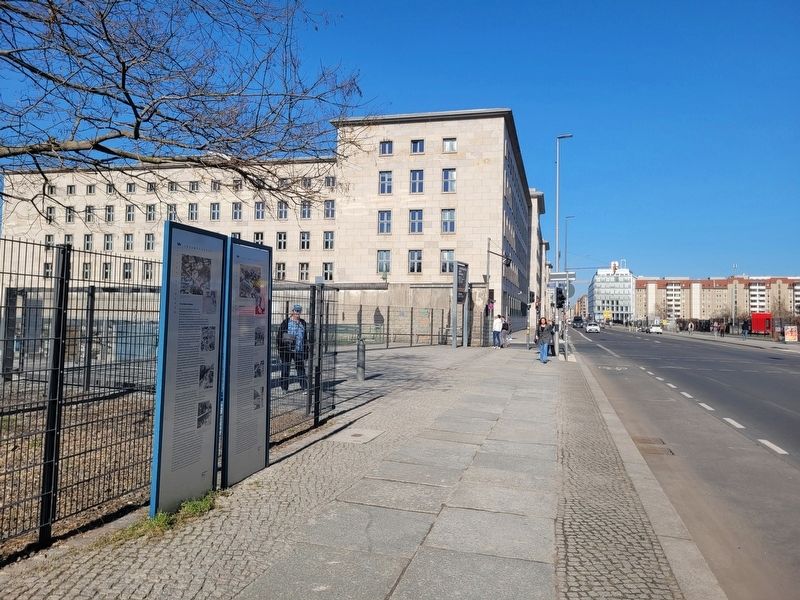
The view of the markers along the street.
Location. 52° 30.427′ N, 13° 23.134′ E. Marker is in Berlin, in Friedrichshain-Kreuzberg. It is in Berliner Innenstadt. It is at the intersection of Niederkirchnerstraße and Zimmerstraße, on the left when traveling north on Niederkirchnerstraße. Touch for map. Marker is at or near this postal address: Niederkirchnerstraße 8, Berlin 10963, Germany. Touch for directions.

Regionally, it is in Europe, the European Union, Atlantic Europe, Central Europe, the Schengen Area, Western Europe, and the Western World. Historically, it finds itself in what was once the Holy Roman Empire.
Other nearby markers. At least 8 other markers are within walking distance of this marker: Berliner Mauer / Berlin Wall (here, next to this marker); Dienststellen von Gestapo und SS / Gestapo and SS Offices (a few steps from this marker); Baudenkmal Berliner Mauer (within shouting distance of this marker); Geschichtsmeile Berliner Mauer / Berlin Wall History Mile (within shouting distance of this marker); Prinz-Albrecht-Palais / Prinz Albrecht Palais (within shouting distance of this marker); History of Berlin’s Government Quarter (within shouting distance of this marker); Hotel Prinz Albrecht (within shouting distance of this marker); Wilhelmstraße 102 (within shouting distance of this marker). Touch for a list and map of all markers in Berlin.
Credits. This page was last revised on September 8, 2026. It was originally submitted on September 8, 2026, by James Hulse of Medina, Texas. This page has been viewed 10 times since then. Photos: 1, 2, 3. submitted on September 8, 2026, by James Hulse of Medina, Texas.
