Green Bay in Prince Edward County, Virginia — The American South (Mid-Atlantic)
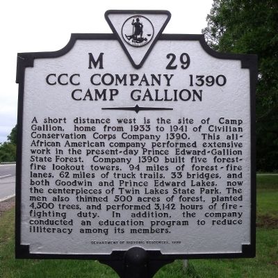
CCC Company 1390
Camp Gallion
Erected 1998 by Department of Historic Resources. (Marker Number M-29.)
Topics and series. This historical marker is listed in these topic lists: African Americans • Charity & Public Work • Education • Horticulture & Forestry. In addition, it is included in the Civilian Conservation Corps (CCC), and the Virginia Department of Historic Resources (DHR) series lists. A significant historical year for this entry is 1933.
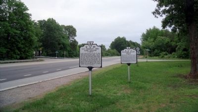
Location. 37° 8.161′ N, 78° 18.697′ W. Marker is in Green Bay, Virginia, in Prince Edward County. Marker is at the intersection of Patrick Henry Highway (U.S. 360) and Tower Road (County Route 623), on the right when traveling west on Patrick Henry Highway. Touch for map. Marker is in this post office area: Green Bay VA 23942, United States of America. Touch for directions.
Other nearby markers. At least 8 other markers are within 5 miles of this marker, measured as the crow flies. Blanche Kelso Bruce (here, next to this marker); St. Matthew's Lutheran Church Christian Day School (approx. 3.1 miles away); Twin Lakes State Park (approx. 3.3 miles away); Pushing the Boundaries (approx. 3.4 miles away); Prince Edward State Park: A Refuge of Freedom (approx. 3.4 miles away); Prince Edward State Park for Negroes (approx. 3˝ miles away); Meherrin Station (approx. 3.8 miles away); a different marker also named Prince Edward State Park for Negroes (approx. 4.1 miles away). Touch for a list and map of all markers in Green Bay.
Credits. This page was last revised on November 11, 2021. It was originally submitted on May 23, 2010, by Bernard Fisher of Richmond, Virginia. This page has been viewed 845 times since then and 39 times this year. Photos: 1, 2. submitted on May 23, 2010, by Bernard Fisher of Richmond, Virginia.

