Tyler in Smith County, Texas — The American South (West South Central)
Cedar Street United Methodist Church
Photographed by Jeff Leichsenring, September 7, 2026
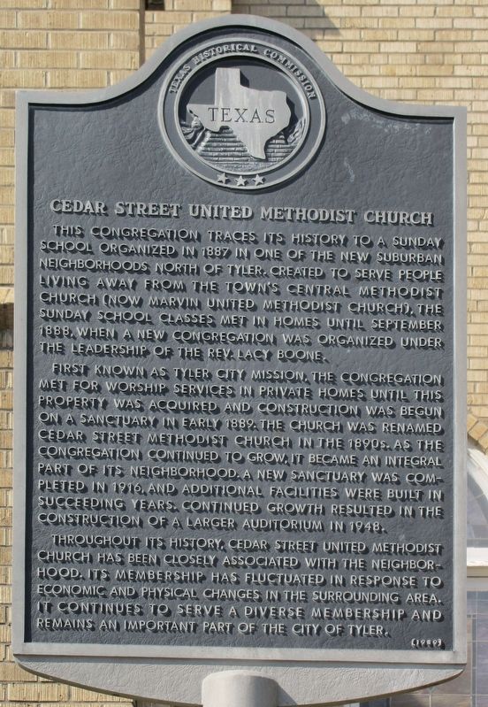
1. Cedar Street United Methodist Church Marker
This congregation traces its history to a Sunday School organized in 1887 in one of the new suburban neighborhoods north of Tyler. Created to serve people living away from the town's central Methodist Church (now Marvin United Methodist Church), the Sunday School classes met in homes until September 1888, when a new congregation was organized under the leadership of the Rev. Lacy Boone.
First known as Tyler City Mission, the congregation met for worship services in private homes until this property was acquired and construction was begun on a sanctuary in early 1889. The church was renamed Cedar Street Methodist Church in the 1890s. As the congregation continued to grow, it became an integral part of its neighborhood. A new sanctuary was completed in 1916, and additional facilities were built in succeeding years. Continued growth resulted in the construction of a larger auditorium in 1948.
Throughout its history, Cedar Street United Methodist Church has been closely associated with the neighborhood. Its membership has fluctuated in response to economic and physical changes in the surrounding area. It continues to
this page online
Erected 1989 by Texas Historical Commission. (Marker Number 7712.)
Topics. This historical marker is listed in this topic list: Religion & Religious Structures. A significant historical month for this entry is September 1888.
Location. 32° 21.866′ N, 95° 17.842′ W. Marker is in Tyler, Texas, in Smith County. It is at the intersection of E Cedar Street and North Church Avenue, on the right when traveling west on E Cedar Street. Touch for map. Marker is at or near this postal address: 1420 N Church Ave, Tyler TX 75702, United States of America. Touch for directions.

Regionally, this marker is in the American South, specifically in the Deep South, and in the Piney Woods. Globally, it is in North America, a Gulf of Mexico state, the Western Hemisphere, the Western World, and the Anglosphere. Historically, it finds itself in what was once New Spain, the Republic of Texas, one of the Confederate States of America, and the Antebellum South.
Other nearby markers. At least 8 other markers are within walking distance of this marker: Major James P. Douglas / Good-Douglas Texas Battery
Photographed by Jeff Leichsenring, September 7, 2026
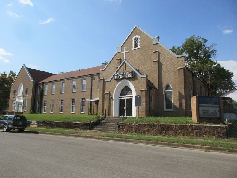
2. Cedar Street United Methodist Church and marker
Credits. This page was last revised on September 12, 2026. It was originally submitted on September 8, 2026, by Jeff Leichsenring of Garland, Texas. This page has been viewed 11 times since then. Photos: 1, 2. submitted on September 8, 2026, by Jeff Leichsenring of Garland, Texas. • James Hulse was the editor who published this page.
