
Pelham Bay Park in the Bronx in Bronx County, New York — The American Northeast (Mid-Atlantic)
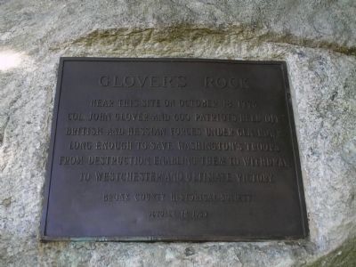
Glover’s Rock
Photographed by Bill Coughlin, June 19, 2010
1. Glover’s Rock Marker
Near this site on October 18, 1776, Col. John Glover and 600 Patriots held off British and Hessian forces under Gen. Howe long enough to save Washington’s troops from destruction, enabling them to withdraw to Westchester and ultimate victory.
Erected 1960 by Bronx County Historical Society.
Topics. This historical marker is listed in this topic list: War, US Revolutionary. A significant historical date for this entry is October 18, 1776.
Location. 40° 51.903′ N, 73° 48.192′ W. Marker is in Bronx, New York, in Bronx County. It is in Pelham Bay Park. It is on Orchard Beach Road 0.2 miles west of Park Drive, on the right when traveling east. Marker is located in Pelham Bay Park. Touch for map. Marker is in this post office area: Bronx NY 10464, United States of America. Touch for directions.

Regionally, this marker is in New York City. It is also in the American Northeast, in the Mid-Atlantic, and on the Eastern Seaboard. Globally, it is in the North Atlantic Region, North America, the Western Hemisphere, the Western World, and the Anglosphere. Historically, it finds itself in what was once New Netherland and also one
this page online
Other nearby markers. At least 8 other markers are within walking distance of this marker: A different marker also named Glover's Rock (a few steps from this marker); Bartow-Pell Mansion (approx. half a mile away); Bartow-Pell Mansion Museum (approx. half a mile away); Col. Lawrence G. Lane (approx. 0.9 miles away); World War II Memorial (approx. 0.9 miles away); Vietnam War Veterans (approx. 0.9 miles away); Korean War Veterans (approx. 0.9 miles away); St. Mary Star of the Sea 9/11 Memorial (approx. one mile away). Touch for a list and map of all markers in Bronx.
Other markers no longer nearby. Glover’s Rock (was a few steps from this marker but has been replaced with another marker now near it); Pell’s Treaty Oak (was approx. 0.6 miles away but has been confirmed missing).
Also see . . .
1. Glover's Rock on Orchard Beach Road Does Not Mark the Site of the Battle of Pelham. Historic Pelham website (Submitted on June 19, 2010, by Bill Coughlin of Woodland Park, New Jersey.)
2. The Battle of Pell’s Point. The American Revolutionary War website. (Submitted on June 19, 2010, by Bill Coughlin of Woodland Park, New Jersey.)
Additional commentary.
1.
Photographed by Bill Coughlin, June 19, 2010
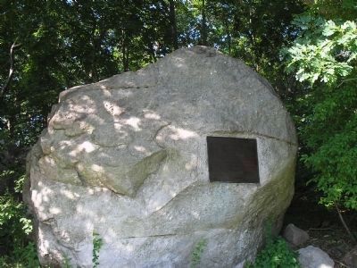
2. Bronx Marker
Despite what the marker states, the Battle of Pelham began at a different location. The confusion resulted from an account of the battle that said that the British landed, and the fighting started, on Pell's Point near a glacial boulder.
The Bronx Chapter of the Daughters of the American Revolution erected a tablet on October 18, 1901 to honor the 125th anniversary of Glover's heroic victory. After it was stolen in the 1930s, the Bronx County Historical Society dedicated another bronze tablet on November 11, 1960 to commemorate this important site.
— Submitted March 7, 2024, by Carolyn Sanders of Plano, Texas.
Photographed by Bill Coughlin, June 19, 2010
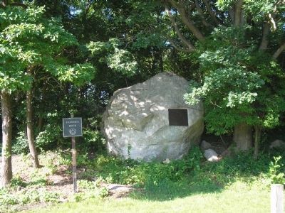
3. Marker in Pelham Bay Park
Photographed by Bill Coughlin, June 19, 2010
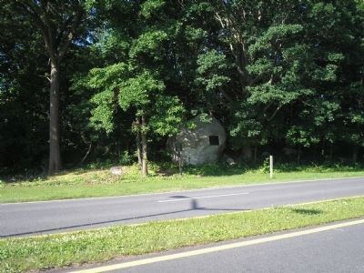
4. Glover’s Rock Marker
Marker is located on a boulder in Pelham Bay Park on Orchard Beach Road.
Credits. This page was last revised on September 9, 2026. It was originally submitted on June 19, 2010, by Bill Coughlin of Woodland Park, New Jersey. This page has been viewed 1,664 times since then and 87 times this year. Last updated on September 8, 2026, by Carl Gordon Moore Jr. of North East, Maryland. Photos: 1, 2, 3, 4. submitted on June 19, 2010, by Bill Coughlin of Woodland Park, New Jersey. • Devry Becker Jones was the editor who published this page.
