Berliner Innenstadt in Mitte, Germany — Northeast German Plain (The European Plain)
Das „Hausgefängnis“ der Gestapo-Zentrale
Geländerundgang
⎯⎯⎯
The “House Prison” at Gestapo Headquarters
Site Tour
| — | Bodendenkmal / Memorial | — |
Photographed by James Hulse, March 6, 2026
1. Das „Hausgefängnis“ der Gestapo-Zentrale / The “House Prison” at Gestapo Headquarters Marker

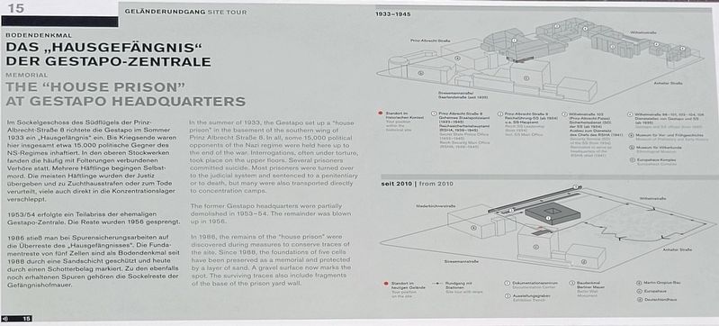
1953/54 erfolgte ein Teilabriss der ehemaligen Gestapo-Zentrale. Die Reste wurden 1956 gesprengt.
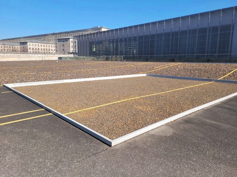
1986 stieß man bei Spurensicherungsarbeiten auf die Überreste des „Hausgefängnisses“. Die Fundamentreste von fünf Zellen sind als Bodendenkmal seit 1988 durch eine Sandschicht geschützt und heute durch einen Schotterbelag markiert. Zu den ebenfalls noch erhaltenen Spuren gehören die Sockelreste der Gefängnishofmauer.
(Bildunterschriften)
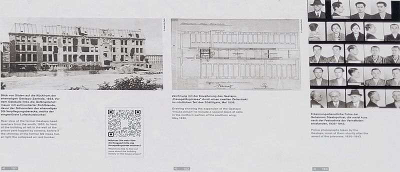
Blick von Süden auf die Rückfront der ehemaligen Gestapo-Zentrale, 1953. Vor dem Gebäude links die Gefängnishofmauer mit aufmontierten Sichtblenden, davor der Schornstein der ehemaligen SS-Verpflegungskaserne, rechts der eingestürzte Luftschutzbunker.
Zeichnung mit der Erweiterung des Gestapo-„Hausgefängnisses“ durch einen zweiten Zellentrakt im nördlichen Teil des Südflügels, Mai 1936.
Erkennungsdienstliche Fotos der Geheimen Staatspolizei, die meist kurz nach der Festnahme der Verhafteten entstanden, 1935–1943.
Blick in eine Einzelzelle des ehemaligen „Hausgefängnisses“, 1948. Die Zellen waren etwa 3,60 m lang und 1,40 bis 1,70 m breit.
Freigelegte Zellenfundamente des ehemaligen Gestapo-„Hausgefängnisses“, September 1986. Die Kränze markieren 5 von insgesamt 20 Zellen des südlichen Zellentrakts.
this page online
The former Gestapo headquarters were partially demolished in 1953–54. The remainder was blown up in 1956.
In 1986, the remains of the “house prison” were discovered during measures to conserve traces of the site. Since 1988, the foundations of five cells have been preserved as a memorial and protected by a layer of sand. A gravel surface now marks the spot. The surviving traces also include fragments of the base of the prison yard wall.
(Captions)
Rear view of the former Gestapo headquarters from the south, 1953. In front of the building at left is the wall of the prison yard topped by screens, before it the chimney of the former SS mess hut, at right the collapsed air raid bunker.
Drawing showing the expansion of the Gestapo “house prison” to include a second block of cells in the northern portion of the southern wing, May 1936.
Police photographs taken by the Gestapo, most of them shortly after the arrest of the prisoners, 1935–1943.
View of a single cell in the former “house prison,” 1948. The cells were about 3.6 m long and between 1.4 and 1.7 m wide.
The excavated foundations of several cells of the former Gestapo “house prison,” September 1986. The wreaths mark 5 of a total of 20 cells in the southern cellblock.
Erected by Topography
Photographed by James Hulse, March 6, 2026
2. Das „Hausgefängnis“ der Gestapo-Zentrale / The “House Prison” at Gestapo Headquarters Marker
Topics. This historical marker is listed in this topic list: War, World II. A significant historical month for this entry is May 1936.
Location. 52° 30.381′ N, 13° 22.987′ E. Marker is in Berlin, in Mitte. It is in Berliner Innenstadt. It is on Niederkirchnerstraße just west of Wilhelmstrasse. The marker is located on the grounds of the Topography of Terror Documentation Center (free history museum). Touch for map. Marker is at or near this postal address: Niederkirchnerstraße 8, Berlin 10963, Germany. Touch for directions.

Regionally, it is in Europe, the European Union, Atlantic Europe, Central Europe, the Schengen Area, Western Europe, and the Western World. Historically, it finds itself in what was once the Holy Roman Empire.
Other nearby markers. At least 8 other markers are within walking distance of this marker: Das Hausgefängnis des Geheimen Staatspolizeiamts (within shouting distance of this marker); Verpflegungsbaracke der SS / SS Mess Hut (within shouting distance of this marker); NS-Luftschutzbauten / Nazi Air Raid Protection Structures (within shouting distance of this marker); Europahaus-Komplex / Europahaus Complex (within shouting distance of this marker); Baudenkmal Berliner Mauer / Berlin Wall Monument (about 90 meters away, measured in a direct line); Topographie des Terrors / Topography of Terror (about 90 meters away); Remains of the Berlin Wall (about 90 meters away); Gestapo-Zentrale / Gestapo Headquarters (about 90 meters away). Touch for a list and map of all markers in Berlin.
Photographed by James Hulse, March 6, 2026
3. Das „Hausgefängnis“ der Gestapo-Zentrale / The “House Prison” at Gestapo Headquarters Marker

Photographed by James Hulse, March 6, 2026
4. Das „Hausgefängnis“ der Gestapo-Zentrale / The “House Prison” at Gestapo Headquarters Marker
Photographed by James Hulse, March 6, 2026
5. Das „Hausgefängnis“ der Gestapo-Zentrale / The “House Prison” at Gestapo Headquarters Marker
Photographed by James Hulse, March 6, 2026
6. Das „Hausgefängnis“ der Gestapo-Zentrale / The “House Prison” at Gestapo Headquarters Marker
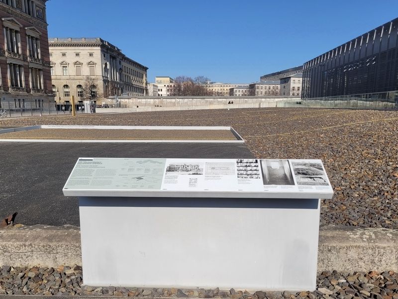
The yellow lines represent the former prison cells of the Gestapo.
Credits. This page was last revised on September 10, 2026. It was originally submitted on September 8, 2026, by James Hulse of Medina, Texas. This page has been viewed 7 times since then. Photos: 1, 2, 3, 4, 5, 6. submitted on September 10, 2026, by James Hulse of Medina, Texas.
