Leagueville in Henderson County, Texas — The American South (West South Central)
Leagueville Baptist Church
Photographed by Jeff Leichsenring, September 7, 2026
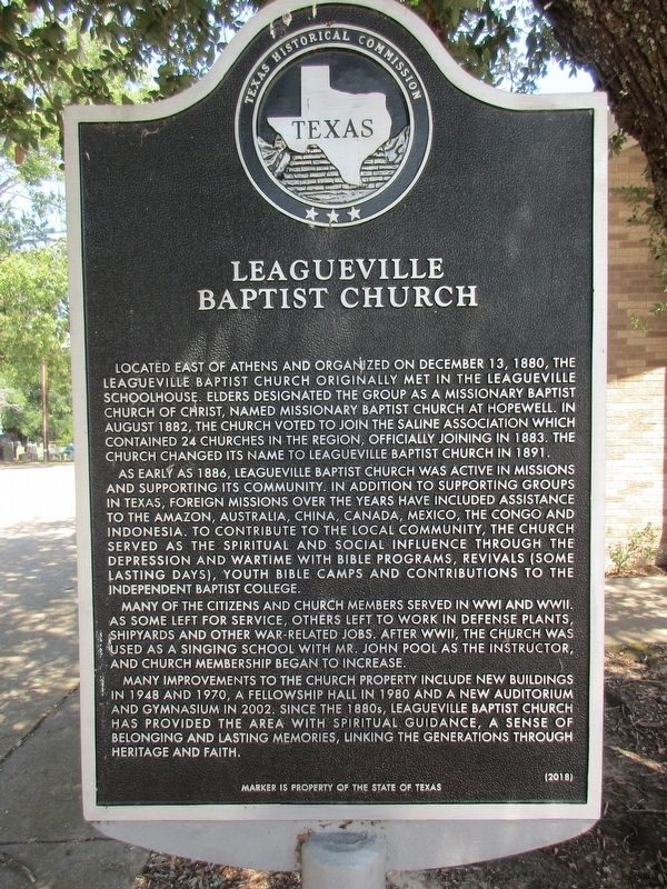
1. Leagueville Baptist Church Marker
Located east of Athens and organized on December 13, 1880, the Leagueville Baptist Church originally met in the Leagueville schoolhouse. Elders designated the group as a Missionary Baptist Church of Christ, named Missionary Baptist Church at Hopewell. In August 1882, the church voted to join the Saline Association which contained 24 churches in the region, officially joining in 1883. The church changed its name to Leagueville Baptist Church in 1891.
As early as 1886, Leagueville Baptist Church was active in missions and supporting its community. In addition to supporting groups in Texas, foreign missions over the years have included assistance to the Amazon, Australia, China, Canada, Mexico, the Congo and Indonesia. To contribute to the local community, the church served as the spiritual and social influence through the depression and wartime with bible programs, revivals (some lasting days), youth bible camps and contributions to the Independent Baptist College.
Many of the citizens and church members served in WWI and WWII. As some left for service, others left to work in defense plants, shipyards
this page online
Many improvements to the church property include new buildings in 1948 and 1970, a fellowship hall in 1980 and a new auditorium and gymnasium in 2002. Since the 1880s, Leagueville Baptist Church has provided the area with spiritual guidance, a sense of belonging and lasting memories, linking the generations through heritage and faith.
Erected 2018 by Texas Historical Commission. (Marker Number 19982.)
Topics. This historical marker is listed in this topic list: Religion & Religious Structures. A significant historical month for this entry is August 1882.
Location. 32° 13.845′ N, 95° 39.344′ W. Marker is in Leagueville, Texas, in Henderson County. It is at the intersection of Farm to Market Road 317 and Farm to Market Road 607, on the right when traveling west on Road 317. Touch for map. Marker is at or near this postal address: 12081 FM 317, Murchison TX 75778, United States of America. Touch for directions.

Regionally, this marker is in the American South and in the Piney
Photographed by Jeff Leichsenring, September 7, 2026
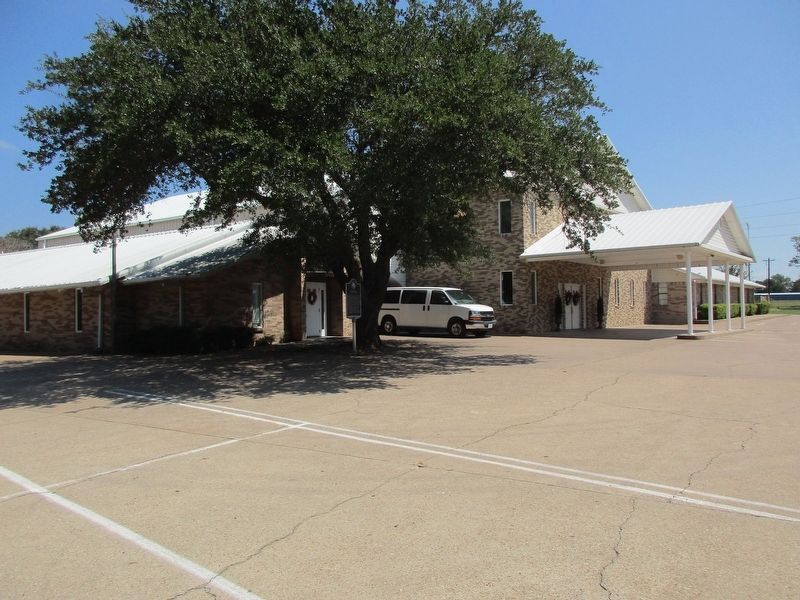
2. Leagueville Baptist Church AND Marker
Other nearby markers. At least 8 other markers are within 5 miles of this marker, measured as the crow flies: Leagueville Cemetery (within shouting distance of this marker); Black Jack Cemetery (approx. 3.4 miles away); Mount Zion Baptist Church (approx. 3½ miles away); New Hope United Methodist Church (approx. 3.7 miles away); Echols Cemetery on Jennings Mountain (approx. 3.8 miles away); Arthur C. Horton, M.D. (approx. 4.3 miles away); Red Hill Cemetery (approx. 4.3 miles away); Davis Reynolds (approx. 4.4 miles away).
Credits. This page was last revised on September 12, 2026. It was originally submitted on September 9, 2026, by Jeff Leichsenring of Garland, Texas. This page has been viewed 6 times since then. Photos: 1, 2. submitted on September 9, 2026, by Jeff Leichsenring of Garland, Texas. • James Hulse was the editor who published this page.
