Near Mabank in Henderson County, Texas — The American South (West South Central)
Ham (Pauline)
Photographed by Jeff Leichsenring, September 7, 2026
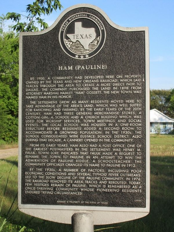
1. Ham (Pauline) Marker
By 1900, a community had developed here on property owned by the Texas and New Orleans Railroad, which laid tracks through the area to create a more direct path to Dallas. The company purchased land in 1898 from attorney Marshal Hamlet "Ham" Gossett. The new town was named Ham in his honor.
The settlement grew as many residents moved here to take advantage of the area's land, which was well suited for ranching and farming. By the early years of the 20th century, Ham had three general merchandise stores, a cotton gin, a school and a church building which was used for worship servies, town meetings and social events. The local school was housed in a one-room structure before residents added a second room to accommodate a growing population. In the 1930s, the school consolidated with Eustace School District. Also during that decade, a cannery opened in the community.
From its early years, Ham also had a post office; one of the earliest postmasters in the settlement was Henry M. Faulk. Town lore indicates that Faulk made a request to rename the town to Pauline in an attempt to win the admiration of Pauline Riddle, a schoolteacher.
this page online
By the 1930s, a number of factors, including poor economic conditions and several typhoid fever outbreaks, led to the slow decline of the Pauline community. In 1976, the railroad removed its area tracks and rerouted. Today, few vestiges remain of Pauline, which is remembered as a once-thriving community whose pioneering residents endured trying circumstances.
Erected 2008 by Texas Historical Commission. (Marker Number 15138.)
Topics. This historical marker is listed in this topic list: Settlements & Settlers. A significant historical year for this entry is 1900.
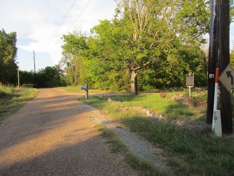
Location. 32° 19.693′ N, 96° 3.172′ W. Marker is near Mabank, Texas, in Henderson County. It is on Pecan Road near Texas Highway 334, on the left when traveling south. Touch for map. Marker is at or near this postal address: 162 Pecan Rd, Mabank TX 75156, United States of America. Touch for directions.

Regionally, this marker is in the American South and in the Piney Woods. Globally, it is in North America, a Gulf of Mexico state, the Western Hemisphere, the Western World, and the Anglosphere. Historically,
Photographed by Jeff Leichsenring, September 7, 2026
2. Ham (Pauline) Marker
Other nearby markers. At least 8 other markers are within 4 miles of this marker, measured as the crow flies: Site of Centerville (approx. 1.9 miles away); Goshen Cemetery (approx. 2.9 miles away); Lee Powell Simpson (approx. 3½ miles away); Payne Springs Methodist Church and Cemetery (approx. 3.6 miles away); First Baptist Church of Mabank (approx. 3.8 miles away); Moorehead-Melton Cemetery (approx. 3.9 miles away); Roddy Lodge No. 734, A.F. & A.M. (approx. 3.9 miles away); First Presbyterian Church of Mabank (approx. 4 miles away). Touch for a list and map of all markers in Mabank.
Credits. This page was last revised on September 12, 2026. It was originally submitted on September 9, 2026, by Jeff Leichsenring of Garland, Texas. This page has been viewed 6 times since then. Photos: 1, 2. submitted on September 9, 2026, by Jeff Leichsenring of Garland, Texas. • James Hulse was the editor who published this page.
