Enkhuizen, North Holland, Netherlands — Northwestern Europe
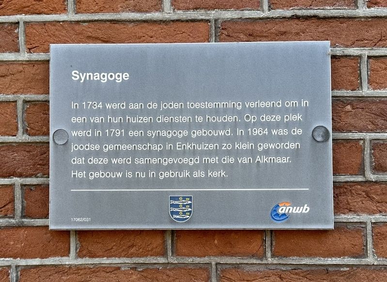
Synagoge
⎯⎯⎯
Synagogue
Photographed by Andrew Ruppenstein, September 7, 2026
1. Synagoge / Synagogue Marker

Erected by Gemeente Enkhuizen, ANWB. (Marker Number 17062/031.)
Topics and series. This historical marker is listed in this topic list: Religion & Religious Structures. In addition, it is included in the Synagogues series list. A significant historical year for this entry is 1734.
Location. 52° 42.191′ N, 5° 17.638′ E. Marker is in Enkhuizen, Noord-Holland (North Holland). It is on Zuider Havendijk, on the right when traveling north. Touch for map. Marker is at or near this postal address: Zuider Havendijk 25, Enkhuizen, Noord-Holland 1601 NC, Netherlands.
this page online

Regionally, it is in Europe, the European Union, Atlantic Europe, the Benelux Low Countries, the Schengen Area, Western Europe, and the Western World. Historically, it finds itself in what was once the Holy Roman Empire.
Other nearby markers. At least 8 other markers are within walking distance of this marker: St. Pancras- of Zuidertoren / St. Pancras- or Southern Tower (about 120 meters away, measured in a direct line); Gevangenis / Prison (about 120 meters away); Vermaning (Doopsgezinde kerk) / Vermaning (Mennonite Church) (approx. 0.2 kilometers away); Enkhuizen Harbor Bombardment Memorial (approx. 0.3 kilometers away); De Munt / The Mint (approx. half a kilometer away); Soephuisje / Soup House (approx. 0.6 kilometers away); Westerstraat 158 (approx. 0.6 kilometers away); Genaamt: Het Huis van Gemak (approx. one kilometer away). Touch for a list and map of all markers in Enkhuizen.
Also see . . . Enkhuizen (Joods Cultureel Kwartier). Excerpt:
During World War II, the Jews of Enkhuizen fared better than Jews elsewhere. The mayor of Enkhuizen refused to cooperate in the expulsion of Jewish(Submitted on September 9, 2026.)children from public schools. In 1943, faced with deportation to Amsterdam, most Enkuizen Jews fled into hiding, enabling many to survive the war.Photographed by Andrew Ruppenstein, September 7, 20262. Synagoge / Synagogue Marker - wide view
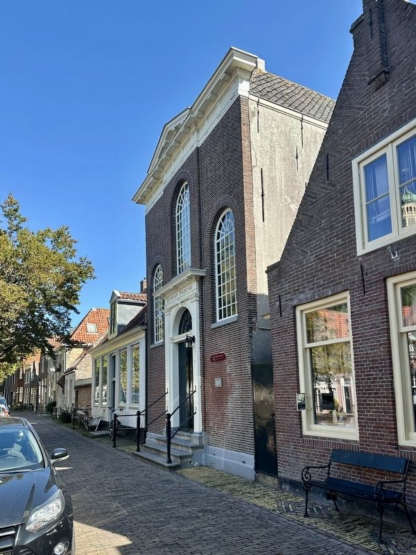
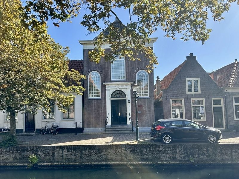
After the war, only a few Jews continued to reside in Enkhuizen. In 1964, the community was merged into that of the city of Alkmaar. Although the synagogue came through the German occupation unharmed, it now houses a church. The Holy Ark of the former synagogue is now in the collection of the Jewish Historical Museum in Amsterdam. Enkuizen's Jewish cemetery and its roughly 130 graves are maintained by the local authorities.
Photographed by Andrew Ruppenstein, September 7, 2026
3. Synagoge / Synagogue
Credits. This page was last revised on September 9, 2026. It was originally submitted on September 9, 2026, by Andrew Ruppenstein of Lamorinda, California. This page has been viewed 7 times since then. Photos: 1, 2, 3. submitted on September 9, 2026, by Andrew Ruppenstein of Lamorinda, California.
