Enkhuizen, North Holland, Netherlands — Northwestern Europe
Westerpoort of Koepoort
⎯⎯⎯
Western Gate or Cow Gate
Photographed by Andrew Ruppenstein, September 7, 2026
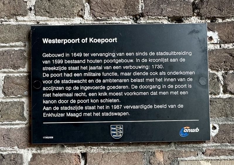
1. Westerpoort of Koepoort / West Gate or Cow Gate Marker

Gebouwd in 1649 ter vervanging van een sinds de stadsuitbreiding van 1599 bestaand houten poortgebouw. In de kroonlijst aan de streekzijde staat het jaartal van een verbouwing: 1730.
De poort had een militaire functie, maar diende ook als onderkomen voor de stadswacht en de ambtenaren belast met het innen van de accijnzen op de ingevoerde goederen. De doorgang in de poort is niet helemaal recht, een knik moest voorkomen dat men met een kanon door de poort kon schieten.
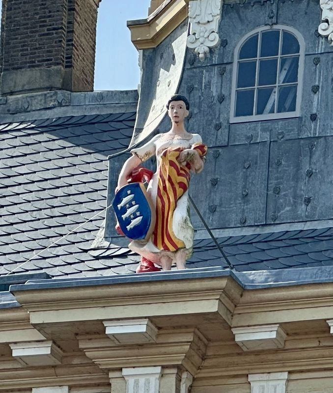
Aan de stadszijde staat het in 1987 vervaardigde beeld van de Enkhuizer Maagd met het stadswapen.
Westerpoort (Western Gate) or Koepoort (Cow Gate)
Built in 1649 to replace a wooden gatehouse that had stood there since the city expansion of 1599. The cornice on the outer side bears the date of a renovation: 1730.
The gate served a military function but also housed the city guard and the officials responsible for collecting excise duties on imported goods. The passageway through the gate is not perfectly straight; a bend was incorporated to prevent a cannon from being fired directly
this page online
On the city-facing side stands the statue of the Maiden of Enkhuizen, featuring the city coat of arms, which was created in 1987.
Erected by Gemeente Enkhuizen, ANWB. (Marker Number 17062/009.)
Topics. This historical marker is listed in these topic lists: Forts and Castles • Industry & Commerce. A significant historical year for this entry is 1649.
Location. 52° 42.097′ N, 5° 16.625′ E. Marker is in Enkhuizen, Noord-Holland (North Holland). It is at the intersection of Westeinde and Westerstraat, on the right when traveling north on Westeinde. Touch for map. Touch for directions.

Regionally, it is in Europe, the European Union, Atlantic Europe, the Benelux Low Countries, the Schengen Area, Western Europe, and the Western World. Historically, it finds itself in what was once the Holy Roman Empire.
Other nearby markers. At least 8 other markers are within walking distance of this marker: Genaamt: Het Huis van Gemak (about 120 meters away, measured in a direct line); Westerstraat 158 (approx. 0.6 kilometers away); Soephuisje / Soup House (approx. 0.6 kilometers away); De Munt / The Mint (approx.
Photographed by Andrew Ruppenstein, September 7, 2026
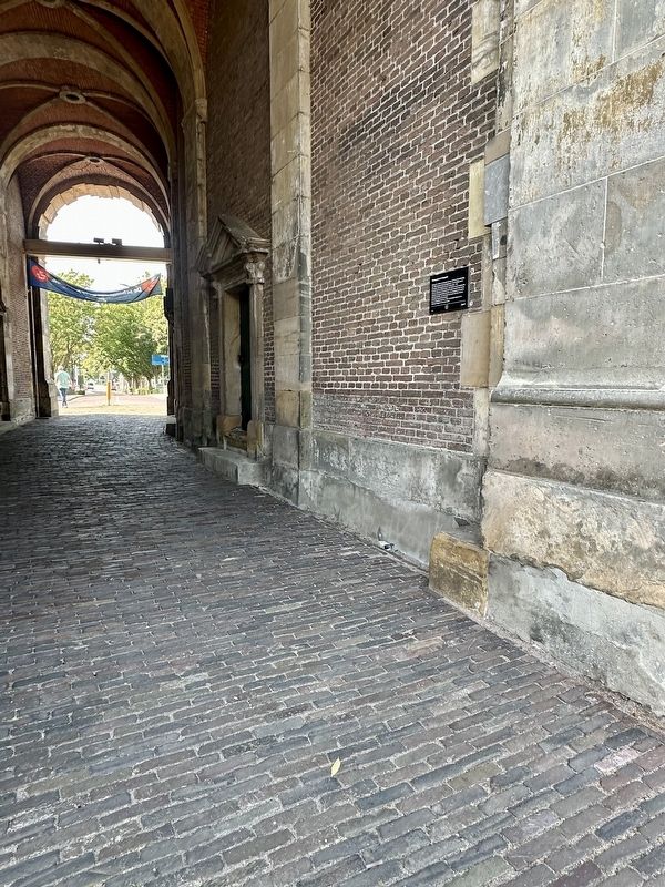
2. Westerpoort of Koepoort / Western Gate or Cow Gate Marker - wide view
The marker is is visible just as one enters the gate from the eastern side.
Also see . . . Koepoort (Wikipedia). Excerpt:
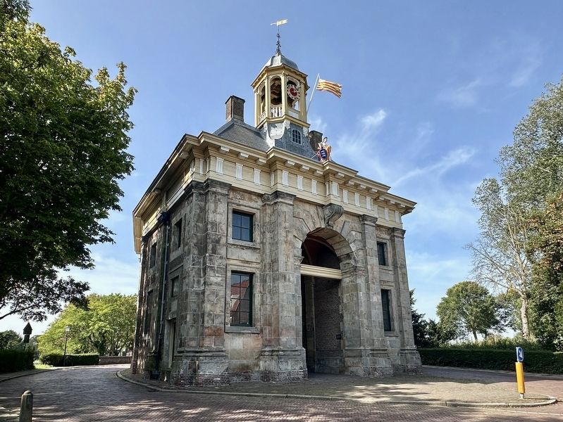
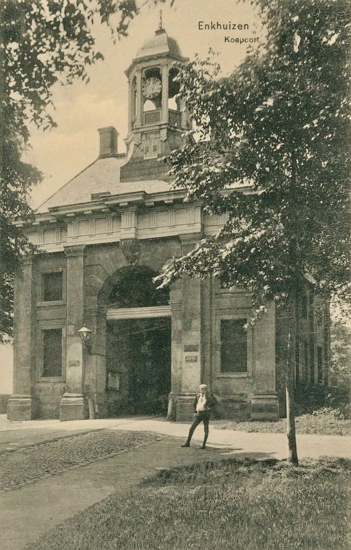
Between 1590 and 1593 Enkhuizen was extended toward the west. A new city wall was built with a moat and seven bastions. At the Koepoort's current location, a wooden gate and a drawbridge were built. Half a century later plans were made for a stone gate building. The Koepoort's architect is probably Jacob van Campen. In 1649 the foundation stone was installed, but it soon turned out that there was no sufficient supply of the Bentheimer sandstone that was used in the design. The gate was finished provisionally in 1654. Traffic was guided through the gate. Because of a paved road towards Hoorn that was made in 1672, a big chunk of all the city's traffic came in through the gate. The Koepoort soon began to(Submitted on September 10, 2026.)decay because of lacking maintenance. In 1730 the gate was restored and a cupola was added. In 1793 a clockwork was placed inside the cupola.Photographed by Andrew Ruppenstein, September 7, 20263. Westerpoort of Koepoort / Western Gate or Cow Gate Marker - eastern side
Since 1930, the traffic is guided around the gate. The main street of Enkhuizen, the Westerstraat, ends at the Koepoort and continues as Westeinde. In 1987 a statue of the so called "Stedemaagd" was placed at the city side of the gate. The statue was made by Han Sterk.
Photographed by Andrew Ruppenstein, September 7, 2026
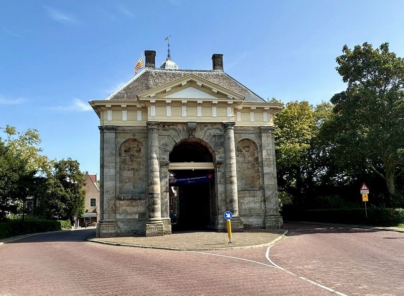
4. Westerpoort of Koepoort / Western Gate or Cow Gate - western side
Photographed by Andrew Ruppenstein, September 7, 2026
5. Maiden of Enkhuizen (mentioned on the marker)
She is bearing, as noted on the marker, the Enkhuizen coat of arms (3 herring on a field of blue), as well as the Enkhuizen flag.
Weenenk & Snel, den Haag (courtesy Trinity College, Watkinson Library), circa 1910
6. Enkhuizen, Koepoort (eastern side)
Credits. This page was last revised on September 10, 2026. It was originally submitted on September 10, 2026, by Andrew Ruppenstein of Lamorinda, California. This page has been viewed 5 times since then. Photos: 1, 2, 3, 4, 5, 6. submitted on September 10, 2026, by Andrew Ruppenstein of Lamorinda, California.
