Enkhuizen, North Holland, Netherlands — Northwestern Europe
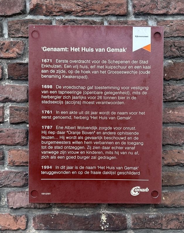
Genaamt: Het Huis van Gemak
| — | Rijksmonument | — |
Photographed by Andrew Ruppenstein, September 7, 2026
1. Genaamt: Het Huis van Gemak Marker

1671 Eerste overdracht voor de Schepenen der Stad Enkhuizen. Een vrij huis, erf met kuipschuur en een kaai aan de zijde, op de hoek van het Groeseswechje (oude benaming Kwakerspad).
1698 De vroedschap gaf toestemming voor vestiging van een tapneeringe (openbare gelegenheid), mits de herbergier zich jaarlijks voor 26 tonnen bier in de stadsexcijs (accijns) moest verantwoorden.
1761 In een akte uit dit jaar wordt de naam voor het eerst genoemd, herberg 'Het Huis van Gemak'.
1787 Ene Albert Wolvendijk zorgde voor onrust. Hij riep daar "Oranje Boven" en andere ophitsende leuzen... Hij wordt als gevaarlijk beschouwd en de burgemeesters willen hem verbannen en de toegang tot de stad ontzeggen. Zij zien daar echter vanaf vanwege zijn vrouw en kinderen, mits hij van nu af, zich als een goed burger zal gedragen.
1994 In dit jaar is de naam 'Het Huis van Gemak' teruggevonden en op de fraaie daklijst geschilderd
'Named: The House van Gemak'
1671 First transfer of ownership recorded before the Aldermen of the City of Enkhuizen. A freehold
this page online
1698 The City Council granted permission to establish a tavern (public house), on the condition that the innkeeper accounted for 26 barrels of beer annually for the purpose of city excise duties.
1761 A deed from this year mentions the name for the first time: the inn 'Het Huis van Gemak'.
1787 A certain Albert Wolvendijk caused a disturbance. He shouted "Oranje Boven" and other inflammatory slogans... He was considered dangerous, and the mayors intended to banish him and bar him from the city. However, they decided against this out of consideration for his wife and children, provided he conducted himself as a good citizen from then on.
1994 In this year, the name 'Het Huis van Gemak' was rediscovered and painted onto the beautiful cornice.
Erected by the ANWB. (Marker Number 15012/001.)
Topics. This historical marker is listed in these topic lists: Industry & Commerce • Notable Buildings. A significant historical year for this entry is 1671.
Location. 52° 42.118′ N, 5° 16.732′ E. Marker
Photographed by Andrew Ruppenstein, September 7, 2026
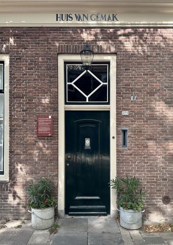
2. Genaamt: Het Huis van Gemak Marker - wide view

Regionally, it is in Europe, the European Union, Atlantic Europe, the Benelux Low Countries, the Schengen Area, Western Europe, and the Western World. Historically, it finds itself in what was once the Holy Roman Empire.
Other nearby markers. At least 8 other markers are within walking distance of this marker: Westerpoort of Koepoort / Western Gate or Cow Gate (about 120 meters away, measured in a direct line); Westerstraat 158 (approx. 0.4 kilometers away); Soephuisje / Soup House (approx. half a kilometer away); De Munt / The Mint (approx. 0.6 kilometers away); Vermaning (Doopsgezinde kerk) / Vermaning (Mennonite Church) (approx. 0.8 kilometers away); St. Pancras- of Zuidertoren / St. Pancras- or Southern Tower (approx. 0.9 kilometers away); Enkhuizen Harbor Bombardment Memorial (approx. one kilometer away); Synagoge / Synagogue
Photographed by Andrew Ruppenstein, September 7, 2026
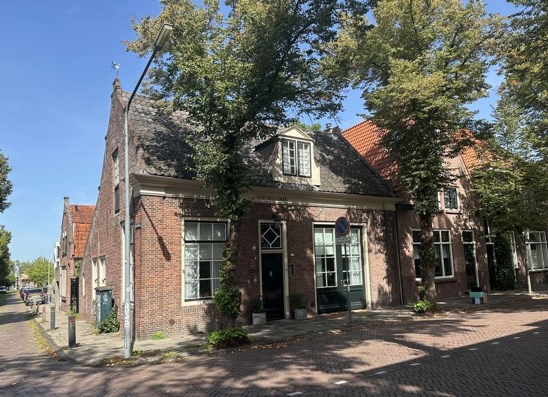
3. The Huis van Gemak and marker
Credits. This page was last revised on September 11, 2026. It was originally submitted on September 11, 2026, by Andrew Ruppenstein of Lamorinda, California. This page has been viewed 4 times since then. Photos: 1, 2, 3. submitted on September 11, 2026, by Andrew Ruppenstein of Lamorinda, California.
