
Berliner Innenstadt in Mitte, Germany — Northeast German Plain (The European Plain)
Haupteinfahrt der Gestapo-Zentrale
Geländerundgang
⎯⎯⎯
Main Driveway to Gestapo Headquarters
Site Tour
| — | 1933-1945 | — |
Photographed by James Hulse, March 6, 2026
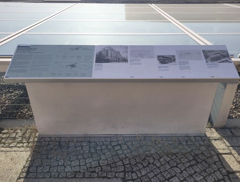
1. Haupteinfahrt der Gestapo-Zentrale / Main Driveway to Gestapo Headquarters Marker

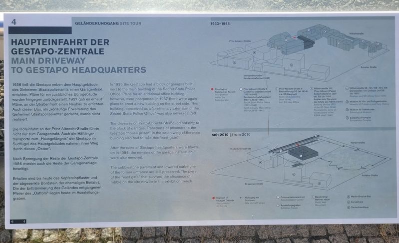
Die Hofeinfahrt an der Prinz-Albrecht-Straße führte nicht nur zum Garagentrakt. Auch die Häftlingstransporte zum „Hausgefängnis“ der Gestapo im Südflügel des Hauptgebäudes nahmen ihren Weg durch dieses „Osttor“.
Nach Sprengung der Reste der Gestapo-Zentrale 1956 wurden auch die Reste der Garagenanlage beseitigt.
Erhalten sind bis heute das Kopfsteinpflaster und der abgesenkte Bordstein der ehemaligen Einfahrt. Die der Enttrümmerung des Geländes entgangenen Pfeiler des „Osttors“ liegen heute im Ausstellungsgraben.
(Bildunterschriften)
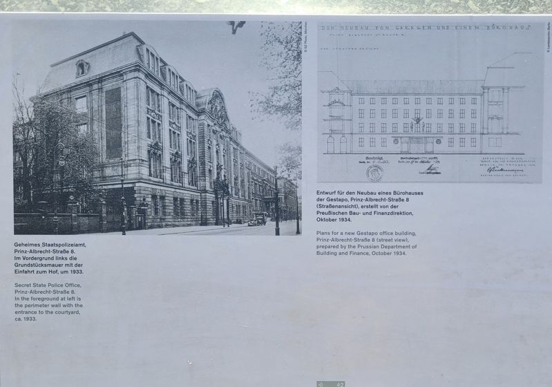
Geheimes Staatspolizeiamt, Prinz-Albrecht-Straße 8. Im Vordergrund links die Grundstücksmauer mit der Einfahrt zum Hof, um 1933.
Entwurf für den Neubau eines Bürohauses der Gestapo, Prinz-Albrecht-Straße 8 (Straßenansicht), erstellt von der Preußischen Bau- und Finanzdirektion, Oktober 1934.
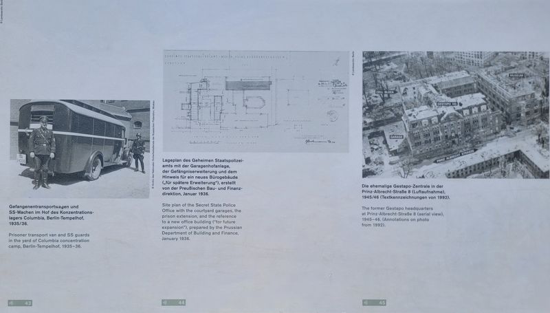
Gefangenentransportwagen und SS-Wachen im Hof des Konzentrationslagers Columbia, Berlin-Tempelhof, 1935/36.
Lageplan des Geheimen Staatspolizeiamts mit der Garagenhofanlage, der Gefängniserweiterung und dem Hinweis für ein neues Bürogebäude („für spätere Erweiterung“), erstellt von der Preußischen Bau- und Finanzdirektion, Januar 1936.
Die ehemalige Gestapo-Zentrale in der Prinz-Albrecht-Straße 8 (Luftaufnahme), 1945/46 (Textkennzeichnungen von 1992).
this page online
The driveway on Prinz-Albrecht-Straße led not only to the block of garages. Transports of prisoners to the Gestapo “house prison” in the south wing of the main building also had to take this “east gate.”
After the ruins of Gestapo headquarters were blown up in 1956, the remains of the garage installation were also removed.
The cobblestone pavement and lowered curbstone of the former entrance are still preserved. The piers of the “east gate” that survived the clearance of rubble on the site now lie in the exhibition trench.
(Captions)
Secret State Police Office, Prinz-Albrecht-Straße 8. In the foreground at left is the perimeter wall with the entrance to the courtyard, ca. 1933.
Plans for a new Gestapo office building, Prinz-Albrecht-Straße 8 (street view), prepared by the Prussian Department of Building and Finance, October 1934.
Prisoner transport van and SS guards in the yard of Columbia concentration camp, Berlin-Tempelhof, 1935–36.
Site plan of the Secret State Police Office with the courtyard garages, the prison extension, and the reference to a new office building (“for future expansion”), prepared by the Prussian Department of Building and Finance, January 1936.
The former Gestapo headquarters at Prinz-Albrecht-Straße 8 (aerial view), 1945–46. (Annotations on photo from 1992.)
Erected by Topography
Photographed by James Hulse, March 6, 2026
2. Haupteinfahrt der Gestapo-Zentrale / Main Driveway to Gestapo Headquarters Marker
Topics. This historical marker is listed in this topic list: War, World II. A significant historical month for this entry is January 1936.
Location. 52° 30.435′ N, 13° 23.044′ E. Marker is in Berlin, in Mitte. It is in Berliner Innenstadt. It is on Niederkirchnerstraße just west of Wilhelmstrasse, on the left when traveling west. The marker is located on the grounds of the Topography of Terror Documentation Center (free history museum). Touch for map. Marker is at or near this postal address: Niederkirchnerstraße 8, Berlin 10963, Germany. Touch for directions.

Regionally, it is in Europe, the European Union, Atlantic Europe, Central Europe, the Schengen Area, Western Europe, and the Western World. Historically, it finds itself in what was once the Holy Roman Empire.
Other nearby markers. At least 8 other markers are within walking distance of this marker: Topography of Terror (within shouting distance of this marker); Topographie des Terrors / Topography of Terror (within shouting distance of this marker); Hotel Prinz Albrecht (within shouting distance of this marker); Gestapo-Zentrale / Gestapo Headquarters (within shouting distance of this marker); Baudenkmal Berliner Mauer (about 90 meters away, measured in a direct line); Baudenkmal Berliner Mauer / Berlin Wall Monument (about 90 meters away); Remains of the Berlin Wall (about 90 meters away); a different marker also named Baudenkmal Berliner Mauer / Berlin Wall Monument (about 90 meters away). Touch for a list and map of all markers in Berlin.
Photographed by James Hulse, March 6, 2026
3. Haupteinfahrt der Gestapo-Zentrale / Main Driveway to Gestapo Headquarters Marker
Photographed by James Hulse, March 6, 2026
4. Haupteinfahrt der Gestapo-Zentrale / Main Driveway to Gestapo Headquarters Marker
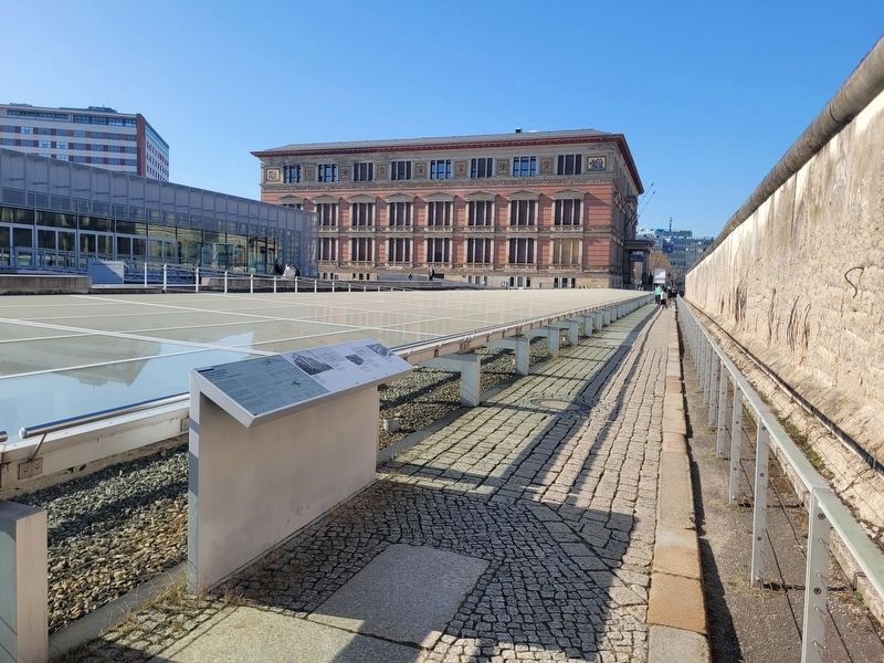
Photographed by James Hulse, March 6, 2026
5. Haupteinfahrt der Gestapo-Zentrale / Main Driveway to Gestapo Headquarters Marker
Credits. This page was last revised on September 12, 2026. It was originally submitted on September 11, 2026, by James Hulse of Medina, Texas. This page has been viewed 7 times since then. Photos: 1, 2, 3, 4, 5. submitted on September 12, 2026, by James Hulse of Medina, Texas.
