
Berliner Innenstadt in Friedrichshain-Kreuzberg, Germany — Northeast German Plain (The European Plain)
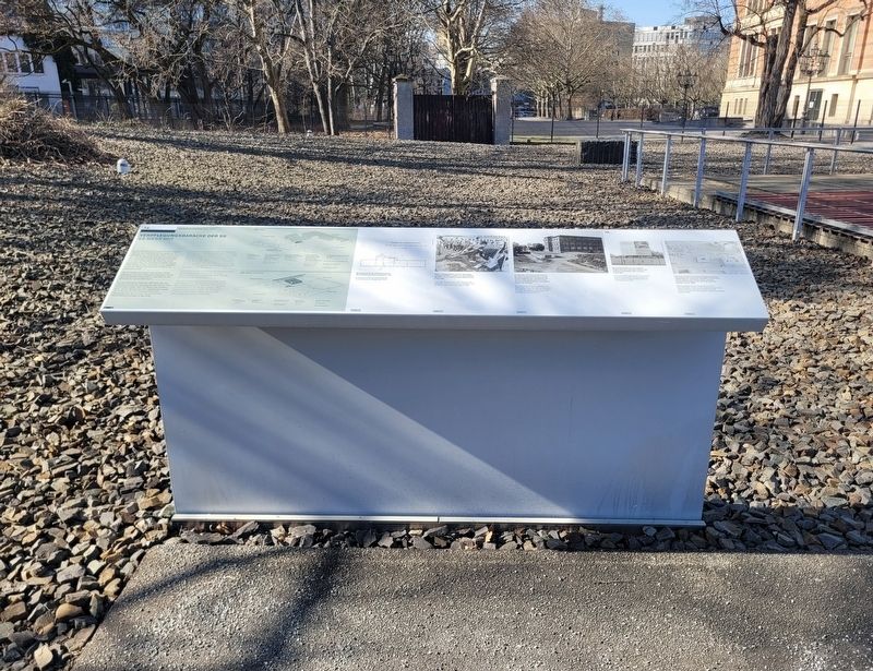
Verpflegungsbaracke der SS
Geländerundgang
⎯⎯⎯
SS Mess Hut
Site Tour
| — | 1933-1945 | — |
Photographed by James Hulse, March 6, 2026
1. Verpflegungsbaracke der SS / SS Mess Hut Marker

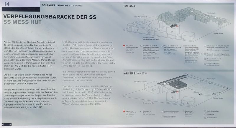
Ob die Holzbaracke schon während des Kriegs abbrannte oder nach Kriegsende abgerissen wurde, ist nicht bekannt. Übrig blieben nach 1945 nur der Schornstein und die Kellerräume.
Auf die Kellerräume stieß man 1987 beim Bau der Ausstellungshalle der „Topographie des Terrors“. Ihre Demontage erfolgte 1997 mit Beginn des Zumthor-Baus, dessen Realisierung 2004 abgebrochen wurde. Die Eröffnung des Dokumentationszentrums Topographie des Terrors nach dem Entwurf von Wilms/Hallmann erfolgte im Mai 2010.
(Bildunterschriften)
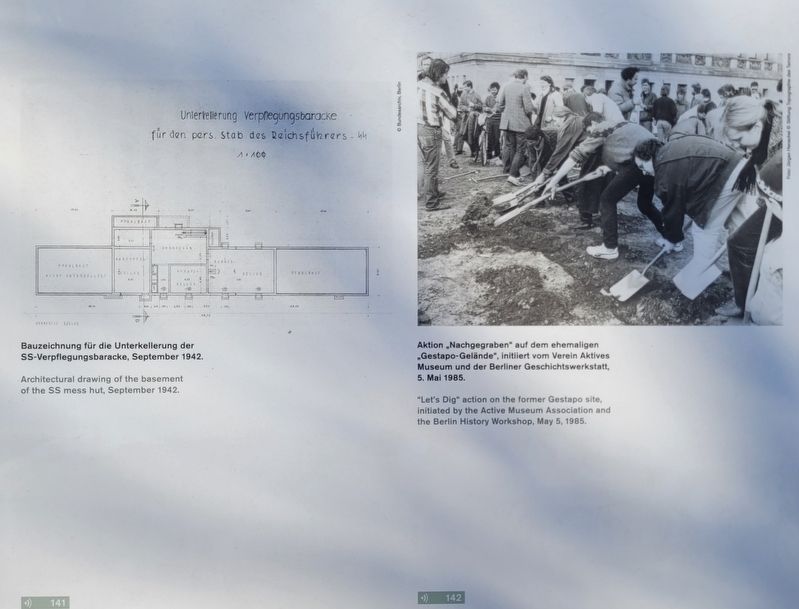
Bauzeichnung für die Unterkellerung der SS-Verpflegungsbaracke, September 1942.
Aktion „Nachgegraben“ auf dem ehemaligen „Gestapo-Gelände“, initiiert vom Verein Aktives Museum und der Berliner Geschichtswerkstatt, 5. Mai 1985.
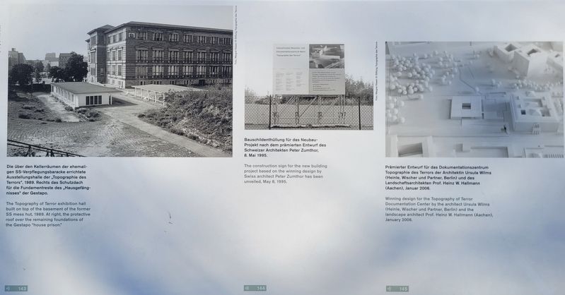
Die über den Kellerräumen der ehemaligen SS-Verpflegungsbaracke errichtete Ausstellungshalle der „Topographie des Terrors“, 1989. Rechts das Schutzdach für die Fundamentreste des „Hausgefängnisses“ der Gestapo.
Bauschildenthüllung für das Neubauprojekt nach dem prämierten Entwurf des Schweizer Architekten Peter Zumthor, 8. Mai 1995.
Prämierter Entwurf für das Dokumentationszentrum Topographie des Terrors der Architektin Ursula Wilms (Heinle, Wischer und Partner, Berlin) und des Landschaftsarchitekten Prof. Heinz W. Hallmann (Aachen), Januar 2006.
this page online
It is unclear whether the wooden hut already burned down during the war or was only torn down afterwards. All that remained after 1945 were the chimney and the cellar rooms.
The cellar rooms were discovered in 1987 during the building of the Topography of Terror exhibition hall. It was dismantled in 1997 with the beginning of construction on the Zumthor building, whose realization was halted in 2004. The Topography of Terror Documentation Center designed by Wilms/Hallmann opened in May 2010.
(Captions)
Architectural drawing of the basement of the SS mess hut, September 1942.
“Let’s Dig” action on the former Gestapo site, initiated by the Active Museum Association and the Berlin History Workshop, May 5, 1985.
The Topography of Terror exhibition hall built on top of the basement of the former SS mess hut, 1989. At right, the protective roof over the remaining foundations of the Gestapo “house prison.”
The construction sign for the new building project based on the winning design by Swiss architect Peter Zumthor has been unveiled, May 8, 1995.
Winning design for the Topography of Terror Documentation Center by the architect Ursula Wilms (Heinle, Wischer und Partner, Berlin) and the landscape architect Prof. Heinz W. Hallmann (Aachen), January 2006.
Erected by Topography
Photographed by James Hulse, March 6, 2026
2. Verpflegungsbaracke der SS / SS Mess Hut Marker
Topics. This historical marker is listed in this topic list: War, World II. A significant historical month for this entry is January 2006.
Location. 52° 30.376′ N, 13° 23.045′ E. Marker is in Berlin, in Friedrichshain-Kreuzberg. It is in Berliner Innenstadt. It is on Niederkirchnerstraße just west of Wilhelmstrasse, on the left when traveling west. Touch for map. Marker is at or near this postal address: Niederkirchnerstraße 8, Berlin 10117, Germany. Touch for directions.

Regionally, it is in Europe, the European Union, Atlantic Europe, Central Europe, the Schengen Area, Western Europe, and the Western World. Historically, it finds itself in what was once the Holy Roman Empire.
Other nearby markers. At least 8 other markers are within walking distance of this marker: NS-Luftschutzbauten / Nazi Air Raid Protection Structures (here, next to this marker); Europahaus-Komplex / Europahaus Complex (within shouting distance of this marker); Das „Hausgefängnis“ der Gestapo-Zentrale / The “House Prison” at Gestapo Headquarters (within shouting distance of this marker); Topographie des Terrors / Topography of Terror (about 90 meters away, measured in a direct line); Das Hausgefängnis des Geheimen Staatspolizeiamts (about 90 meters away); Topography of Terror (about 90 meters away); Prinz-Albrecht-Palais / Prinz Albrecht Palais (about 90 meters away); Haupteinfahrt der Gestapo-Zentrale / Main Driveway to Gestapo Headquarters (about 120 meters away). Touch for a list and map of all markers in Berlin.
Photographed by James Hulse, March 6, 2026
3. Verpflegungsbaracke der SS / SS Mess Hut Marker
Photographed by James Hulse, March 6, 2026
4. Verpflegungsbaracke der SS / SS Mess Hut Marker
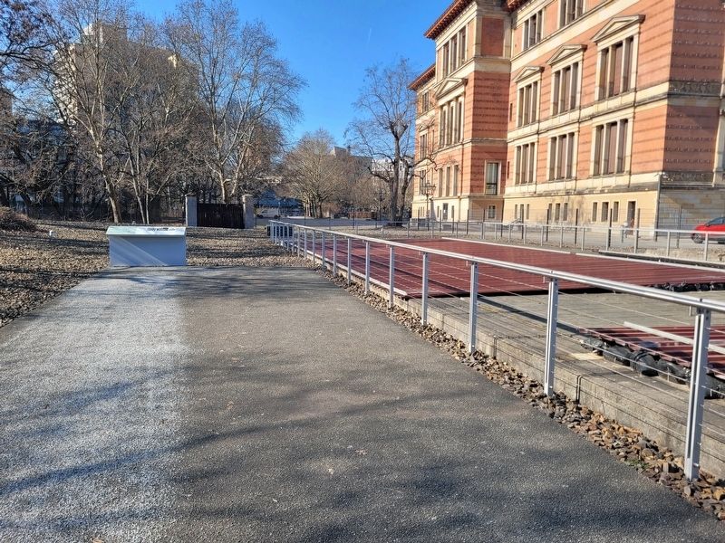
Photographed by James Hulse, March 6, 2026
5. Verpflegungsbaracke der SS / SS Mess Hut Marker
Credits. This page was last revised on September 12, 2026. It was originally submitted on September 11, 2026, by James Hulse of Medina, Texas. This page has been viewed 7 times since then. Photos: 1, 2, 3, 4, 5. submitted on September 12, 2026, by James Hulse of Medina, Texas.
