
Berliner Innenstadt in Mitte, Germany — Northeast German Plain (The European Plain)
Das Hausgefängnis des Geheimen Staatspolizeiamts
The House Prison of the Secret State Police Office
| — | 1933–1945 | — |
Photographed by James Hulse, March 6, 2026
1. Das Hausgefängnis des Geheimen Staatspolizeiamts Marker

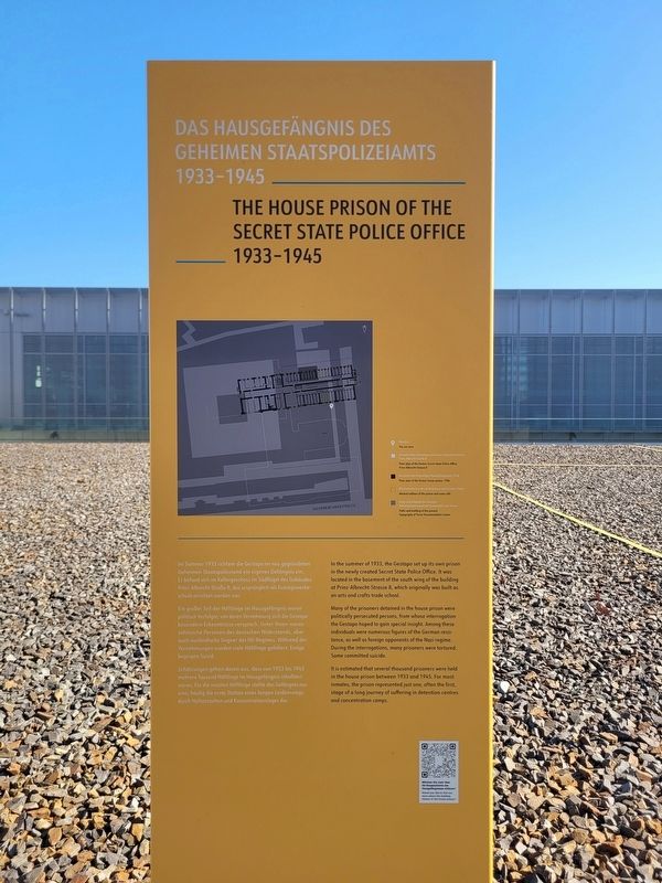
Ein großer Teil der Häftlinge im Hausgefängnis waren politisch Verfolgte, von deren Vernehmung sich die Gestapo besondere Erkenntnisse versprach. Unter ihnen waren zahlreiche Personen des deutschen Widerstands, aber auch ausländische Gegner des NS-Regimes. Während der Vernehmungen wurden viele Häftlinge gefoltert. Einige begingen Suizid.
Schätzungen gehen davon aus, dass von 1933 bis 1945 mehrere Tausend Häftlinge im Hausgefängnis inhaftiert waren. Für die meisten Häftlinge stellte das Gefängnis nur eine, häufig die erste Station eines langen Leidenswegs durch Haftanstalten und Konzentrationslager dar.
Umrisse des ehemaligen Geheimen Staatspolizeiamts, heute Dokumentationszentrum
Grundriss des „Hausgefängnisses“ 1936
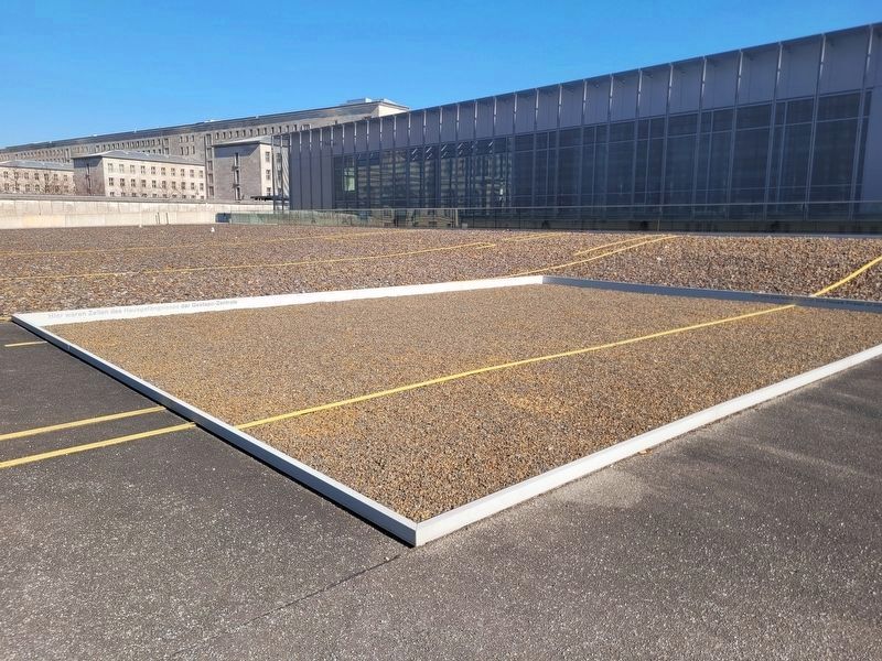
Markierte Umrisse des Gefängnisses und einzelner Zellen
Wege und Gebäude des heutigen Dokumentationszentrums Topographie des Terrors
this page online
Many of the prisoners detained in the house prison were politically persecuted persons, from whose interrogation the Gestapo hoped to gain special insight. Among these individuals were numerous figures of the German resistance, as well as foreign opponents of the Nazi regime. During the interrogations, many prisoners were tortured. Some committed suicide.
It is estimated that several thousand prisoners were held in the house prison between 1933 and 1945. For most inmates, the prison represented just one, often the first, stage of a long journey of suffering in detention centres and concentration camps.
Floor plan of the former Secret State Police Office, now Documentation Center
Floor plan of the “house prison,” 1936
Marked outlines of the prison and some cells
Paths and buildings of the present Topography of Terror Documentation Centre
Erected by Topography of
Photographed by James Hulse, March 6, 2026
2. Das Hausgefängnis des Geheimen Staatspolizeiamts Marker
Topics. This historical marker is listed in this topic list: War, World II. A significant historical year for this entry is 1933.
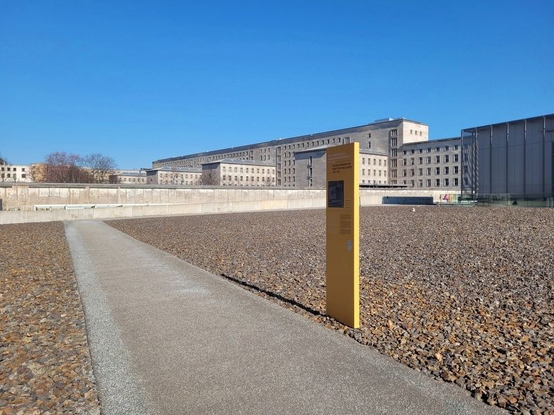
Location. 52° 30.396′ N, 13° 22.971′ E. Marker is in Berlin, in Mitte. It is in Berliner Innenstadt. It is on Niederkirchnerstraße just west of Wilhelmstrasse, on the left when traveling west. The marker is located on the grounds of the Topography of Terror Documentation Center (free history museum). Touch for map. Marker is at or near this postal address: Niederkirchnerstraße 8, Berlin 10963, Germany. Touch for directions.

Regionally, it is in Europe, the European Union, Atlantic Europe, Central Europe, the Schengen Area, Western Europe, and the Western World. Historically, it finds itself in what was once the Holy Roman Empire.
Other nearby markers. At least 8 other markers are within walking distance of this marker: Das „Hausgefängnis“ der Gestapo-Zentrale / The “House Prison” at Gestapo Headquarters (within shouting distance of this marker); Baudenkmal Berliner Mauer / Berlin Wall Monument (within shouting distance of this marker); Remains of the Berlin Wall (within
Photographed by James Hulse, March 6, 2026
3. Das Hausgefängnis des Geheimen Staatspolizeiamts Marker
Photographed by James Hulse, March 6, 2026
4. Das Hausgefängnis des Geheimen Staatspolizeiamts Marker
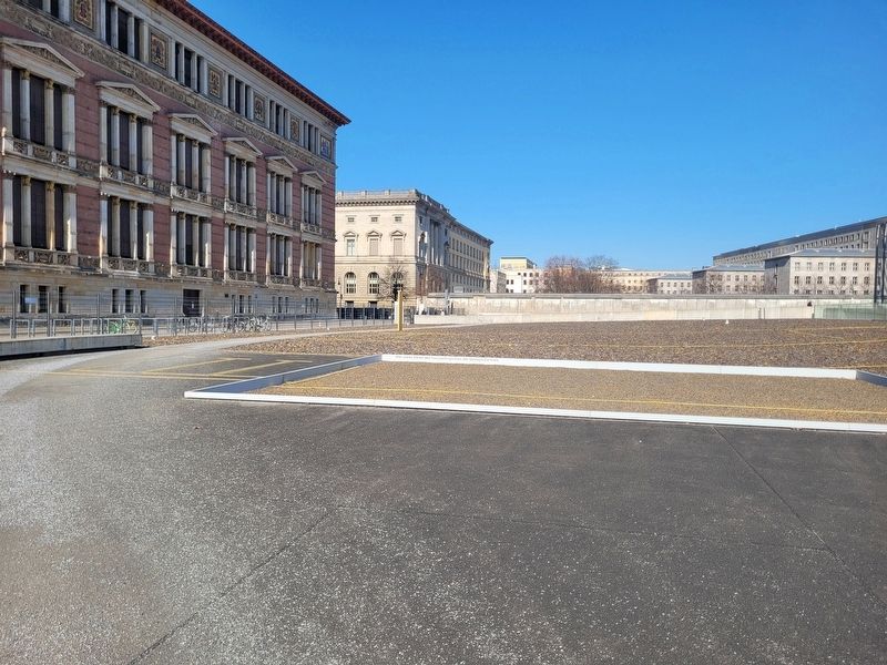
Yellow Outline.
Photographed by James Hulse, March 6, 2026
5. Das Hausgefängnis des Geheimen Staatspolizeiamts Marker
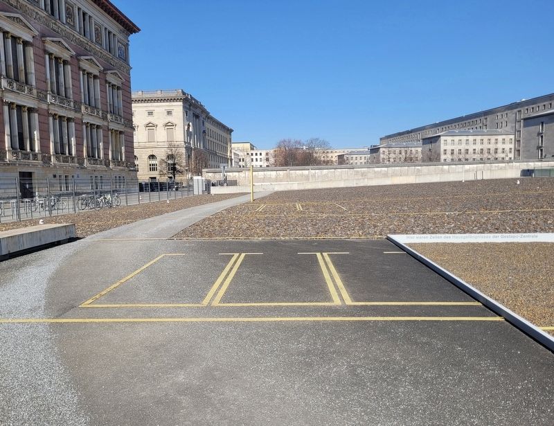
Yellow Outline.
Credits. This page was last revised on September 12, 2026. It was originally submitted on September 11, 2026, by James Hulse of Medina, Texas. This page has been viewed 4 times since then. Photos: 1, 2, 3, 4, 5. submitted on September 12, 2026, by James Hulse of Medina, Texas.
