Kodiak in Kodiak Island Borough, Alaska — Northwest (North America)
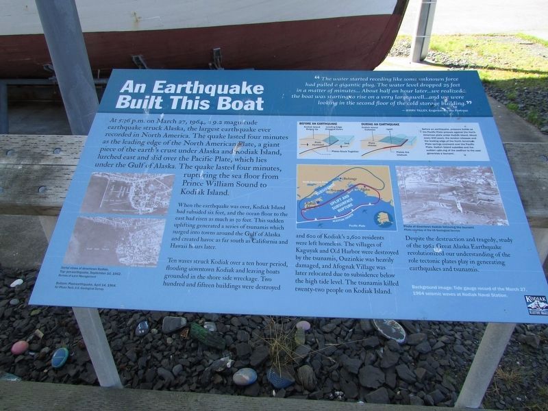
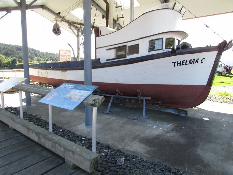
An Earthquake Built This Boat
Photographed by Bill Coughlin, August 26, 2026
1. An Earthquake Built This Boat Marker
“The water started receding like some unknown force had pulled a gigantic plug. The water level dropped 25 feet in a matter of minutes . . . About half an hour later . . . we realized the boat was starting to rise on a very large swell . . . and we were looking in the second floor of the cold storage building.”
At 5:35 p.m. on March 27, 1964, a 9.2 magnitude earthquake struck Alaska, the largest earthquake ever recorded in North America. The quake lasted four minutes as the leading edge of the North American Plate, a giant piece of the earth’s crust under Alaska and Kodiak Island, lurched east and slid over the Pacific Plate, which lies under the Gulf of Alaska. The quake lasted four minutes, rupturing the sea floor from Prince William Sound to Kodiak Island.
When the earthquake was over, Kodiak Island had subsided six feet, and the ocean floor to the east has risen as much as 30 feet. This sudden uplifting generated a series of tsunamis which surged into towns around the Gulf of Alaska and created havoc as far south as California and Hawaii hours later.
Ten waves struck Kodiak over
this page online
Despite the destruction and tragedy, study of the 1964 Great Alaska Earthquake revolutionized our understanding of the role tectonic plates play in generating earthquakes and tsunamis.
Topics. This historical marker is listed in this topic list: Disasters. A significant historical date for this entry is March 27, 1964.
Location. 57° 47.182′ N, 152° 24.418′ W. Marker is in Kodiak, Alaska, in Kodiak Island Borough. It is on Mission Road south of W Marine Way, on the left when traveling south. Marker is located at Oscar’s Spit in St. Paul Harbor. Touch for map. Marker is in this post office area: Kodiak AK 99615, United States of America. Touch for directions.

Regionally, this marker is in the Alutiiq (Sugpiaq)
Photographed by Bill Coughlin, August 26, 2026
2. An Earthquake Built This Boat Marker
Other nearby markers. At least 8 other markers are within walking distance of this marker: Construction of the Thelma C (here, next to this marker); This Boat Was Built For Kodiak (here, next to this marker); This Boat was Built For Salmon (a few steps from this marker); A Community (Re)Built This Boat (a few steps from this marker); Kodiak’s Native Fishermen (a few steps from this marker); Revolutionary War Patriots (within shouting distance of this marker); Good Friday Quake (within shouting distance of this marker); Erskine House (approx. 0.2 miles away). Touch for a list and map of all markers in Kodiak.
More about this marker. Photographs on the marker depict Aerial views of downtown Kodiak pre-earthquake, September 10, 1962; post-earthquake, April 14, 1964; and Downtown Kodiak following the tsunami.
Credits. This page was last revised on September 11, 2026. It was originally submitted on September 11, 2026, by Bill Coughlin of Woodland Park, New Jersey. This page has been viewed 11 times since then. Photos: 1, 2. submitted on September 11, 2026, by Bill Coughlin of Woodland Park, New Jersey.
