Somerset in Somerset County, Pennsylvania — The American Northeast (Mid-Atlantic)
St. Paul's Presbyterian Church
Photographed by Bradley Owen, August 26, 2026
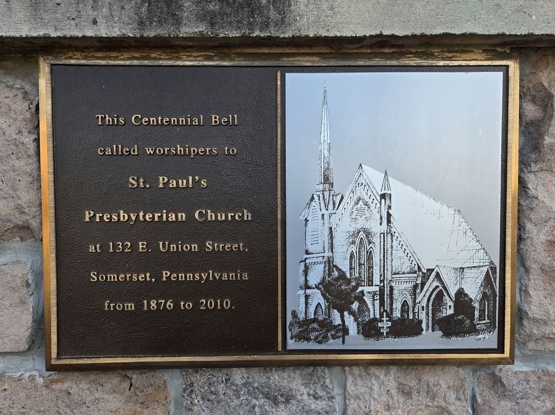
1. St. Paul's Presbyterian Church Marker
St. Paul's Presbyterian Church
at 132 E. Union Street, Somerset, Pennsylvania from 1876 to 2010.
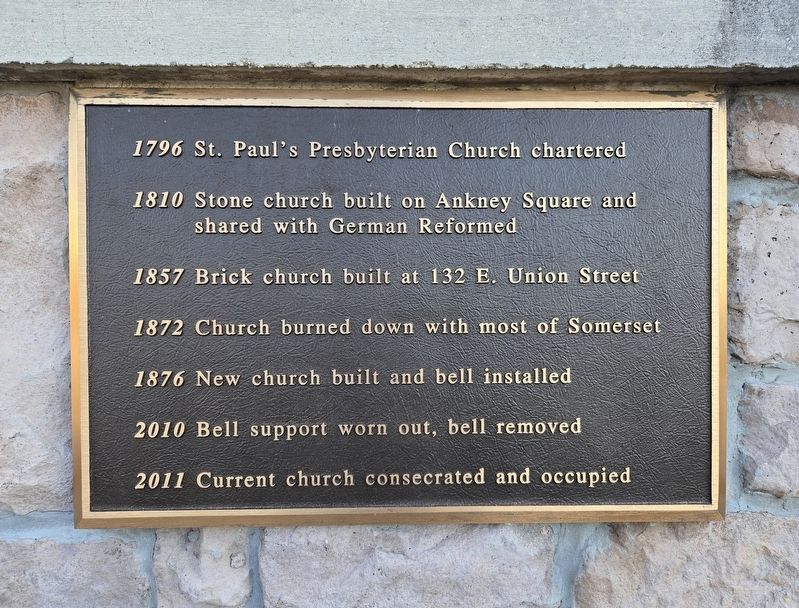
1796 St. Paul's Presbyterian Church chartered
1810 Stone church built on Ankney Square and shared with German Reformed
1857 Brick church built at 132 E. Union Street
1872 Church burned down with most of Somerset
1876 New church built and bell installed
2010 Bell support worn out, bell removed
2011 Current church consecrated and occupied
Erected by St. Paul's Presbyterian Church.
Topics and series. This historical marker is listed in these topic lists: Disasters • Religion & Religious Structures. In addition, it is included in the Historic Bells series list. A significant historical year for this entry is 1876.
Location. 40° 2.637′ N, 79° 4.562′ W. Marker is in Somerset, Pennsylvania, in Somerset County. It is on North Center Avenue (Pennsylvania Route 601) just north of Knepper Lane, on the left when traveling north. Touch for map. Marker is at or near this postal address: 1845 North Center Avenue, Somerset PA 15501, United States of America. Touch for directions.

Regionally,
this page online
Other nearby markers. At least 8 other markers are within 3 miles of this marker, measured as the crow flies: c.1830s Log Farmstead (approx. 1.9 miles away); Walter's Mill Covered Bridge (approx. 1.9 miles away); Robert A. Gilmour (approx. 1.9 miles away); Time Capsule (approx. 2.3 miles away); Somerset County Vietnam Veterans Memorial (approx. 2.4 miles away); Court House (approx. 2.4 miles away); Somerset County Korean War / Vietnam War Memorial (approx. 2.4 miles away); Somerset County World War II Memorial (approx. 2.4 miles away). Touch for a list and map of all markers in Somerset.
Photographed by Bradley Owen, August 26, 2026
2. St. Paul's Presbyterian Church Marker
Photographed by Bradley Owen, August 26, 2026
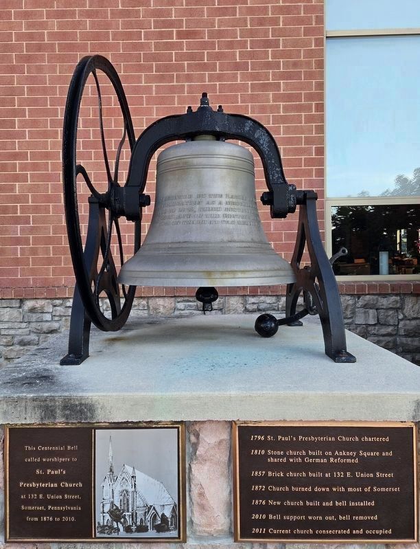
3. St. Paul's Presbyterian Church Bell and Marker
Bell text:
Presented by the ladies of the congregation as a memorial of the fire of 1872, which destroyed this church, and of the centennial year оf 1876 in which it was rebuilt.
McShane Bell Foundry. Henry McShane & Co. Baltimore, MD. 1876.
Photographed by Bradley Owen, August 26, 2026
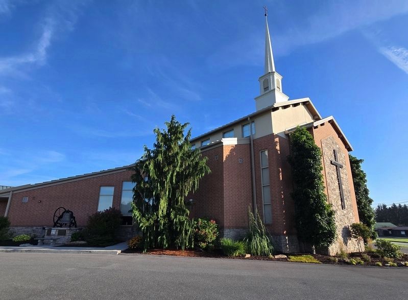
4. St. Paul's Presbyterian Church and Marker
Bell and marker are located in the lower left of the photo.
Credits. This page was last revised on September 12, 2026. It was originally submitted on September 12, 2026, by Bradley Owen of Morgantown, West Virginia. This page has been viewed 8 times since then. Photos: 1, 2, 3, 4. submitted on September 12, 2026, by Bradley Owen of Morgantown, West Virginia.
