Lincoln Township near Somerset in Somerset County, Pennsylvania — The American Northeast (Mid-Atlantic)
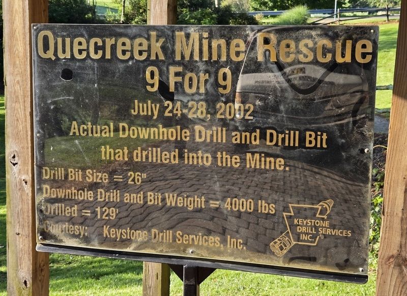
Quecreek Mine Rescue 9 For 9
Photographed by Bradley Owen, August 26, 2026
1. Quecreek Mine Rescue 9 For 9 Marker
July 24-28, 2002
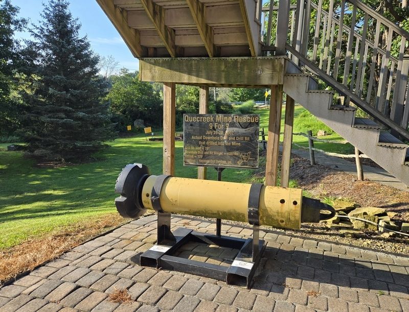
Actual downhole drill and drill bit that drilled into the mine.
Drill Bit Size = 26"
Downhole Drill and Bit Weight = 4000 lbs
Drilled = 129'
Erected 2016 by Keystone Drill Services, Inc. and the Quecreek Mine Rescue Foundation.
Topics. This historical marker is listed in these topic lists: Disasters • Industry & Commerce. A significant historical date for this entry is July 24, 2002.
Location. 40° 4.715′ N, 79° 5.136′ W. Marker is near Somerset, Pennsylvania, in Somerset County. It is in Lincoln Township. It can be reached from Haupt Road (Pennsylvania Route 4015) west of Somerset Pike ( Route 985), on the right. Touch for map. Marker is at or near this postal address: 151 Haupt Road, Somerset PA 15501, United States of America. Touch for directions.

Regionally, this marker is in Pennsylvania’s Laurel Highlands. It is also in the American Northeast, in the Mid-Atlantic, in Appalachia, and specifically in Northern Appalachia. Globally, it is in North America, the Western Hemisphere, the Western World, and the Anglosphere. Historically, it finds itself in what was once the Haudenosaunee
this page online
Other nearby markers. At least 8 other markers are within 5 miles of this marker, measured as the crow flies: Quecreek Mine Accident and Rescue (within shouting distance of this marker); Walter's Mill Covered Bridge (approx. 0.6 miles away); c.1830s Log Farmstead (approx. 0.6 miles away); 9 for 9 (approx. 1½ miles away); St. Paul's Presbyterian Church (approx. 2.4 miles away); Somerset County National Guard Memorial (approx. 4.2 miles away); Robert A. Gilmour (approx. 4.3 miles away); Time Capsule (approx. 4.7 miles away). Touch for a list and map of all markers in Somerset.
Also see . . . Quecreek Mine Rescue: New Display Added.
“The rescue of nine miners in 2002 was an amazing experience for everyone at Keystone and for me personally,” said Tom Walker, President, Keystone Drill Services, Inc. “We will never forget the opportunity we had to contribute our equipment and expertise to this successful rescue.”(Submitted on September 13, 2026, by Bradley Owen of Morgantown, West Virginia.)
“On behalf of Keystone, I am very honored to be able to donate the Ingersoll-Rand manufactured drill bit and down the hole hammer used to actuallybreak through to the miners,” said Scott Slater, CEO, Keystone Drill Services, Inc. “I am very proud of the hard work and dedication of all our employees involved in the rescue. Every time they visit the Quecreek site, they can feel tremendous about their part in the history made there.”Photographed by Bradley Owen, August 26, 20262. Quecreek Mine Rescue 9 For 9 Marker
Credits. This page was last revised on September 13, 2026. It was originally submitted on September 12, 2026, by Bradley Owen of Morgantown, West Virginia. This page has been viewed 8 times since then. Photos: 1, 2. submitted on September 13, 2026, by Bradley Owen of Morgantown, West Virginia.
