Northampton Township in Bucks County, Pennsylvania — The American Northeast (Mid-Atlantic)
From Loss to Renewal ...
Photographed by Richard Peterson, September 7, 2026
1. From Loss to Renewal ... Marker
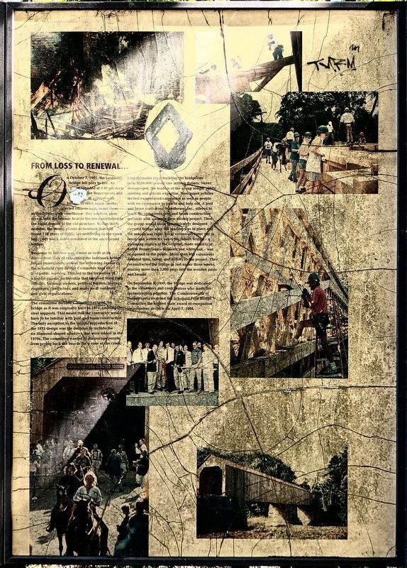
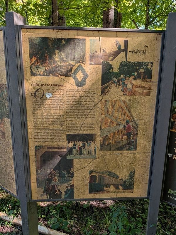
Response to the loss was almost as swift as its destruction. Talk of rebuilding the landmark bridge began immediately, and by the following January the Schofield Ford Bridge Committee held its first public meeting. This led to the formation of a public-private partnership that involved State Park officials, business owners, political leaders, lawyers, engineers, contractors, and many local residents and civic organizations.
The committee decided early on to rebuild the bridge as it was originally built in 1873, omitting the steel supports. This meant that the contractor would have to be familiar with post
this page online
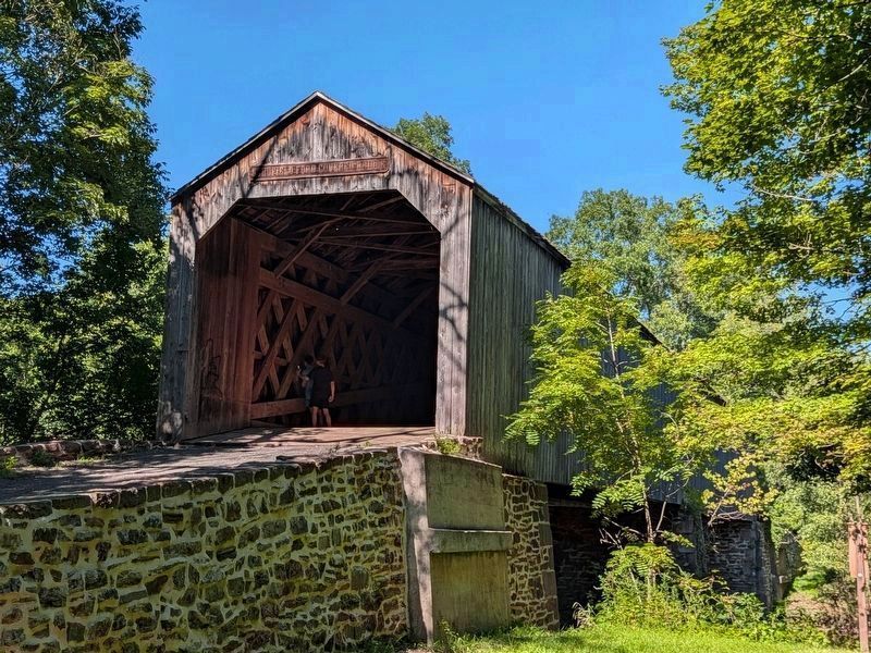
Cost estimates for rebuilding the bridge ran from $250,000 to over one million dollars. Never discouraged, the leaders of the group sought public funding and private expertise. Newspaper articles invited experienced carpenters as well as people with no experience to join in and help out. A post and beam contractor, Woodhouse, Inc., offered to teach the volunteers post and beam construction methods with a simple barn-raising project. Then the group would build the intricately designed covered bridge after the funding was in place and the season was right. Local volunteers came out in force, and within six years the rebuilt bridge – a gleaming replica of the original, made entirely of native Pennsylvania hemlock and white oak – was re-opened to the public. More than 800 volunteers donated time, talent, and dollars to the project. They reconstructed the bridge in

Photographed by Richard Peterson, September 7, 2026
2. Schofield Ford Covered Bridge, group of four Markers at right
On September 6, 1997, the bridge was dedicated to the volunteers and contributors who made the reconstruction possible. The Commonwealth of Pennsylvania awarded the Schofield Ford Bridge Committee the highest state award of recognition for volunteer projects on April 7, 1998.
Topics. This historical marker is listed in these topic lists: Bridges & Viaducts • Charity & Public Work. A significant historical date for this entry is April 7, 1998.
Location. 40° 14.633′ N, 74° 58.867′ W. Marker is in Northampton Township, Pennsylvania, in Bucks County. It can be reached from Swamp Road 0.7 miles east of Worthington Mill Road. Marker is in Tyler State Park. It is on the Covered Bridge Trail, 0.2 mile from the parking area which is 0.2 mile from Swamp Road. Touch for map. Marker is in this post office area: Richboro PA 18954, United States of America. Touch for directions.

Regionally, this marker is in Southeast Pennsylvania and in Greater Philadelphia. It is also in the American Northeast and in the Mid-Atlantic. Globally, it is in North America, the
Photographed by Richard Peterson, September 7, 2026
3. Schofield Ford Covered Bridge
Other nearby markers. At least 8 other markers are within walking distance of this marker: From Public Highway to Scenic Byway ... (here, next to this marker); A Bridge from Past to Present, Neighbor to Neighbor ... (a few steps from this marker); The Schofield Ford Covered Bridge (about 300 feet away, measured in a direct line); Community-built Landmark (about 300 feet away); Bridging Past and Present (about 300 feet away); Summer House Garden Seat (approx. 0.7 miles away); The Sculptures of Stella Elkins Tyler (approx. ¾ mile away); Tyler Gardens Planting Area (approx. ¾ mile away).
Photographed by Richard Peterson, September 7, 2026
4. From Loss to Renewal ... Marker
Credits. This page was last revised on September 21, 2026. It was originally submitted on September 13, 2026, by Richard Peterson of East Windsor, New Jersey. This page has been viewed 6 times since then. Photos: 1, 2, 3, 4. submitted on September 13, 2026, by Richard Peterson of East Windsor, New Jersey. • Bill Pfingsten was the editor who published this page.
