Scottsbluff in Scotts Bluff County, Nebraska — The American Midwest (Upper Plains)
Marching to Zion/Marchando al monte Sion
Photographed by Cosmos Mariner, August 1, 2021
1. Marching to Zion/Marchando al monte Sion Marker

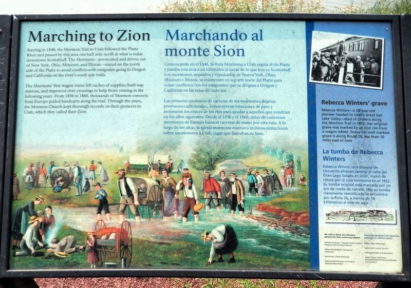
Starting in 1846, the Mormon Trail to Utah followed the Platte River and passed by this area one half mile north in what is today downtown Scottsbluff. The Mormons — persecuted and driven out of New York, Ohio, Missouri, and Illinois — stayed on the north side of the Platte to avoid conflicts with emigrants going to Oregon and California on the river's south side trails.
The Mormons' first wagon trains left caches of supplies, built way stations, and improved river crossings to help those coming in the following years. From 1856 to 1860, thousands of Mormon converts from Europe pulled handcarts along the trail. Through the years, the Mormon Church kept thorough records on their pioneers to Utah, which they called their Zion.
Rebecca Winters’ Grave
Rebecca Winters — a 50-year-old pioneer headed to Utah’s Great Salt Lake Valley — died of Cholera along the Mormon Trail in 1852. Her original grave was marked by an iron rim from a wagon wheel. Today her well-marked grave is along Route 26, less than 10 miles east of here.
Comenzando en el 1846, la Ruta Mormona
this page online
Las primeras caravanas de carretas de los mormones dejaron provisiones adicionales, construyeron estaciones de paso y mejoraron los cruces de los ríos para ayudar a aquellos que vendrían en los años siguientes. Desde el 1856 y el 1860, miles de conversos mormones de Europa halaron carretas de mano por esta ruta. A lo largo de los años, la iglesia mormona mantuvo archivos minuciosos sobre sus pioneros a Utah lugar que llamaban su Sion.
La tumba de Rebecca Winters
Rebecca Winters, una pionera de cincuenta años en camino al valle del Gran Lago Salado en Utah, murió de cólera por la ruta mormona en el 1852. Su tumba original está marcada por un aro de rueda de carreta. Hoy su tumba claramente identificada se encuentra por la Ruta 26, a menos de 16 kilómetros al este de aquí.
Erected by National Parks Service, Cities
Photographed by Cosmos Mariner, August 1, 2021
2. Marching to Zion/Marchando al monte Sion Marker
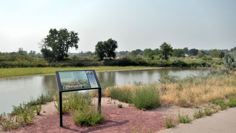
Looking south from the Monument Valley Pathway. The North Platte River is in the background.
Topics and series. This historical marker is listed in these topic lists: Religion & Religious Structures • Settlements & Settlers. In addition, it is included in the Mormon Pioneer Trail series list. A significant historical year for this entry is 1846.
Location. 41° 51.052′ N, 103° 40.388′ W. Marker is in Scottsbluff, Nebraska, in Scotts Bluff County. It can be reached from Five Rocks Road (Avenue I) 0.4 miles south of South Beltline Highway West (State Highway 79H Spur). The marker is on the Monument Valley Pathway, just east of Riverside Park. Touch for map. Marker is in this post office area: Scottsbluff NE 69361, United States of America. Touch for directions.

Regionally, this marker is in the Nebraska Panhandle. It is also in the American Midwest, in the Corn Belt, and on the prairies. Globally, it is in North America, the Western Hemisphere, the Western World, and the Anglosphere. Historically, it finds itself in what was once the Louisiana Purchase.
Other nearby markers. At least 8 other markers are within walking distance of this marker: Me-a-pa-te (about 400 feet away, measured in a direct line); Rapid Changes/Cambios rápidos (approx. 0.2 miles away); Turn Back from Here?/¿Regresar de aquí? (approx. 0.2 miles away); Settling the North Platte Valley/Colonizando el valle North Platte (approx. 0.3 miles away); The Great Platte River Road/El camino del gran Río Platte (approx. 0.3 miles away); Treeless Prairie/Pradera sin árboles (approx. 0.4 miles away); The “Flat Water” Platte River/El Río Platte de agua plana (approx. 0.4 miles away); Water Challenges/Desafíos del Agua (approx. half a mile away). Touch for a list and map of all markers in Scottsbluff.
Related markers. Click here for a list of markers that are related to this marker.
Also see . . . Mormon Trail (Wikipedia).
Excerpt: The the 1,300-mile route from Illinois to Utah on which Mormon pioneers traveled from 1846 to 1869. The Mormon Trail is a part of the United States National Trails System, known as the Mormon Pioneer National Historic Trail. The Mormon Trail extends from Nauvoo, Illinois, which was the principal settlement of the Latter Day Saints from 1839 to 1846, to Salt Lake City, Utah, which was settled by Brigham Young and his followers beginning in 1847. From Council Bluffs, Iowa to Fort Bridger in Wyoming, the trail follows much the same route as the Oregon Trail and the California Trail; these trails are collectively known as the Emigrant Trail.(Submitted on September 15, 2026, by Cosmos Mariner of Cape Canaveral, Florida.)During the winter of 1846–47, the emigrants wintered in Iowa, other nearby states, and the unorganized territory that later became Nebraska, with the largest group residing in Winter Quarters, Nebraska. In the spring of 1847, Young led the vanguard company to the Salt Lake Valley, which was then outside the boundaries of the United States and later became Utah. The trail was used for more than 20 years, until the completion of the first transcontinental railroad in 1869.
Credits. This page was last revised on September 16, 2026. It was originally submitted on September 14, 2026, by Cosmos Mariner of Cape Canaveral, Florida. This page has been viewed 13 times since then. Photos: 1, 2. submitted on September 15, 2026, by Cosmos Mariner of Cape Canaveral, Florida.
