Boswell in Somerset County, Pennsylvania — The American Northeast (Mid-Atlantic)
Town of Boswell

Photographed by Bradley Owen, August 26, 2026
1. Town of Boswell Marker
Boswell was founded by the Merchants Coal Company of Baltimore, Maryland. Civil engineer William J. Vickroy and Charles E. Hower, the company's first mine engineer, designed the town in 1901. The town was laid out on a forty-five degree grid pattern on a one square mile parcel of land containing 1,600 50' x 120' lots. The streets were 36 feet wide with 12-foot sidewalks and 20-foot alleys.
The coal company constructed five types of both single and double housing for miners and mine managers. All housing was constructed of stone, brick or wood. The use of stone and brick in the construction of company towns was extremely rare and gave Boswell its unique appearance. The mining company operated its own brick factory on the southeast side of Quemahoning Creek. It was capable of producing 30,000 bricks a day and the ashlar and sandstone was obtained from nearby quarries.
Although Boswell was planned and constructed by the coal company most of the town was controlled and developed by private investors independent of the coal company. Even the company store, originally known as the Quemahoning Supply Company, was owned
this page online
Boswell was incorporated into a borough in 1904. In 1994 the northern part of the borough was designated a National Historic District.
(Captions):
Borough of Boswell Circa 1934
Turn of the Century Main Street
The Superintendent's Home, The Merchants Coal Co.
Quemahoning Supply Company
First National Bank.
The Old Merchants Hotel.
Post Office & Municipal Building.
Morris Avenue
Erected by Boswell Area Historical Society.
Topics. This historical marker is listed in these topic lists: Industry & Commerce • Settlements & Settlers. A significant historical year for this entry is 1901.
Location. 40° 9.906′ N, 79° 1.808′ W. Marker is in Boswell, Pennsylvania, in Somerset County. It can be reached from Penn Avenue (Pennsylvania Route 601) north of Blacks Hill Road (Local Route 735), on the right when traveling north. Marker is located in Orenda Park. Touch for map. Marker is at or near this postal address: 3421 Penn Avenue, Boswell PA 15531, United States of America. Touch for directions.

Regionally, this
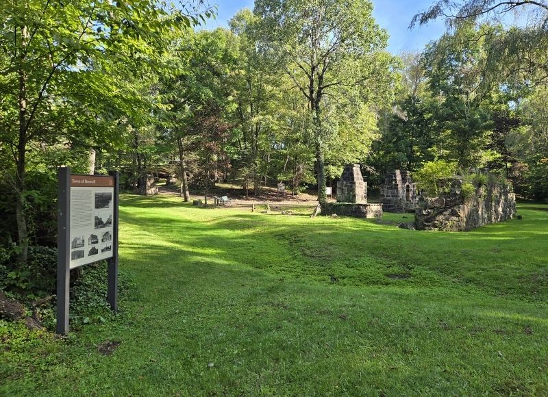
Photographed by Bradley Owen, August 26, 2026
2. Town of Boswell Marker
Other nearby markers. At least 8 other markers are within 2 miles of this marker, measured as the crow flies: Boswell Panorama (within shouting distance of this marker); Thomas Boswell (about 300 feet away, measured in a direct line); Boswell Brick Plant (about 300 feet away); Jenner Brewing Company Bricks (about 300 feet away); Industrial Heritage Along the Lincoln Highway (about 300 feet away); Boswell Legion Veterans Memorial (approx. 0.2 miles away); Highway Attractions (approx. 1.6 miles away); Log Grist Mill (approx. 1.6 miles away). Touch for a list and map of all markers in Boswell.
Credits. This page was last revised on September 14, 2026. It was originally submitted on September 14, 2026, by Bradley Owen of Morgantown, West Virginia. This page has been viewed 4 times since then. Photos: 1, 2. submitted on September 14, 2026, by Bradley Owen of Morgantown, West Virginia.
