Palo Alto in Santa Clara County, California — The American West (Pacific Coastal)
America250 Liberty Tree Grove
Photographed by Alice Mansell, September 7, 2026
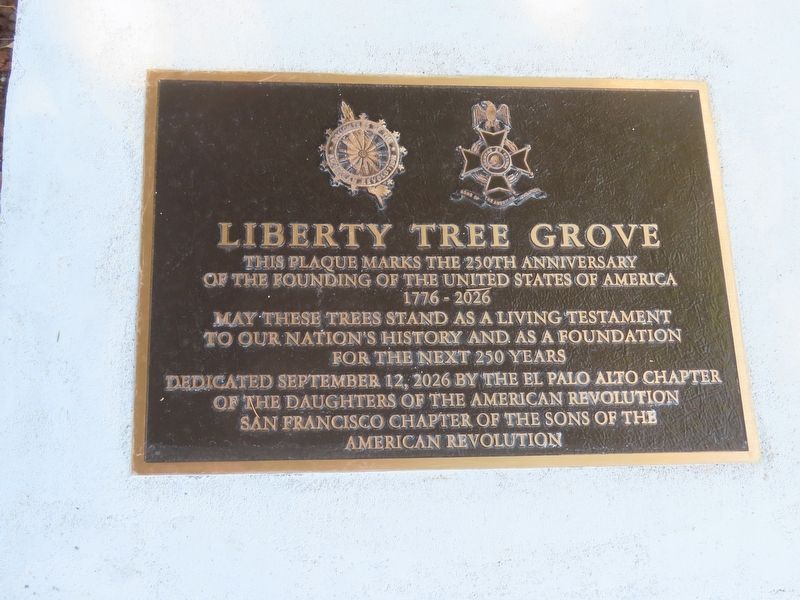
1. America250 Liberty Tree Grove Marker
This plaque marks the 250th Anniversary of the founding of the United States of America
Dedicated September 12, 2026 by the El Palo Alto Chapter of the Daughters of the American Revolution
San Francisco Chapter of the Sons of the American Revolution
Erected 2026 by Chapters of Daughters of the American Revolution, Sons of the American Revolution.
Topics and series. This historical marker is listed in these topic lists: Horticulture & Forestry • Patriots & Patriotism • War, US Revolutionary. In addition, it is included in the America 250, the Daughters of the American Revolution (DAR), and the Sons of the American Revolution (SAR) series lists. A significant historical date for this entry is July 4, 1776.
Location. 37° 26.523′ N, 122° 9.876′ W. Marker is in Palo Alto, California, in Santa Clara County. Marker is located near the SE corner of El Camino Real and University Avenue in the parking lot of a Sheraton Hotel (formerly a Holiday Inn). In 2026, extensive shrubbery blocks the street
this page online

Regionally, this marker is in California’s San Francisco Bay Area, in Silicon Valley, and on the Coast Ranges. It is also on the American Pacific Coast. Globally, it is in North America, on the Ring of Fire, on the Pacific Rim, in the Western Hemisphere, in the Western World, and in the Anglosphere. Historically, it finds itself in what was once New Spain and also Mexico’s Alta California.
Other nearby markers. At least 8 other markers are within walking distance of this marker: Bicentennial Redwood Mini Grove (here, next to this marker); Hostess House (about 400 feet away, measured in a direct line); The Face Book (approx. 0.2 miles away); History of Tower Well (approx. 0.3 miles away); First Elementary School (approx. 0.3 miles away); Electronics Research Laboratory (approx. 0.4 miles away); 401 Florence (approx. 0.4 miles away); San Francisquito Creek Watershed (approx. half a mile away). Touch for a list and map
Photographed by Alice Mansell, September 12, 2026
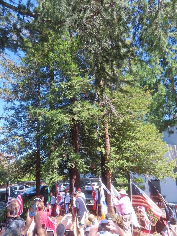
2. America250 Liberty Tree Grove Marker unveiling
Another marker is no longer nearby. The Hostess House War and Veterans Memorial (was about 400 feet away but has been confirmed missing).
More about this marker. The marker is located in the middle of a hotel parking lot across the street from a railroad station and bus depot.
Regarding America250 Liberty Tree Grove. The redwood trees surrounding this marker were planted in 1974 from four foot tall seedlings of El Palo Alto, the redwood tree namesake of the City of Palo Alto. That tree still stands nearby in 2026. That tree also serves as the logo of Stanford University. “El Palo Alto” (meaning “The Tall Stick” or “Tall Tree” in Spanish) was first mapped by Franciscan Friar Pedro Font in March 1776 when he served as cartographer on the 1775-6 Juan Bautista de Anza Expedition which escorted over 200 Spanish colonists, mostly women and children, to the San Francisco Bay Area. The colonists were tasked to establish the San Francisco Presidio and Mission Dolores, both founded on June 27, 1776. This marker sits along the National Park Service’s Juan Bautista De Anza National Historic Trail established
Photographed by Alice Mansell, September 12, 2026
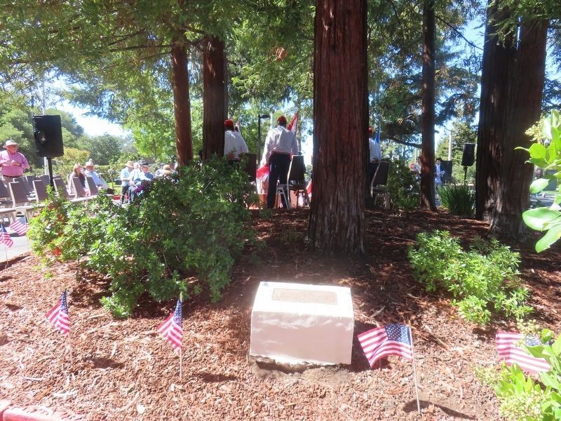
3. 1974 Liberty Tree Grove Marker
The City of Palo Alto’s USA 1976 Bicentennial Committee was instrumental in helping the Daughters of the American Revolution to install this 1974 marker at the hotel parking lot site. The redwood seedlings planted in 1974 were grown with the help of a City staffer. (This marker has a separate entry).
Related marker. Click here for another marker that is related to this marker.
Photographed by Alice Mansell, September 12, 2026
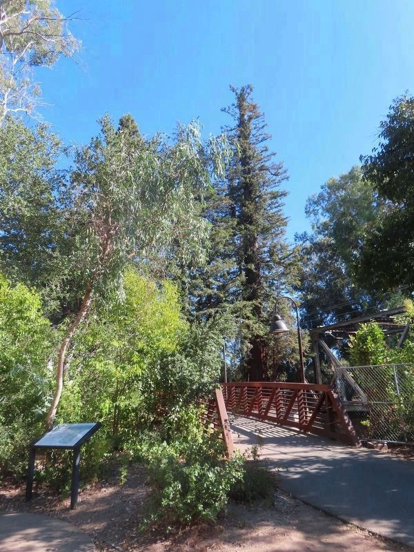
4. El Palo Alto redwood tree at center
Seeds from this tree were used to grow the seedlings for the 1974 mini-grove
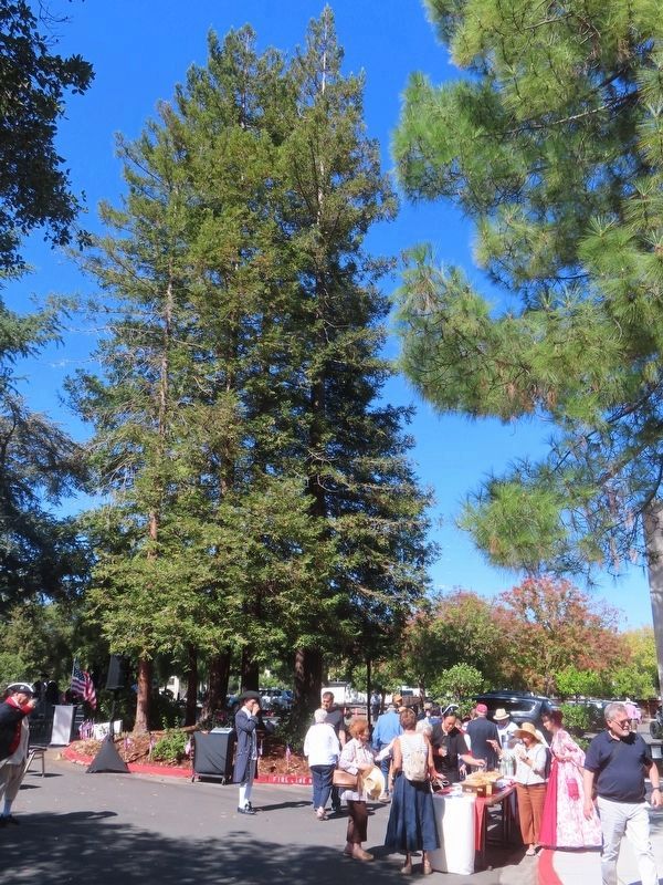
Photographed by Alice Mansell, September 12, 2026
5. Reception after 2026 Liberty Tree Grove plaque dedication
Showing the 2026 height of the trees in this redwood tree grove
Credits. This page was last revised on September 15, 2026. It was originally submitted on September 14, 2026, by Alice Mansell of Los Altos, California. This page has been viewed 12 times since then. Photos: 1, 2, 3, 4, 5. submitted on September 14, 2026, by Alice Mansell of Los Altos, California. • Andrew Ruppenstein was the editor who published this page.
