Ouderkerk aan de Amstel in Ouder-Amstel, North Holland, Netherlands — Northwestern Europe
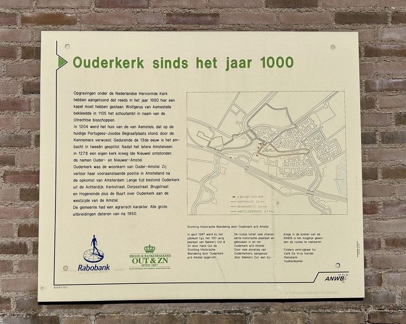
Ouderkerk sinds het jaar 1000
⎯⎯⎯
Ouderkerk Since the Year 1000
Photographed by Andrew Ruppenstein, September 1, 2026
1. Ouderkerk sinds het jaar 1000 / Ouderkerk Since the Year 1000 Marker

Opgravingen onder de Nederlandse Hervormde Kerk hebben aangetoond dat reeds in het jaar 1000 hier een. kapel moet hebben gestaan. Wolfgerus van Aemestelle bekleedde in 1105 het schoutambt in naam van de Utrechtse bisschoppen.
In 1204 werd het huis van de van Aemstels, dat op de huidige Portugees-Joodse Begraafplaats stond, door de Kennemers verwoest. Gedurende de 13de eeuw is het ambacht in tweeën gesplitst. Nadat het latere Amstelveen in 1278 een eigen kerk kreeg (de Nieuwe) ontstonden de namen Ouder- en Nieuwer-Amstel.
Ouderkerk was de woonkern van Ouder-Amstel. Zij verloor haar vooraanstaande positie in Amstelland na. de opkomst van Amsterdam. Lange tijd bestond Ouderkerk uit de Achterdijk, Kerkstraat, Dorpsstraat, Brugstraat en Hogereinde plus de Buurt over Ouderkerk aan de westzijde van de Amstel.
De gemeente had een agrarisch karakter. Alle grote uitbreidingen dateren van na 1950.
(caption for walking tours map)
Stichting Historische Wandeling door Ouderkerk a/d Amstel
In april 1997 werd bij het jubileum t.g.v. het 100-jarig bestaan van Bakkerij Out & Zn door Hans Out de Stichting Historische Wandeling door Ouderkerk a/d Amstel opgericht. De routes tonen vele interessante historische plaatsen en gebouwen in en om Ouderkerk a/d Amstel. Door vele donaties van Ouderkerkers, aangevuld door Bakkerij Out, een bij-drage in de kosten van de ANWB is het mogelijk geworden de routes te realiseren.
Folders verkrijgbaar bij:
Café De Vrije Handel
Rabobank
Oudheidkamer
Ouderkerk since the year 1000
Excavations
this page online
In 1204, the estate of the Van Aemstel family—located on the site of the current Portuguese-Jewish Cemetery—was destroyed by the Kennemers. During the 13th century, the administrative district was split in two. After the area that would later become Amstelveen acquired its own church (the Nieuwe or "New" Church) in 1278, the names Ouder-Amstel and Nieuwer-Amstel emerged.
Ouderkerk served as the main settlement of Ouder-Amstel. It lost its prominent position in the Amstelland region following the rise of Amsterdam. For a long time, Ouderkerk consisted of the streets Achterdijk, Kerkstraat, Dorpsstraat, Brugstraat, and Hogereinde, along with the "Buurt over Ouderkerk" (the neighborhood across from Ouderkerk) on the west bank of the Amstel River.
The municipality was agricultural in nature. All major expansions date from after 1950.
(caption for walking tours map)
Historical Walk through Ouderkerk aan de Amstel Foundation
The Historical Walk through Ouderkerk aan de Amstel Foundation was established by Hans Out in April 1997 to mark the centenary of the Out & Zn Bakery. The routes showcase many interesting historical sites and buildings in and around Ouderkerk aan de Amstel. Realizing these routes was made possible through numerous donations from local residents, supplemented by contributions from the Out Bakery and the ANWB.
Brochures available at:
Café De Vrije Handel
Rabobank
Oudheidkamer (“Local History Room”)
Erected by ANWB,
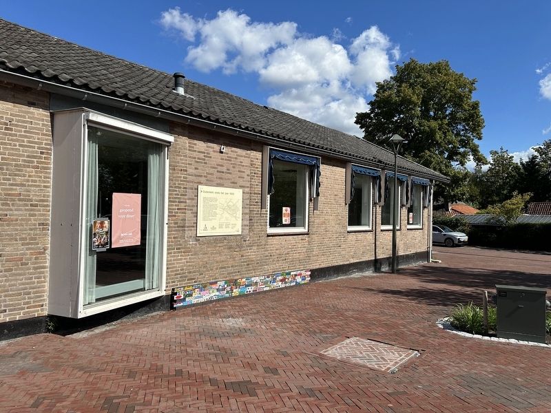
Photographed by Andrew Ruppenstein, September 1, 2026
2. Ouderkerk sinds het jaar 1000 / Ouderkerk Since the Year 1000 Marker - wide view
Topics. This historical marker is listed in this topic list: Notable Places. A significant historical month for this entry is April 1997.
Location. 52° 17.787′ N, 4° 54.222′ E. Marker is in Ouderkerk aan de Amstel, Noord-Holland (North Holland), in Ouder-Amstel. It is at the intersection of Korendragerstraat and Kerkstraat, on the right when traveling south on Korendragerstraat. Touch for map. Marker is at or near this postal address: Korendragerstraat 3, Ouderkerk aan de Amstel, Noord-Holland 1191 JA, Netherlands. Touch for directions.

Regionally, it is in Europe, the European Union, Atlantic Europe, the Benelux Low Countries, the Schengen Area, Western Europe, and the Western World. Historically, it finds itself in what was once the Holy Roman Empire.
Other nearby markers. At least 8 other markers are within walking distance of this marker: Huis met de kettingen / House with the Chains (within shouting distance of this marker); Café De Vrije handel (within shouting distance of this marker); D’Corendrager / “The Grain Carrier” (within shouting distance of this marker); De Haegh
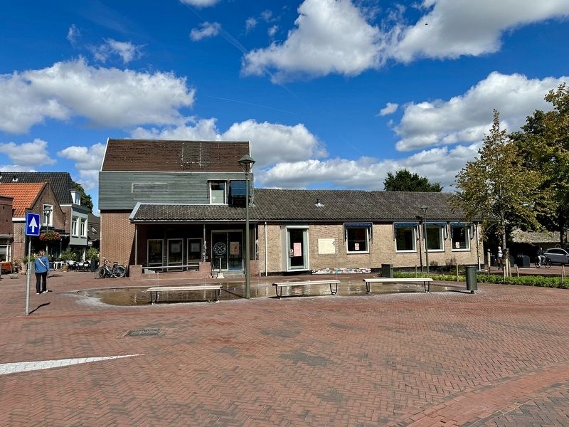
Photographed by Andrew Ruppenstein, September 1, 2026
3. Ouderkerk sinds het jaar 1000 / Ouderkerk Since the Year 1000 Marker - wider view
Also see . . . Ouderkerk aan de Amstel (Wikipedia). (Submitted on September 15, 2026.)
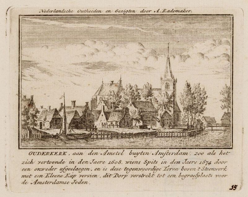
Abraham Rademaker (courtesy Stadsarchief Amsterdam via Wikimedia Commons), circa 1608
4. View of Ouderkerk aan de Amstel around 1608
Credits. This page was last revised on September 15, 2026. It was originally submitted on September 15, 2026, by Andrew Ruppenstein of Lamorinda, California. This page has been viewed 12 times since then. Photos: 1, 2, 3, 4. submitted on September 15, 2026, by Andrew Ruppenstein of Lamorinda, California.
