Pleasant Hill in Northampton County, North Carolina — The American South (South Atlantic)
Cornwallis
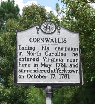
Photographed by Mike Wintermantel, August 9, 2013
1. Cornwallis Marker
Erected 1938 by North Carolina Division of Archives and History. (Marker Number E-13.)
Topics and series. This historical marker is listed in this topic list: War, US Revolutionary. In addition, it is included in the North Carolina Division of Archives and History series list. A significant historical month for this entry is May 1781.
Location. 36° 32.612′ N, 77° 31.817′ W. Marker is in Pleasant Hill, North Carolina, in Northampton County. It is on Skippers Road (U.S. 301) 0.6 miles north of North Carolina Highway 48, on the right when traveling north. Touch for map. Marker is in this post office area: Pleasant Hill NC 27866, United States of America. Touch for directions.

Regionally, this marker is in North Carolina’s Coastal Plain. It is also in the American South and specifically in the Upper South. Globally, it is in North America, the Western Hemisphere, the Western World, and the Anglosphere. Historically, it finds itself in what was once the territory of the Mississippian
this page online
Other nearby markers. At least 8 other markers are within 8 miles of this marker, measured as the crow flies: Like to Eat? (approx. 2½ miles away in Virginia); Nicholas Roberts (approx. 6.1 miles away); Bernice Kelly Harris (approx. 6½ miles away); Paul H. Rose (approx. 6½ miles away); Garysburg United Methodist Church (approx. 6.9 miles away); First Kraft Pulp in United States (approx. 7.9 miles away); Batteaux and Batteauxmen (approx. 8.1 miles away); Roanoke Canal (approx. 8.1 miles away).
Related markers. Click here for a list of markers that are related to this marker. To better understand the relationship, study each marker in the order shown.
![[Missing] Wide view of the Cornwallis Marker image. Click for full size.](Photos1/110/Photo110357.jpg?11252005 "[Missing] Wide view of the Cornwallis Marker. Click for full size.")
Photographed by Paul Crumlish, May 6, 2010
2. [Missing] Wide view of the Cornwallis Marker
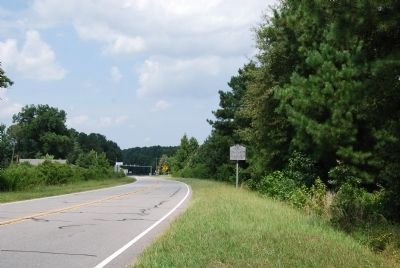
Photographed by Mike Wintermantel, August 9, 2013
3. Cornwallis Marker
Credits. This page was last revised on September 11, 2024. It was originally submitted on May 23, 2010, by PaulwC3 of Northern, Virginia. This page has been viewed 967 times since then and 41 times this year. Photos: 1. submitted on August 11, 2013, by Mike Wintermantel of Pittsburgh, Pennsylvania. 2. submitted on May 23, 2010, by PaulwC3 of Northern, Virginia. 3. submitted on August 11, 2013, by Mike Wintermantel of Pittsburgh, Pennsylvania.
