Ouderkerk aan de Amstel in Ouder-Amstel, North Holland, Netherlands — Northwestern Europe
D’Corendrager
⎯⎯⎯
“The Grain Carrier”
Photographed by Andrew Ruppenstein, September 1, 2026
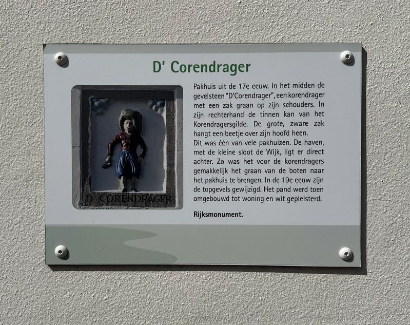
1. D’Corendrager / “The Grain Carrier” Marker

Pakhuis uit de 17e eeuw. In het midden de gevelsteen "D'Corendrager", een korendrager met een zak graan op zijn schouders. In zijn rechterhand de tinnen kan van het Korendragersgilde. De grote, zware zak hangt een beetje over zijn hoofd heen. Dit was één van vele pakhuizen. De haven, met de kleine sloot de Wijk, ligt er direct achter. Zo was het voor de korendragers gemakkelijk het graan van de boten naar het pakhuis te brengen. In de 19e eeuw zijn de topgevels gewijzigd. Het pand werd toen omgebouwd tot woning en wit gepleisterd.
Rijksmonument.
The Grain Carrier
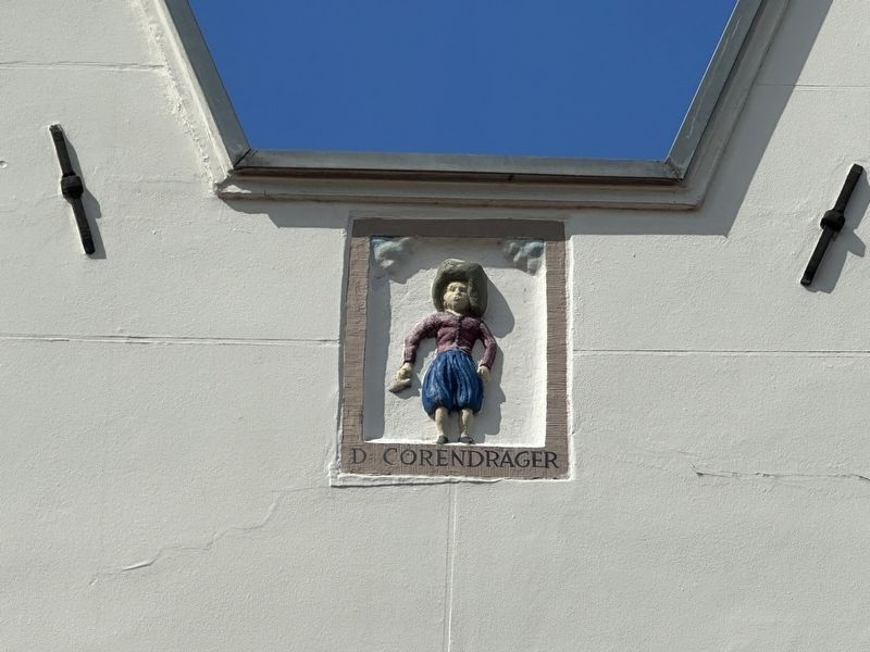
A 17th-century warehouse. Centrally located is the "D'Corendrager" (“The Grain Carrier”) stone relief, depicting a grain porter with a sack of grain on his shoulders. In his right hand, he holds the pewter jug belonging to the Grain Carriers' Guild. The large, heavy sack hangs slightly over his head. This was one of many warehouses. The harbor—along with the small canal known as "de Wijk"—lies directly behind it, making it easy for the porters to transport grain from the boats to the warehouse.
this page online
National monument.
Topics. This historical marker is listed in this topic list: Industry & Commerce.
Location. 52° 17.786′ N, 4° 54.181′ E. Marker is in Ouderkerk aan de Amstel, Noord-Holland (North Holland), in Ouder-Amstel. It is on Kerkstraat, on the right when traveling south. Touch for map. Marker is at or near this postal address: Kerkstraat 45, Ouderkerk aan de Amstel, Noord-Holland 1191 JD, Netherlands. Touch for directions.

Regionally, it is in Europe, the European Union, Atlantic Europe, the Benelux Low Countries, the Schengen Area, Western Europe, and the Western World. Historically, it finds itself in what was once the Holy Roman Empire.
Other nearby markers. At least 8 other markers are within walking distance of this marker: Huis met de kettingen / House with the Chains (a few steps from this marker); Ouderkerk sinds het jaar 1000 / Ouderkerk Since the Year 1000 (within shouting distance of this marker); Amstelkerk
Photographed by Andrew Ruppenstein, September 1, 2026
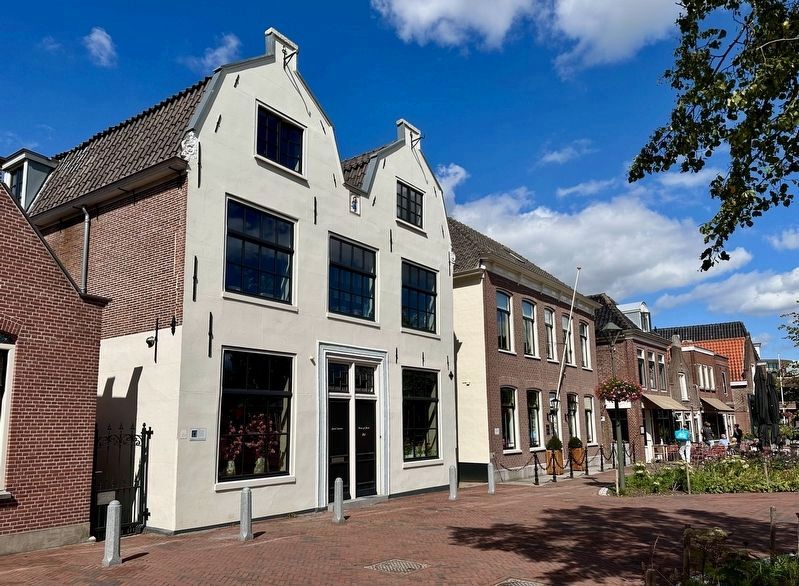
2. D’Corendrager / “The Grain Carrier” building and marker
The marker is visible here on the corner of the white building. The relief is visible at the roofline, between the two peaks.
Photographed by Andrew Ruppenstein, September 1, 2026
3. “The Grain Carrier” stone relief
Credits. This page was last revised on September 16, 2026. It was originally submitted on September 16, 2026, by Andrew Ruppenstein of Lamorinda, California. This page has been viewed 5 times since then. Photos: 1, 2, 3. submitted on September 16, 2026, by Andrew Ruppenstein of Lamorinda, California.
