Kernville in Kern County, California — The American West (Pacific Coastal)
Arrastra and Chilean Wheel

Photographed by Craig Baker, June 7, 2026
1. Arrastra and Chilean Wheel Marker
Some of the earliest methods of crushing gold ore were the use of Arrastras and Chilean Wheels. A drag stone used in an Arrastra is at your feet and next to it on your right is a Chilean Wheel. Visit the Mining Exhibit in the Museum for further information.
Topics. This historical marker is listed in this topic list: Industry & Commerce.
Location. 35° 45.314′ N, 118° 25.603′ W. Marker is in Kernville, California, in Kern County. It is on Big Blue Road 0.1 miles west of Kernville Road, on the left when traveling west. Touch for map. Marker is at or near this postal address: 49 Big Blue Rd, Kernville CA 93238, United States of America. Touch for directions.

Regionally, this marker is in the San Joaquin Valley, specifically in the Central Valley, and in the Sierra Nevada. It is also on the American Pacific Coast. Globally, it is in North America, on the Ring of Fire, on the Pacific Rim, in the Western Hemisphere, in the Western World, and in the Anglosphere. Historically, it finds itself in what was once New Spain and also Mexico’s Alta California.
this page online
Other nearby markers. At least 8 other markers are within 8 miles of this marker, measured as the crow flies: Kern River Valley History (here, next to this marker); The Harley Mine (a few steps from this marker); Bob Powers (a few steps from this marker); Kernville (approx. 2½ miles away); Kernville Veterans Memorial (approx. 2½ miles away); Old Kernville (approx. 2.7 miles away); Campsite of Edward Kern (approx. 7½ miles away); Old Isabella (approx. 7½ miles away). Touch for a list and map of all markers in Kernville.
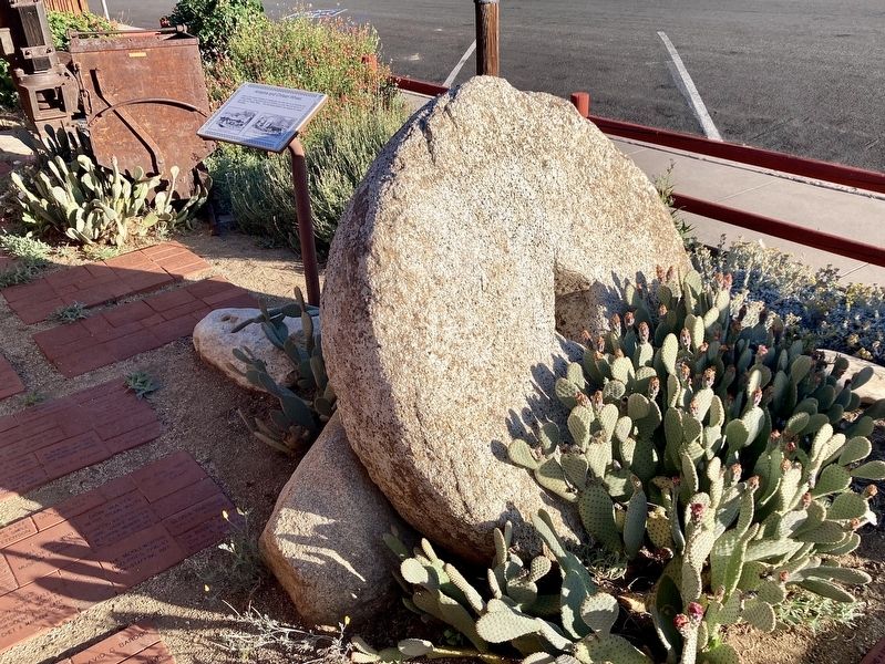
Photographed by Craig Baker, June 7, 2026
2. Chilean Wheel and Marker

Photographed by Craig Baker, June 7, 2026
3. Kern River Valley Museum
The marker is in front of the museum.
Credits. This page was last revised on September 16, 2026. It was originally submitted on September 16, 2026, by Craig Baker of Sylmar, California. This page has been viewed 9 times since then. Photos: 1, 2. submitted on September 16, 2026, by Craig Baker of Sylmar, California. 3. submitted on June 9, 2026, by Craig Baker of Sylmar, California.
