Cranbury in Middlesex County, New Jersey — The American Northeast (Mid-Atlantic)
Site of House of Dr. Hezekiah Stites
B. 1726 –D. 1796
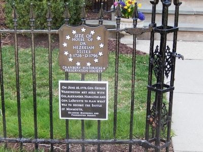
Photographed by Don Morfe, April 6, 2016
1. Site of House of Dr. Hezekiah Stites Marker
On June 26, 1778, Gen. George Washington met here with Col. Alexander Hamilton and Gen. Lafayette to plan what was to become the Battle of Monmouth.
Erected by Cranbury Historical and Preservation Society.
Topics. This historical marker is listed in this topic list: War, US Revolutionary. A significant historical date for this entry is June 26, 1778.
Location. 40° 18.323′ N, 74° 31.154′ W. Marker is in Cranbury, New Jersey, in Middlesex County. It is on South Main Street north of Cranbury Neck Road, on the right when traveling north. Touch for map. Marker is at or near this postal address: 50 South Main Street, Cranbury NJ 08512, United States of America. Touch for directions.

Regionally, this marker is in New Jersey’s Central Jersey, in Greater Princeton, and in the New York City Metropolitan Area. It is also in the American Northeast, in the Mid-Atlantic, and on the Eastern Seaboard. Globally, it is in the North Atlantic Region, North America, the Western Hemisphere, the Western World, and the Anglosphere. Historically, it finds itself in what was once New Netherland and also one of the original Thirteen
this page online
Other nearby markers. At least 8 other markers are within walking distance of this marker: Parsonage Barn (about 400 feet away, measured in a direct line); The First Presbyterian Church and Cemetery (approx. 0.2 miles away); Cranberry Mills (approx. ¼ mile away); Site of Encampment (approx. 0.3 miles away); The Cranbury Dam (approx. 0.3 miles away); Todd Beamer (approx. 0.6 miles away); Second Presbyterian Church of Cranbury (approx. 0.7 miles away); a different marker also named The Second Presbyterian Church of Cranbury (approx. 0.7 miles away). Touch for a list and map of all markers in Cranbury.
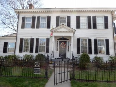
Photographed by Don Morfe, April 6, 2016
2. Site of House of Dr. Hezekiah Stites Marker
Credits. This page was last revised on September 21, 2026. It was originally submitted on April 12, 2016, by Don Morfe of Baltimore, Maryland. This page has been viewed 1,565 times since then and 93 times this year. Last updated on September 18, 2026, by Carl Gordon Moore Jr. of North East, Maryland. Photos: 1, 2. submitted on April 12, 2016, by Don Morfe of Baltimore, Maryland. • Devry Becker Jones was the editor who published this page.
