Havre de Grace in Harford County, Maryland — The American Northeast (Mid-Atlantic)
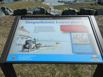
Susquehanna Lower Ferry
Star-Spangled Banner National Historic Trail
| — | National Park Service, U.S. Department of the Interior | — |
Photographed by Bill Pfingsten, April 3, 2013
1. Susquehanna Lower Ferry Marker
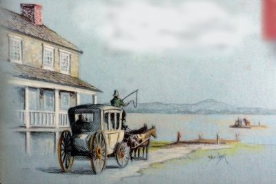
The taverns and the ferry made Havre de Grace, originally called Susquehanna Lower Ferry, a successful town in the early 19th century. People arrived via the Post Road, the major route of north/south travel in the day, and crossed the Susquehanna River on one of the ferries.
"By several passengers in the stage, which arrived last evening, information is received that about the dawn of day yesterday morning, a considerable number of the enemy came up as high as Havre-de-Grace and commenced the bombardment of that place with shot, shells and rockets."
- Baltimore Patriot, May 4, 1813
[Caption:]
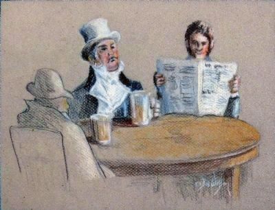
Taverns provided food, drink, and lodging for travelers as they waited for river conditions to allow passage. Mrs. Sears' Tavern stood near this location and Mr. Mansfield's Tavern was just north. News traveled into town with the passengers on the Post Road, and locals would frequent the taverns to hear the latest happenings in Baltimore and Philadelphia.
Erected by National Park Service, U.S. Department of the Interior.
Topics and series. This historical marker is listed in these topic lists: Industry & Commerce
this page online
Location. Marker is missing. It was located near 39° 33.148′ N, 76° 5.457′ W. Marker was in Havre de Grace, Maryland, in Harford County. It could be reached from North Union Avenue south of Otsego Avenue, on the right when traveling north. The marker stands in David Craig Park south of the Railroad Bridge. Touch for map. Marker was at or near this postal address: 501 St John St, Havre de Grace MD 21078, United States of America. Touch for directions.

Regionally, this marker was in the Baltimore Metro Region and in Central Maryland. It was also in the American Mid-Atlantic, in the Chesapeake Bay Region, and on the Eastern Seaboard. Globally, it was in the North Atlantic Region, North America, the Western Hemisphere, the Western World, and the Anglosphere. Historically, it found itself in what was once one of the original Thirteen Colonies and also the Antebellum South.
Other nearby markers. At least 8 other markers are within walking distance of this location: Under Attack
Photographed by Bill Pfingsten, April 3, 2013
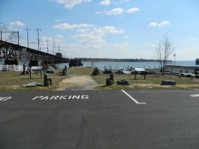
2. Susquehanna Lower Ferry Marker on right with Susquehanna River beyond.
Photographed by Allen C. Browne, October 4, 2013
3. Susquehanna Lower Ferry
Pastel by Bill Watson
Photographed by Allen C. Browne, October 4, 2013
4. In the Tavern
Pastel by Bill Watson
Photographed by Allen C. Browne, October 4, 2013
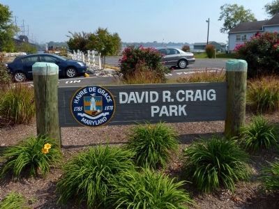
5. David R. Craig Park
This park is named for the County Executive of Harford County.
Credits. This page was last revised on September 21, 2026. It was originally submitted on April 4, 2013, by Bill Pfingsten of Bel Air, Maryland. This page has been viewed 1,752 times since then and 95 times this year. Last updated on September 18, 2026, by Kevin Vincent of Arlington, Virginia. Photos: 1, 2. submitted on April 4, 2013, by Bill Pfingsten of Bel Air, Maryland. 3, 4, 5. submitted on October 10, 2013, by Allen C. Browne of Silver Spring, Maryland. • Devry Becker Jones was the editor who published this page.
