Versailles in Woodford County, Kentucky — The American South (East South Central)
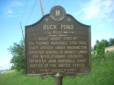
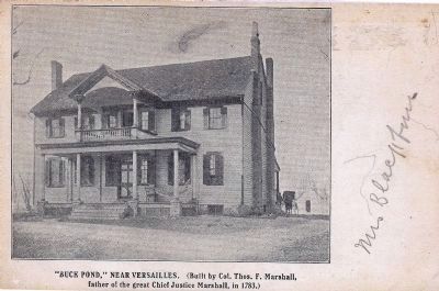
Buck Pond
1¼ Miles →
Erected by Kentucky Department of Highways. (Marker Number 114.)
Topics and series. This historical marker is listed in these topic lists: Settlements & Settlers • War, US Revolutionary. In addition, it is included in the Kentucky Historical Society series list. A significant historical year for this entry is 1783.
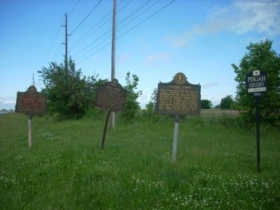
Location. 38° 2.962′ N, 84° 42.052′ W. Marker is in Versailles, Kentucky, in Woodford County. Marker is at the intersection of Lexington Road (U.S. 60) and Paynes Mill Road, on the right when traveling west on Lexington Road. Marker is located with two other markers identifying Calmes Tomb and Hemp in Kentucky. Touch for map. Marker is in this post office area: Versailles KY 40383, United States of America. Touch for directions.
Other nearby markers. At least 8 other markers are within 2 miles of this marker, measured as the crow flies. Calmes Tomb (here, next to this marker); Hemp in Kentucky / Woodford County Hemp (here, next to this marker); Huntertown (approx. one mile away); Josephine Henry (approx. 1.4 miles away); Randall Lee Gibson / Jerome Bonaparte Robertson (approx. 1.6 miles away); Woodford County, 1789 / County Named (approx. 1.6 miles away); Woodford County's Civil War Generals (approx. 1.6 miles away); Watkins Tavern (approx. 1.6 miles away). Touch for a list and map of all markers in Versailles.
Credits. This page was last revised on June 16, 2016. It was originally submitted on May 24, 2010, by John Desaulniers, Jr. of Mingo, Iowa. This page has been viewed 1,009 times since then and 18 times this year. Photos: 1. submitted on May 24, 2010, by John Desaulniers, Jr. of Mingo, Iowa. 2. submitted on December 21, 2013, by Wendy J. W. Straight of Dunkirk, New York. 3. submitted on May 24, 2010, by John Desaulniers, Jr. of Mingo, Iowa. • Bill Pfingsten was the editor who published this page.


