Near Pasco in Franklin County, Washington — The American West (Northwest)
Lewis and Clark National Historic Trail
Photographed by Barry Swackhamer, June 13, 2026
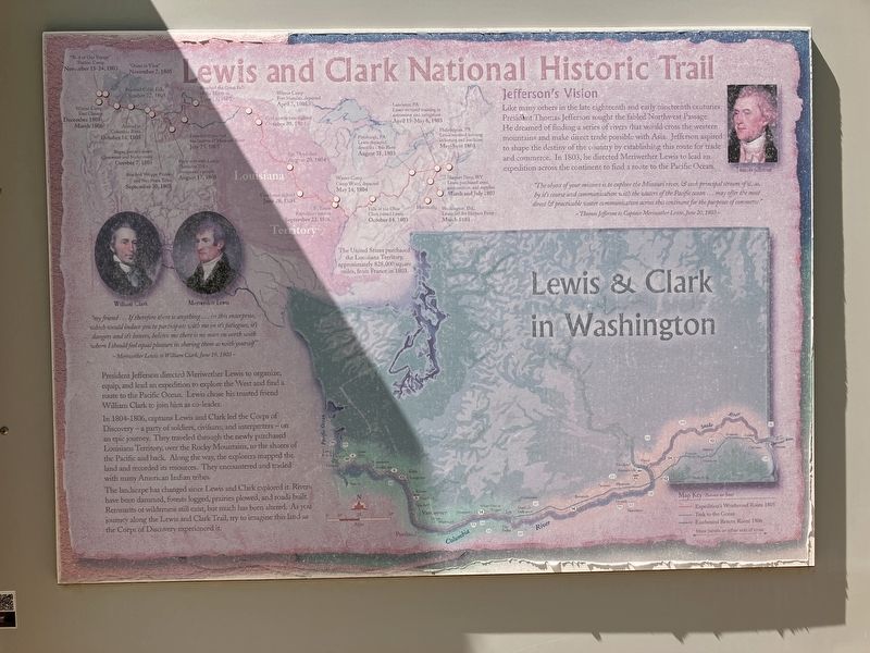
1. Lewis and Clark National Historic Trail Marker
Click on this image to enlarge it and examine details of the Lewis and Clark Expedition map.
" my friend ... If therefore there is anything...in this enterprise which would induce you to participate with me in it's fatigues, it's dangers and it's honors, believe me there is no man on earth with whom I should feel equal pleasure in sharing them as with yourself"
Meriwether Lewis to William Clark, June 19, 1803
President Jefferson directed Meriwether Lewis to organize, equip, and lead an expedition to explore the West and find a route to the Pacific Ocean. Lewis chose his trusted friend William Clark to join him as co-leader.
In 1804-1806, captains Lewis and Clark lead the Corps of Discovery - a party of soldiers, civilians, and interpreters - on an epic journey. They traveled through the newly purchased Louisiana Territory, over the Rocky Mountains, to the shores of the Pacific and back. Along the way, the explorers mapped the land and recorded its resources. They encountered and traded with many American Indian tribes.
The landscape has changed since Lewis and Clark explored it. Rivers have been damed, forests logged, prairies plowed. and roads built. Remnants
this page online
Jefferson's Vision
Like many others in the late eighteenth and early nineteenth centuries, President Thomas Jefferson sought the fabled Northwest Passage. He dreamed of finding a series of rivers that would cross the western mountains and make direct trade possible with Asia. Jefferson aspired to shape the destiny of the country by establishing this route for trade and commerce. In 1803, he directed Meriwether Lewis to lead an expedition across the continent to find a route to the Pacific Ocean.
" The object of your mission is to explore the Missouri river, & such principal streams of it, as, by it's course and communication with the waters of the Pacific ocean ... may offer the most direct & practicable water communication across this continent for the purposes of commerce." -- Thomas Jefferson to Captain Lewis, June 20, 1803
Erected by Washington Lewis & Clark Expedition Bicentennial Commission.
Topics. This memorial is listed in this topic
Photographed by Barry Swackhamer, June 13, 2026
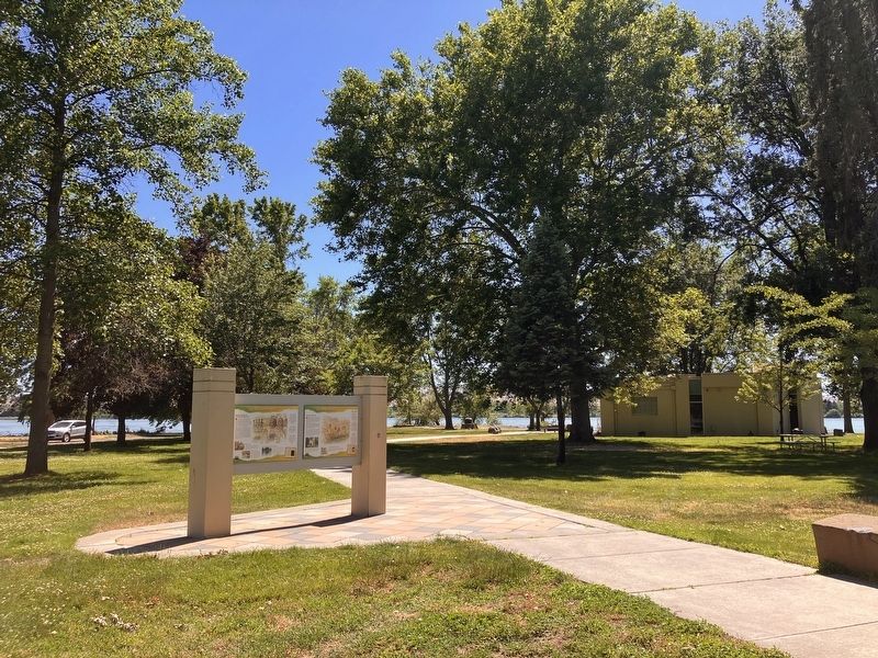
2. Lewis and Clark National Historic Trail Marker
Location. 46° 11.969′ N, 119° 2.332′ W. Memorial is near Pasco, Washington, in Franklin County. It can be reached from Sacajawea Park Road near South Road 40 East. This marker is located in Sacajawea Park. Touch for map. Memorial is at or near this postal address: 2503 Sacajawea Park Road, Pasco WA 99301, United States of America. Touch for directions.

Regionally, this memorial is in Washington’s Columbia Basin. It is also in the American Mountain West and in the Lewis & Clark Corridor. Globally, it is in North America, on the Pacific Rim, in the Western Hemisphere, in the Western World, and in the Anglosphere.
Other nearby markers. At least 8 other markers are within walking distance of this marker: "Sah-cah-ga-weah" (here, next to this marker); "great Columbia river" (here, next to this marker); Snake River Passage & Columbia Plains Crossing (here, next to this marker); Mayor A. P. Gray (within shouting distance of this marker); Columbia River (within shouting distance of this marker); Snake River (within shouting distance of this marker); At the Confluence (within shouting distance of this marker); Lewis & Clark Camp (within shouting distance of this marker). Touch for a list and map of all markers in Pasco.
More about this memorial. Identical markers are located at several places along Washington's Lewis and Clark Trail.
Credits. This page was last revised on September 19, 2026. It was originally submitted on September 19, 2026, by Barry Swackhamer of Brentwood, California. This page has been viewed 5 times since then. Photos: 1, 2. submitted on September 19, 2026, by Barry Swackhamer of Brentwood, California.
