Ouderkerk aan de Amstel in Ouder-Amstel, North Holland, Netherlands — Northwestern Europe
Schoonzicht/Amstel-dael
Photographed by Andrew Ruppenstein, September 1, 2026
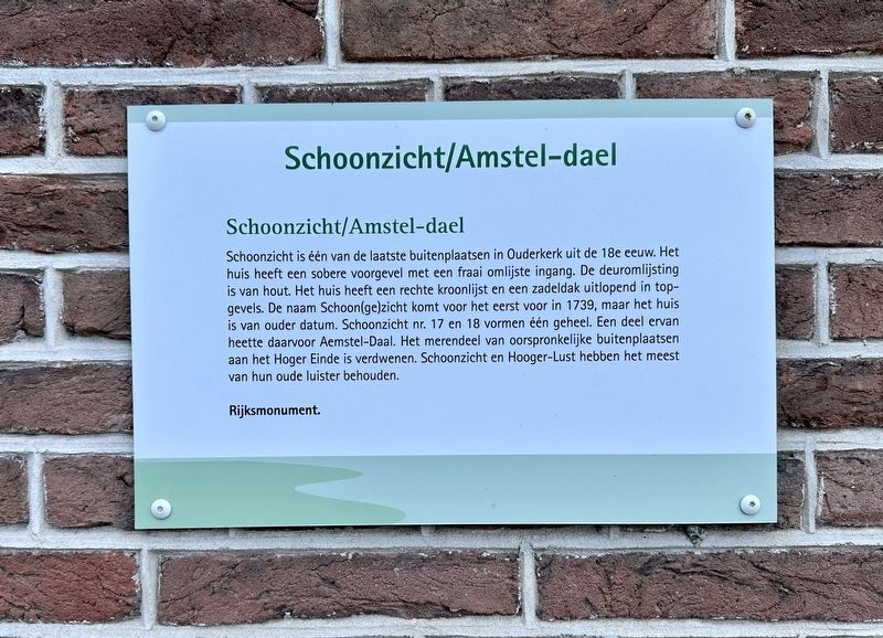
1. Schoonzicht/Amstel-dael Marker

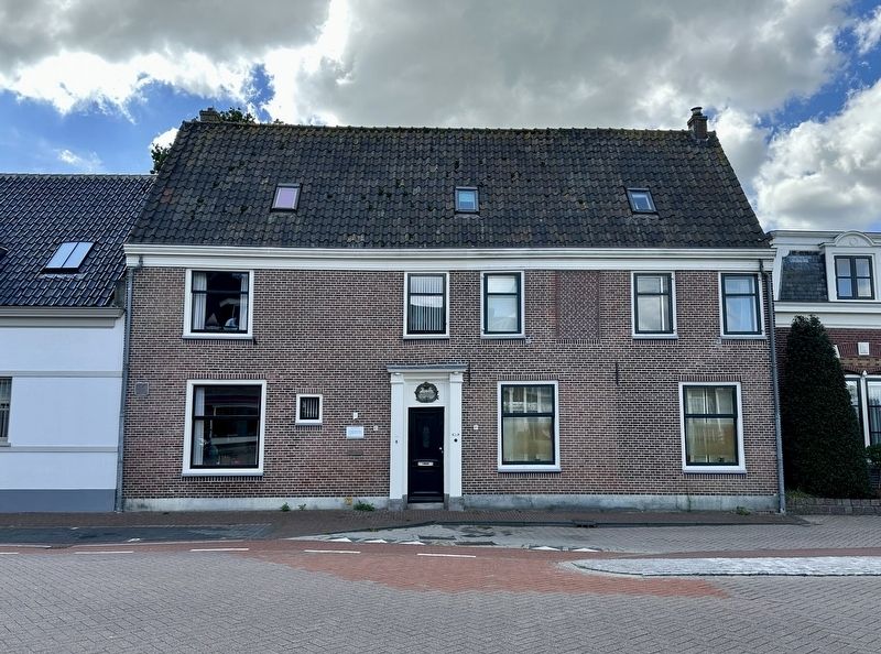
Schoonzicht is één van de laatste buitenplaatsen in Ouderkerk uit de 18e eeuw. Het huis heeft een sobere voorgevel met een fraai omlijste ingang. De deuromlijsting is van hout. Het huis heeft een rechte kroonlijst en een zadeldak uitlopend in top-gevels. De naam Schoon(ge)zicht komt voor het eerst voor in 1739, maar het huis is van ouder datum. Schoonzicht nr. 17 en 18 vormen één geheel. Een deel ervan heette daarvoor Aemstel-Daal. Het merendeel van oorspronkelijke buitenplaatsen aan het Hoger Einde is verdwenen. Schoonzicht en Hooger-Lust hebben het meest van hun oude luister behouden.
Schoonzicht/Amstel-dael Schoonzicht is one of the last remaining 18th-century country estates in Ouderkerk. The house features an understated façade with an elegantly framed entrance; the door surround is made of wood. The house has a straight cornice and a gable roof terminating in stepped gables. The name Schoonzicht first appears in records in 1739, though the house itself predates that time. The properties at Schoonzicht Nos. 17 and 18 form a single complex;
this page online
National monument.
Topics. This historical marker is listed in this topic list: Notable Buildings. A significant historical year for this entry is 1739.
Location. 52° 17.894′ N, 4° 54.038′ E. Marker is in Ouderkerk aan de Amstel, Noord-Holland (North Holland), in Ouder-Amstel. It is on Hoger Einde-Zuid, on the right when traveling south. Touch for map. Marker is at or near this postal address: Hoger Einde-Zuid 17, Ouderkerk aan de Amstel, Noord-Holland 1191 AH, Netherlands. Touch for directions.

Regionally, it is in Europe, the European Union, Atlantic Europe, the Benelux Low Countries, the Schengen Area, Western Europe, and the Western World. Historically, it finds itself in what was once the Holy Roman Empire.
Other nearby markers. At least 8 other markers are within walking distance of this marker: Hooger-Lust (within shouting distance of this marker); Brugstraat, Lange brug en Ponteveer / Brugstraat, “Long Bridge”, and Ferry
Photographed by Andrew Ruppenstein, September 1, 2026
2. Schoonzicht/Amstel-dael Marker - wide view
Also see . . . Schoonzicht (Historisch Amstelland, in Dutch). Excerpt (in translation):
Country Estates: Like Hooger-Lust (Hoger Einde Zuid 6), Schoonzicht is one of the last remaining 18th-century country estates in Ouderkerk. Hoger Einde was an attractive location for wealthy Amsterdam merchants to establish a country estate. However, such estates were not intended solely for leisure; they also served as investments (in agricultural operations) and were beneficial for health. The canals of Amsterdam were a source of foul odors. People were deeply afraid of contagious diseases. …(Submitted on September 20, 2026.)
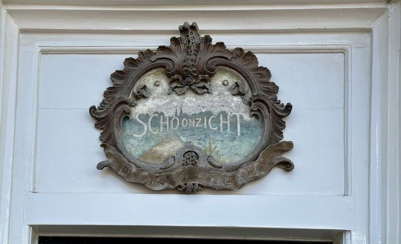
Most of these country estates were builtduring the 17th and 18th centuries. Such an estate was also known as a plaisierthuijn (pleasure garden). Distinguished houses featuring pleasure gardens and tea pavilions sprang up all along the Amstel River during that period. In the 18th century, no fewer than seven country estates stood along Hoger Einde (from north to south): Karssenhof, Amsteldaal, Schoonzicht, Vredelust, Toorenvliet (later renamed Stroom-en-Lommer), Hooger-Lust, and Hooger-Amstel. The majority of the original buildings have disappeared. Hooger-Lust and Schoonzicht (Nos. 6 and 17/18; both National Monuments) have retained the most of their former grandeur. …Photographed by Andrew Ruppenstein, September 1, 20263. Schoonzicht/Amstel-dael - decorative detail above the door
Credits. This page was last revised on September 20, 2026. It was originally submitted on September 20, 2026, by Andrew Ruppenstein of Lamorinda, California. This page has been viewed 9 times since then. Photos: 1, 2, 3. submitted on September 20, 2026, by Andrew Ruppenstein of Lamorinda, California.
