G4 in Mannheim, Baden-Württemberg, Germany — Central Europe
Trinitatiskirche, G 4
⎯⎯⎯
Trinity Church, G 4
| — | Kulturdenkmal / Cultural Monument | — |
Photographed by James Hulse, September 16, 2026
1. Trinitatiskirche, G 4 / Trinity Church, G 4 Marker

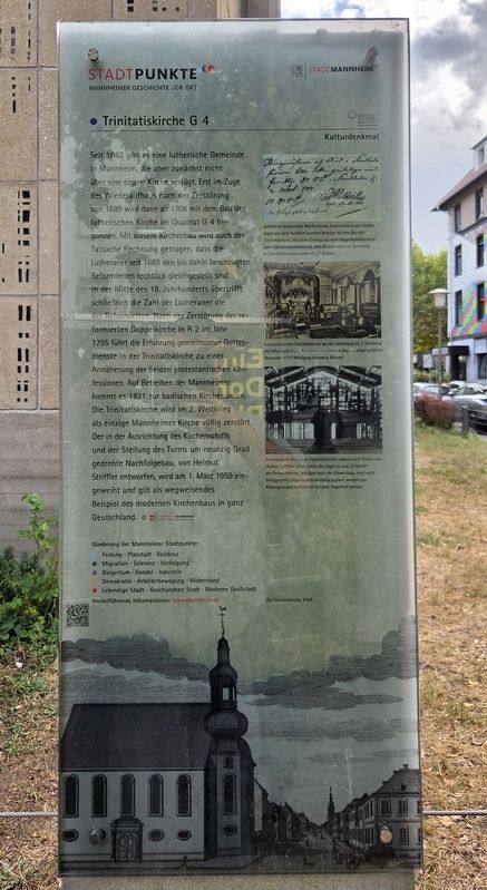
Zahlreiche lutherische Reichsstände, Institutionen und Städte sogar aus dem Ausland spenden Beiträge für den Bau der Trinitatiskirche. Wie dem Eintrag aus dem Hauptkollektenbuch von 1707 zu entnehmen ist, gibt die schwedische Gemeinde in Stockholm etwas mehr als 37 Gulden.
Innenansicht der Trinitatiskirche vor der Zerstörung im 2. Weltkrieg mit Altar und Orgel. Auf dieser exzellenten Stumm-Orgel spielt im Dezember 1777 Wolfgang Amadeus Mozart.
Innenansicht der neuen Trinitatiskirche, erbaut nach Plänen von Helmut Striffler 1958–1959. Die Orgel ist zum Zeitpunkt der Fotoaufnahme, also kurz nach der Einweihung, noch nicht fertiggestellt. Ursprünglich dreiteilig geplant, werden aus Kostengründen schließlich nur zwei Orgelteile gebaut.
Die Trinitatiskirche, 1782.
© Stadtarchiv Mannheim Institut Für Stadtgeschichte
Weiterführende
this page online
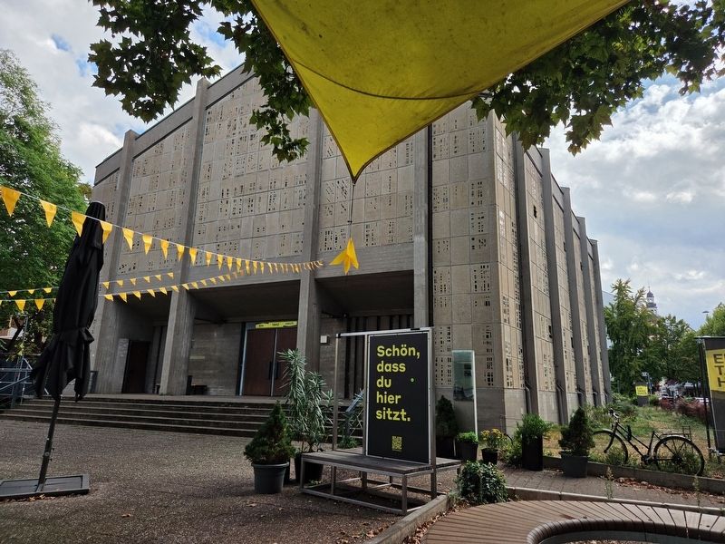
Mannheim has had a Lutheran congregation since 1662, but it initially had no church of its own. Construction of the Lutheran church in Square G 4 began in 1706 during the rebuilding that followed the destruction of 1689. The new church also reflected the fact that the Lutherans had received the same legal status as the previously favored Reformed community in 1685. By the middle of the 18th century, the number of Lutherans had surpassed the number of Reformed Christians. After the Reformed Double Church in R 2 was destroyed in 1795, the two Protestant denominations held services together in Trinity Church. This brought the communities closer and helped lead to the Baden Church Union in 1821. Trinity Church was the only church in Mannheim to be completely destroyed during World War II. Its replacement, designed by Helmut Striffler with the nave and tower turned ninety degrees from their former positions, was dedicated on March 1, 1959. It is considered a pioneering example of modern church architecture throughout Germany.
Numerous Lutheran Imperial Estates, institutions and cities, including some outside Germany, contributed money toward the construction of Trinity Church. According to an entry in the main collection ledger from 1707, the Swedish congregation in Stockholm donated slightly more than 37 guilders.
Interior of Trinity Church before its destruction during World War II, showing the altar and organ. Wolfgang Amadeus Mozart played this excellent Stumm organ in December 1777.
Interior of the new Trinity Church, constructed from Helmut Striffler’s plans in 1958–1959. When this photograph was taken shortly after the dedication, the organ had not yet been completed. Although originally designed in three sections, only two sections were constructed because of costs.
Trinity Church, 1782.
Further
Photographed by James Hulse, September 16, 2026
2. Trinity Church and Marker
Erected by Stadtpunkte Mannheimer Geschichte Vor Ort and Stadt Mannheim.
Topics. This historical marker is listed in this topic list: Religion & Religious Structures. A significant historical date for this entry is March 1, 1959.
Location. 49° 29.427′ N, 8° 27.866′ E. Marker is in Mannheim, Baden-Württemberg. It is in G4. It is on G 4 close to F4, on the right when traveling north. Touch for map. Marker is at or near this postal address: G 4 20, Mannheim BW 68159, Germany. Touch for directions.

Regionally, this marker is on the German Upper Rhine. Globally, it is in Europe, the European Union, Atlantic Europe, Central Europe, the Schengen Area, Western Europe, and the Western World. Historically, it finds itself in what was once the Roman Empire, the Holy Roman Empire, and the former West Germany.
Other nearby markers. At least 8 other markers are within walking distance of this marker: Juden in Mannheim / Jews in Mannheim (about 90 meters away, measured in a direct line); Hauptsynagoge F 2 und Lemle-Moses-Klaus F 1 / Main Synagogue F 2 and Lemle Moses Klaus F 1 (about 90 meters away); Sozialer Wohnungsbau im Quadrat F 5 / Social Housing in Square F 5
Photographed by James Hulse
3. Trinitatiskirche, G 4 / Trinity Church, G 4 Marker
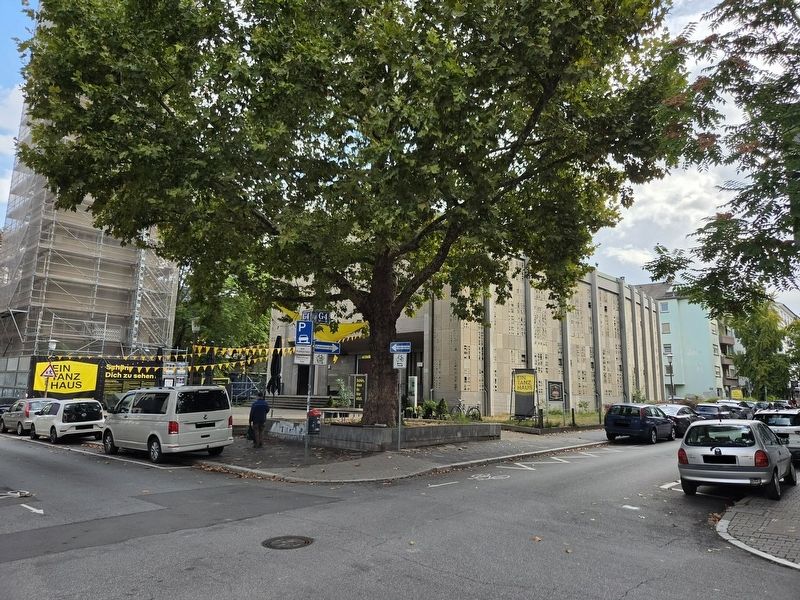
The view of the church and marker from across the street.
Credits. This page was last revised on September 22, 2026. It was originally submitted on September 20, 2026, by James Hulse of Medina, Texas. This page has been viewed 4 times since then. Photos: 1, 2, 3. submitted on September 22, 2026, by James Hulse of Medina, Texas.
