Innenstadt/Jungbusch in Mann in Mannheim, Baden-Württemberg, Germany — Central Europe
Hochbunker Neckarvorlandstraße
⎯⎯⎯
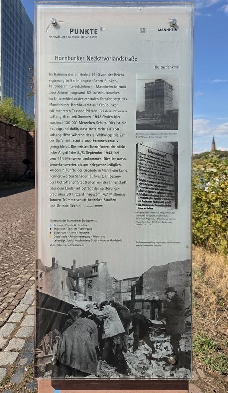
Neckarvorlandstraße Air-Raid Bunker
| — | Kulturdenkmal / Cultural Monument | — |
Photographed by James Hulse, September 16, 2026
1. Hochbunker Neckarvorlandstraße / Neckarvorlandstraße Air-Raid Bunker Marker

Der Hochbunker am Luisenring bietet im Alarmfall 5 500 Personen Schutz. Foto von 1944.
Viele der Bunker werden nach Kriegsende als Notunterkünfte benutzt. Die Bewohner haben ein strenges Reglement zu beachten, wie an dieser Hausordnung eines Mannheimer Bunkers von 1949 abzulesen ist.
Zur Trümmerbeseitigung verpflichtete Mannheimer beladen die Trümmerbahn, um 1946.
Weiterführende Informationen: www.mannheim.de
© Stadtarchiv Mannheim Institut Für Stadtgeschichte
As part of the bunker-construction program initiated by the national government in Berlin in the fall of 1940, a total of 52 air-raid bunkers were built in Mannheim within about two years. Unlike the central government’s specifications, Mannheim’s building department chose to construct large bunkers with space for several thousand people. During the
this page online
The high-rise bunker on Luisenring could shelter 5,500 people during an air-raid alert. Photograph from 1944.
After the war, many bunkers were used as emergency accommodations. Residents had to follow strict regulations, as shown by these house rules from a Mannheim bunker in 1949.
Mannheim residents required to assist with rubble removal load the rubble railway, around 1946.
Further information: www.mannheim.de
Erected by Stadtpunkte Mannheimer Geschichte
Photographed by James Hulse, September 16, 2026
2. Hochbunker Neckarvorlandstraße / Neckarvorlandstraße Air-Raid Bunker Marker
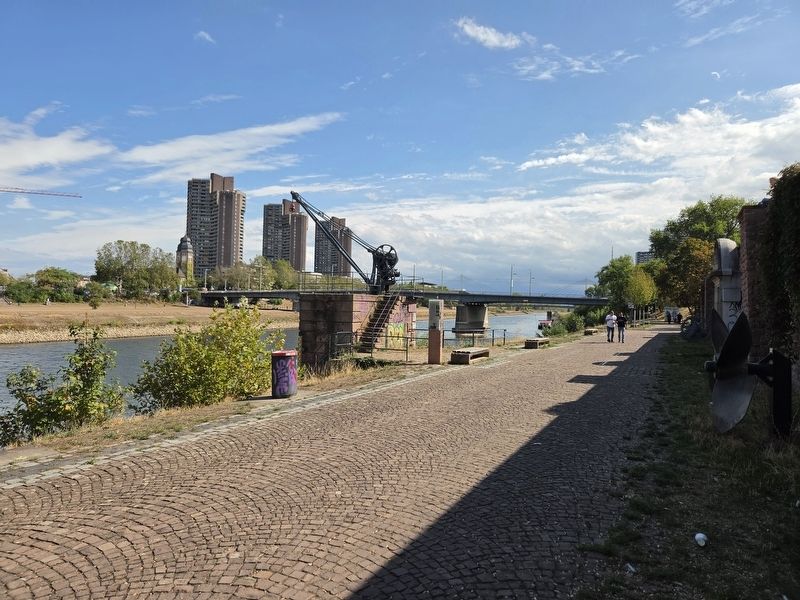
The is on the reverse side of the marker along side the crane.
Topics. This historical marker is listed in this topic list: War, World II. A significant historical month for this entry is September 1943.
Location. 49° 29.658′ N, 8° 28.157′ E. Marker is in Mann, Baden-Württemberg, in Mannheim. It is in Innenstadt/Jungbusch. It can be reached from Luisenring 0.1 kilometers west of Kurpfalzbrücke, on the right when traveling west. Touch for map. Marker is at or near this postal address: Luisenring 51, Mann BW 68159, Germany. Touch for directions.

Regionally, this marker is on the German Upper Rhine. Globally, it is in Europe, the European Union, Atlantic Europe, Central Europe, the Schengen Area, Western Europe, and the Western World. Historically, it finds itself in what was once the Roman Empire, the Holy Roman Empire, and the former West Germany.
Other nearby markers. At least 8 other markers are within walking distance of this marker: Neckarkran der Firma Mohr & Federhaff / Neckar Crane of the Mohr & Federhaff Company (here, next to this marker); Schiffs- und Maschinenbau AG Mannheim – Schimag (a few steps from this marker); Festungsfunde beim Bau des Regenüberlaufbeckens (within shouting distance of this marker); Museumsschiff Mannheim / Mannheim Museum Ship (within shouting distance of this marker); Die Stadtentwässerung – wie alles begann / Urban Drainage – How It All Began (within shouting distance of this marker); Aalschokker / Eel-Fishing Boat (within shouting distance of this marker); Alexander Sender Wassermann (about 210 meters away, measured in a direct line); Mathilde Wassermann (about 240 meters away).
Credits. This page was last revised on September 22, 2026. It was originally submitted on September 20, 2026, by James Hulse of Medina, Texas. This page has been viewed 5 times since then. Photos: 1, 2. submitted on September 22, 2026, by James Hulse of Medina, Texas.
