Lompoc in Santa Barbara County, California — The American West (Pacific Coastal)
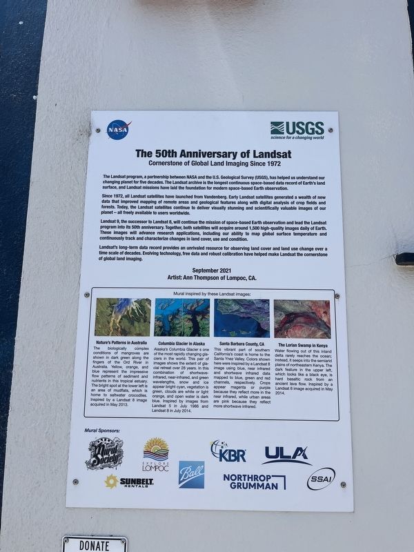
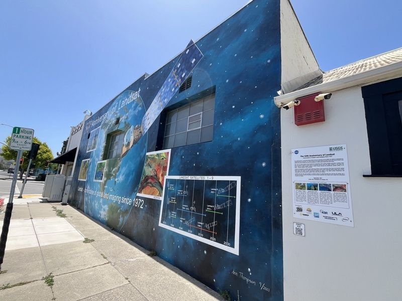
The 50th Anniversary of Landsat
Cornerstone of Global Land Imaging Since 1972
Photographed by Adam Margolis, June 1, 2026
1. The 50th Anniversary of Landsat Marker
Since 1972, all Landsat satellites have launched from Vandenberg. Early Landsat satellites generated a wealth of new data that improved mapping of remote areas and geological features along with digital analysis of crop fields and forests. Today, the Landsat satellites continue to deliver visually stunning and scientifically valuable images of our planet - all freely available to users worldwide.
Landsat 9, the successor to Landsat 8, will continue the mission of space-based Earth observation and lead the Landsat program into its 50th anniversary. Together, both satellites will acquire around 1,500 high-quality images daily of Earth. These images will advance research applications, including our ability to map global surface temperature and continuously track and characterize changes
this page online
Landsat's long-term data record provides an unrivaled resource for observing land cover and land use change over a time scale of decades. Evolving technology, free data and robust calibration have helped make Landsat the cornerstone of global and imaging.
Erected 2021 by NASA and USGS. A significant historical year for this entry is 1972.
Location. 34° 38.358′ N, 120° 27.558′ W. Marker is in Lompoc, California, in Santa Barbara County. It is at the intersection of N I Street and West Ocean Avenue, on the right when traveling south on N I Street. Touch for map. Marker is at or near this postal address: 205 W Ocean Avenue, Lompoc CA 93436, United States of America. Touch for directions.

Regionally, this marker is on the Central Coast, specifically on the Coast Ranges, and specifically in the Transverse Ranges. It is also on the American Pacific Coast. Globally, it is in North America, on the Ring of Fire, on the Pacific Rim, in the Western Hemisphere, in the Western World, and in the Anglosphere. Historically, it finds itself in what was once New Spain and also Mexico’s Alta California.
Photographed by Adam Margolis, June 1, 2026
2. The 50th Anniversary of Landsat Marker
Other nearby markers. At least 8 other markers are within walking distance of this marker: Odd Fellows Building (about 300 feet away, measured in a direct line); The Lilley Building (about 400 feet away); Italian Stone Pines (approx. 0.2 miles away); Lompoc Carnegie Library (approx. 0.2 miles away); Lompoc World War I Monument (approx. 0.2 miles away); Lompoc's Mission Vieja (approx. 0.2 miles away); Tragedy of Point Pedernales/Honda Point (approx. half a mile away); Mission Vieja: The Community (approx. 0.6 miles away). Touch for a list and map of all markers in Lompoc.
Credits. This page was last revised on September 20, 2026. It was originally submitted on September 20, 2026, by Adam Margolis of Mission Viejo, California. This page has been viewed 4 times since then. Photos: 1, 2. submitted on September 20, 2026, by Adam Margolis of Mission Viejo, California. • Andrew Ruppenstein was the editor who published this page.
