
Southbridge in Wilmington in New Castle County, Delaware — The American Northeast (Mid-Atlantic)
Mount Joy United Methodist Church
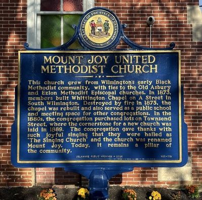
Photographed by Pete Skillman, September 21, 2026
1. Mount Joy United Methodist Church Marker
Erected 2026 by Delaware Public Archives. (Marker Number NCC-179.)
Topics and series. This historical marker is listed in these topic lists: African Americans • Education • Religion & Religious Structures. In addition, it is included in the Delaware Public Archives series list. A significant historical year for this entry is 1873.
Location. 39° 43.786′ N, 75° 32.68′ W. Marker is in Wilmington, Delaware, in New Castle County. It is in Southbridge. It is on Townsend Street, on
this page online

Regionally, this marker is in Greater Philadelphia. It is also in the American Mid-Atlantic, on the Delmarva Peninsula, and on the Eastern Seaboard. Globally, it is in the North Atlantic Region, North America, the Western Hemisphere, the Western World, and the Anglosphere. Historically, it finds itself in what was once New Netherland and also one of the original Thirteen Colonies.
Other nearby markers. At least 8 other markers are within walking distance of this marker: South Wilmington (approx. 0.2 miles away); Swedes Landing Trail (approx. 0.3 miles away); Bird's Eye View (approx. half a mile away); Steamboats & Ferries (approx. half a mile away); a different marker also named Steamboats & Ferries (approx. half a mile away); Mother Union American Methodist Episcopal Church (approx. 0.6 miles away); Landing of the Swedes (approx. 0.6 miles away); Anthony (approx. 0.6 miles away). Touch for a list and map of all markers in Wilmington.
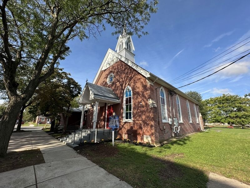
Photographed by Pete Skillman, September 21, 2026
2. Mount Joy United Methodist Church Marker - wide view
Credits. This page was last revised on September 23, 2026. It was originally submitted on September 21, 2026, by Pete Skillman of Wilmington, Delaware. This page has been viewed 16 times since then. Photos: 1, 2. submitted on September 21, 2026, by Pete Skillman of Wilmington, Delaware.
