Bentonville in Benton County, Arkansas — The American South (West South Central)
Vaughn Presbyterian Church
Photographed by Marc Hayot, September 23, 2026
1. Vaughn Presbyterian Church Marker
(main panel:)
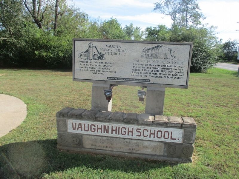
Vaughn Presbyterian Church
Located on this site and built in 1889, the wood structure was the center of activity for the small town and surrounding rural area.
Vaughn Public School
Located on this site and built in 1913, the stone and wood structure housed grades 1 thru 12 until 1950 then grades 1 thru 6 until it was closed in 1960 and added to the Bentonville School District
Donated by friends of the school and church 2010
(lower section:)
Vaughn High School.
Built by W. Jackson. B. Pearce.
J.H. Richman, K Phillips. S.L. Rice.
Directors 1918. D Bennett. T.G. True.
Erected 2010 by Friends of the School and Church.
Topics. This historical marker is listed in these topic lists: Education • Religion & Religious Structures • Settlements & Settlers. A significant historical year for this entry is 1889.
Location. 36° 18.882′ N, 94° 18.202′ W. Marker is unreadable. Marker is in Bentonville, Arkansas, in Benton County. It is at the intersection of Southwest Regional Airport Boulevard (State Highway 12) and South Vaughn Road (State Highway 279), on the right when traveling north
this page online

Regionally, this marker is in Northwest Arkansas, on the Ozark Plateau, in the Cherokee Heritage Region, and in Osage Territory. It is also in the American South, specifically in the Upper South, and in the Ozarks. Globally, it is in North America, the Western Hemisphere, the Western World, and the Anglosphere. Historically, it finds itself in what was once the territory of the Mississippian Culture, the Louisiana Purchase, one of the Confederate States of America, and the Antebellum South.
Other nearby markers. At least 8 other markers are within 7 miles of this location, measured as the crow flies: 1st/142nd Field Artillery Memorial (approx. half a mile away); McKissick's Spring (approx. 3.4 miles away);
Photographed by Marc Hayot, September 23, 2026
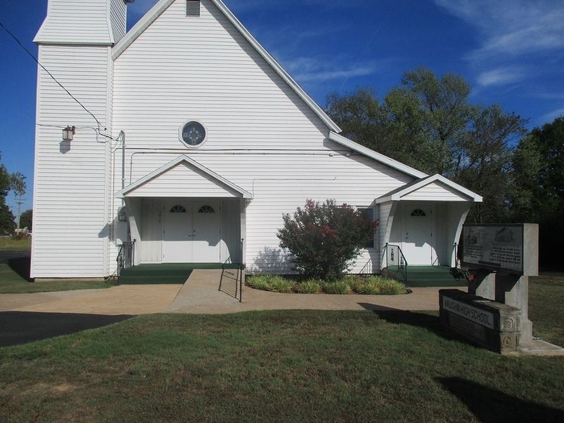
2. Vaughn Presbyterian Church Marker and Church Building
Another marker is no longer nearby. Big Tree (was approx. 5.9 miles away but has been permanently removed).
Regarding Vaughn Presbyterian Church. Vaughn Presbyterian Church was originally named Hazel Glen Presbyterian and formed by the citizens of Hazel Valley in the community's one-room school house. Vaughn Public School was built in 1914 on church grounds.
Also see . . . Together they stand Vaughn Church celebrates 125 years of community, memories. This article provides a more detailed history of Vaughn Presbyterian Church.
Originally named Hazel Glen Presbyterian, the church was formed in 1889 by 20 citizens of Hazel Valley in the one-room school house there.(Submitted on September 23, 2026, by Marc Hayot of Siloam Springs, Arkansas.)
Credits. This page was last revised on September 23, 2026. It was originally submitted on September 23, 2026, by Marc Hayot of Siloam Springs, Arkansas. This page has been viewed 8 times since then. Photos: 1, 2. submitted on September 23, 2026, by Marc Hayot of Siloam Springs, Arkansas. • Andrew Ruppenstein was the editor who published this page.
