Milford in South Central Region, Connecticut — The American Northeast (New England)
The Battle of Ridgefield
America 250 | Connecticut
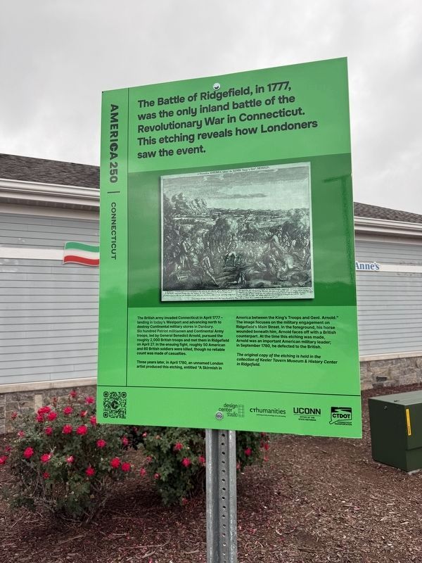
The Battle of Ridgefield, in 1777, was the only inland battle of the Revolutionary War in Connecticut. This etching reveals how Londoners saw the event.
The British army invaded Connecticut in April 1777 - landing in today's Westport and advancing north to destroy Continental military stores in Danbury. Six hundred Patriot militiamen and Continental Army troops, led by General Benedict Arnold, pursued roughly 2,000 British troops and met them in Ridgefield on April 27. In the ensuing fight, roughly 50 American and 60 British soldiers were killed, though no reliable count was made of casualties.
Three years later, in April 1780, an unnamed London artist produced this etching, entitled "A Skirmish in America between the King's Troops and Genl. Arnold." The image focuses on the military engagement on Ridgefield's Main Street. In the foreground, his horse wounded beneath him, Arnold faces off with a British counterpart. At the time this etching was made, Arnold was an important American military leader; in September 1780, he defected to the British.
The original copy of the etching is held in the collection of Keeler Tavern Museum & History Center in Ridgefield.
Erected by Design
this page online
Topics and series. This historical marker is listed in these topic lists: Arts, Letters, Music • Patriots & Patriotism • War, US Revolutionary. In addition, it is included in the America 250 series list. A significant historical date for this entry is April 27, 1777.
Location. 41° 14.818′ N, 73° 0.598′ W. Marker is in Milford in South Central Region, Connecticut. It is on Connecticut Turnpike (Interstate 95) west of Marsh Hill Road, on the right when traveling south. Touch for map. Marker is at or near this postal address: 2 Connecticut Tpke, Milford CT 06460, United States of America. Touch for directions.

Regionally, this marker is in the Connecticut River Valley, on the Connecticut Shoreline, and in Greater New Haven. It is also in the American Northeast, in New England, and on the Eastern Seaboard. Globally, it is in the North Atlantic Region, North America, the Western Hemisphere, the Western World, and the Anglosphere. Historically, it finds itself in what was once New Haven County and also one of the original

Other nearby markers. At least 8 other markers are within 3 miles of this marker, measured as the crow flies: Hannah Bunce (about 500 feet away, measured in a direct line); Orange Veterans Monument (approx. 2.3 miles away); Orange (approx. 2.4 miles away); Veterans Memorial (approx. 2½ miles away); Peter Pond (approx. 2½ miles away); George W. Baird (approx. 2.6 miles away); A Connecticut Minuteman’s Homestead (approx. 2.6 miles away); West Haven Vietnam Veterans Memorial (approx. 2.7 miles away). Touch for a list and map of all markers in Milford.
Credits. This page was last revised on September 23, 2026. It was originally submitted on September 23, 2026, by Devry Becker Jones of Washington, District of Columbia. This page has been viewed 5 times since then. Photos: 1, 2, 3. submitted on September 23, 2026, by Devry Becker Jones of Washington, District of Columbia.
