Ouderkerk aan de Amstel in Ouder-Amstel, North Holland, Netherlands — Northwestern Europe
De Oude Smidse
⎯⎯⎯
“The Old Smithy”
Photographed by Andrew Ruppenstein, September 1, 2026
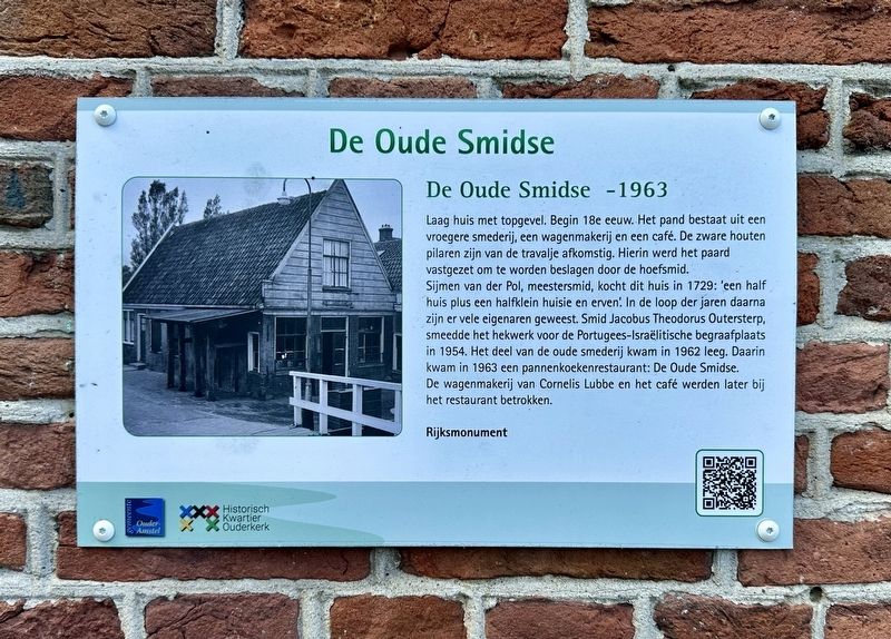
1. De Oude Smidse / The Old Smithy Marker

Laag huis met topgevel. Begin 18e eeuw. Het pand bestaat uit een vroegere smederij, een wagenmakerij en een café. De zware houten pilaren zijn van de travalje afkomstig. Hierin werd het paard vastgezet om te worden beslagen door de hoefsmid.
Sijmen van der Pol, meestersmid, kocht dit huis in 1729: 'een half huis plus een halfklein huisie en erven. In de loop der jaren daarna zijn er vele eigenaren geweest. Smid Jacobus Theodorus Outersterp, smeedde het hekwerk voor de Portugees-Israëlitische begraafplaats in 1954. Het deel van de oude smederij kwam in 1962 leeg. Daarin kwam in 1963 een pannenkoekenrestaurant: De Oude Smidse. De wagenmakerij van Cornelis Lubbe en het café werden later bij het restaurant betrokken.
Rijksmonument
The Old Smithy -1963
A low house with a gable front, dating from the early 18th century. The building comprises a former blacksmith's shop, a wheelwright's workshop, and a café. The heavy wooden pillars come from the travalje (farrier's stocks); this was the frame where a horse was secured to be shod by the farrier.
Sijmen
this page online
Erected by Gemeente Ouder-Amstel, Historisch Kwartier Ouderkerk.
Topics. This historical marker is listed in this topic list: Industry & Commerce. A significant historical year for this entry is 1729.
Location. 52° 17.699′ N, 4° 54.109′ E. Marker is in Ouderkerk aan de Amstel, Noord-Holland (North Holland), in Ouder-Amstel. It is at the intersection of Achterdijk and Rondehoep Oost, on the right when traveling south on Achterdijk. Touch for map. Marker is at or near this postal address: Achterdijk 2, Ouderkerk aan de Amstel, Noord-Holland 1191 JK, Netherlands. Touch for directions.

Regionally, it is in Europe,
Photographed by Andrew Ruppenstein, September 1, 2026
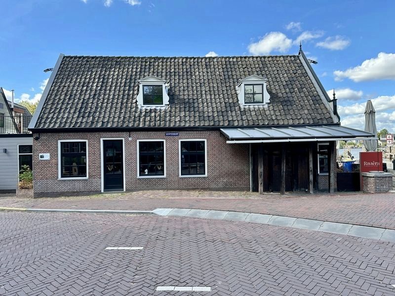
2. De Oude Smidse / “The Old Smithy” Marker - wide view
The marker is visible here on the left corner of the building.
Other nearby markers. At least 8 other markers are within walking distance of this marker: Sint Urbanuskerk / St. Urbanus Church (a few steps from this marker); Kerkbrug/Korte brug / “Church Bridge”/“Short Bridge” (a few steps from this marker); Bakkerij Out / Out Bakery (within shouting distance of this marker); Museum Amstelland (within shouting distance of this marker); Witte huis / White House (about 90 meters away, measured in a direct line); Amstelkerk (about 120 meters away); D’Corendrager / “The Grain Carrier” (about 180 meters away); Huis met de kettingen / House with the Chains (about 180 meters away). Touch for a list and map of all markers in Ouderkerk aan de Amstel.
Also see . . .
1. Oude Smidse! (Youtube, 1:40). A short video by Historisch Kwartier Ouderkerk, in Dutch with English subtitles (Submitted on September 24, 2026.)
2. De Oude Smidse (Historisch Kwartier Ouderkerk, in Dutch). (Submitted on September 24, 2026.)
Photographed by Andrew Ruppenstein, September 1, 2026
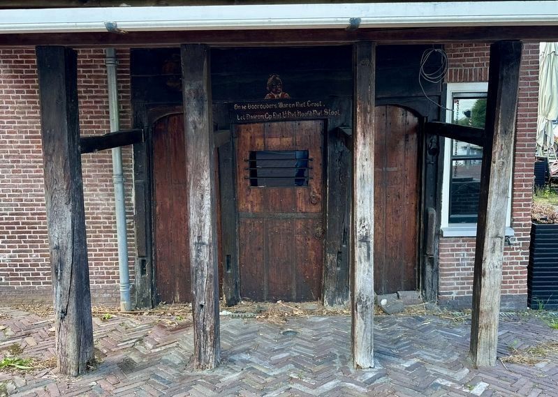
3. Entrance beneath the awning…
Beneath the awning is a very low door that was the entrance to the smithy, and then later - a pancake restaurant. Visible above the door is a warning to those who would enter. (See next photo)
Photographed by Andrew Ruppenstein, September 1, 2026
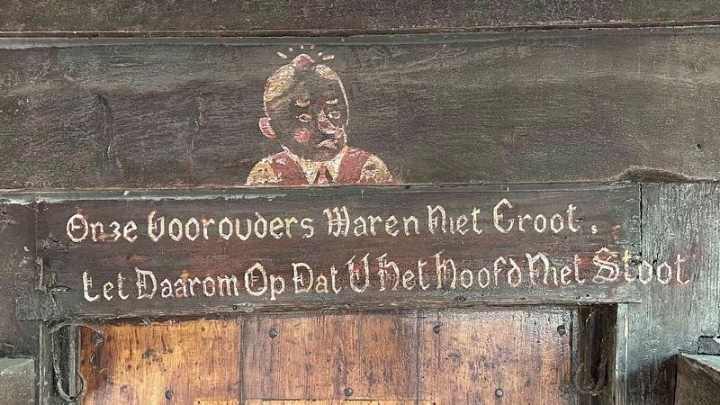
4. Don’t bump your head…
Onze voorouders waren niet groot, let daarom op dat u het hoofd niet stoot - (“Our ancestors were not tall, so take care not to bump your head”).
Photographed by Andrew Ruppenstein, September 1, 2026
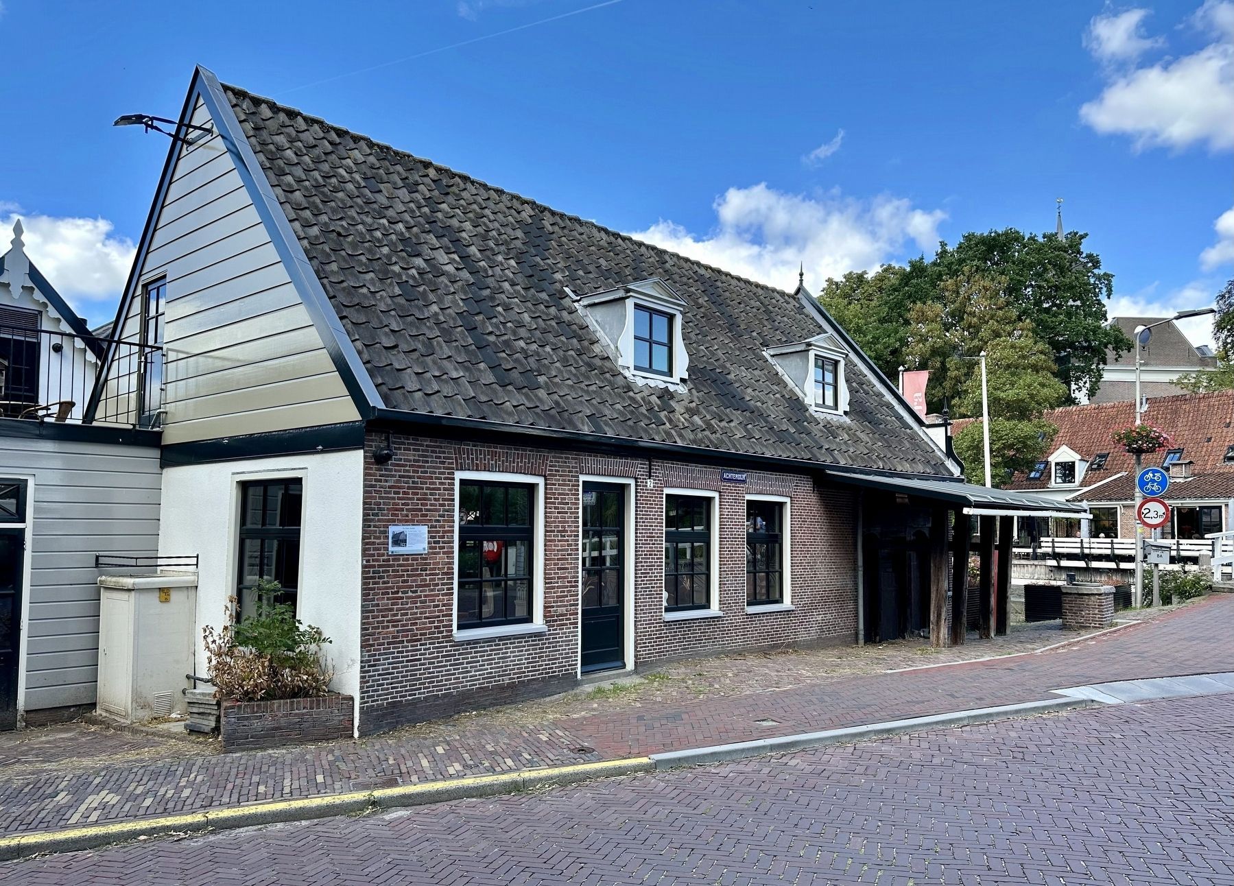
5. De Oude Smidse / “The Old Smithy” building and Marker
The Haarlem State Archives hold a deed of conveyance from 1729 in which Sijmen van der Pol and his wife Jacoba Groen purchase "half a house plus half a small house and the associated plots"—located across the Kerkbrug—from Jan Schuffel and his wife Geertie Groen for 700 guilders. The buyer, Sijmen van der Pol, was a master blacksmith. After his death, his second wife, Jannetje Willemse, managed the blacksmith’s shop until their son Frederik came of age. In 1746, the widow sold the half-house and plot, the half-share of the blacksmith’s shop, and the half-share of the rear building. Over the subsequent years, the blacksmith’s shop changed hands many times. In the 20th century, the (van) Outersterp family became the owners. One of the sons, Jacobus Theodorus, forged the ironwork for the Portuguese-Israelite cemetery in 1954. - Historisch Kwartier Ouderkerk, in translation
Credits. This page was last revised on September 24, 2026. It was originally submitted on September 23, 2026, by Andrew Ruppenstein of Lamorinda, California. This page has been viewed 11 times since then. Photos: 1. submitted on September 23, 2026, by Andrew Ruppenstein of Lamorinda, California. 2. submitted on September 24, 2026, by Andrew Ruppenstein of Lamorinda, California. 3, 4, 5. submitted on September 23, 2026, by Andrew Ruppenstein of Lamorinda, California.
