Warrenville in Aiken County, South Carolina — The American South (South Atlantic)
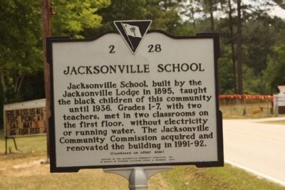
Jacksonville School
⎯⎯⎯
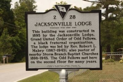
Jacksonville Lodge
Photographed by Mike Stroud, 2010
1. Jacksonville School Marker
Jacksonville Lodge
Erected 2005 by The Jacksonville Community Commission, Inc., in Memory of Founding President Erwin M. Robinson. (Marker Number 2-28.)
Topics. This historical marker is listed in these topic lists: African Americans • Education • Fraternal or Sororal Organizations • Notable Buildings. A significant historical year for this entry is 1895.
Location. 33° 29.992′ N, 81° 50.542′ W. Marker is in Warrenville, South Carolina, in Aiken County. It is at the intersection
this page online

Regionally, this marker is in Greater Augusta and in the Midlands. It is also in the American South and specifically in the Deep South. Globally, it is in North America, the Western Hemisphere, the Western World, and the Anglosphere. Historically, it finds itself in what was once the territory of the Mississippian Culture, one of the original Thirteen Colonies, one of the Confederate States of America, and the Antebellum South.
Other nearby markers. At least 10 other markers are within 6 miles of this marker, measured as the crow flies: Jefferson High School / Rev. Austin Jefferson, Sr. (approx. 1.3 miles away); Storm Branch Baptist Church (approx. 3.8 miles away); William Gregg (approx. 5 miles away); Graniteville Mill (approx. 5 miles away); 200th Anniversary of the United States (approx. 5 miles away); Graniteville Train Derailment
Photographed by Mike Stroud, May 16, 2010
2. Jacksonville Lodge Marker
Other markers no longer nearby. Graniteville Academy (was approx. 5.4 miles away but has been confirmed missing); Beech Island Agricultural Club (was approx. 5.4 miles away but has been confirmed missing).
Related marker. Click here for another marker that is related to this marker. About the Storm Branch Baptist Church
Photographed by Mike Stroud, May 16, 2010
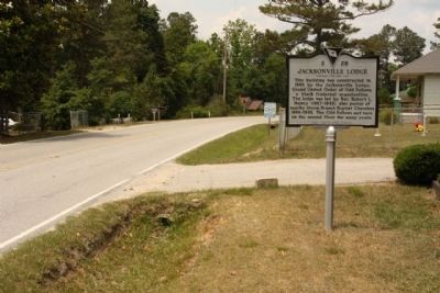
3. Jacksonville School / Jacksonville Lodge Marker, looking north along Huber Clay Road
Photographed by Mike Stroud, May 16, 2010
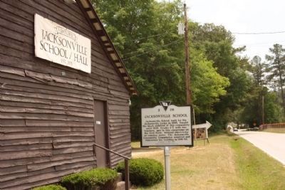
4. Jacksonville School / Jacksonville Lodge Marker along Huber Clay Road
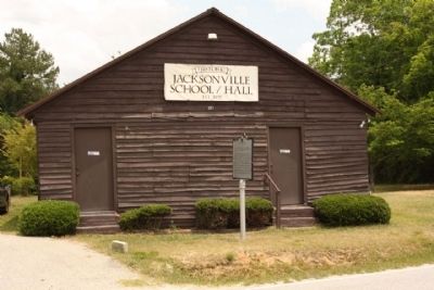
Photographed by Mike Stroud, May 16, 2010
5. Jacksonville School / Jacksonville Lodge
present day; seems to be a re-creation as there is no second floor as mentioned on the marker
Credits. This page was last revised on June 16, 2016. It was originally submitted on May 26, 2010, by Mike Stroud of Bluffton, South Carolina. This page has been viewed 1,568 times since then and 37 times this year. Photos: 1, 2, 3, 4, 5. submitted on May 26, 2010, by Mike Stroud of Bluffton, South Carolina.
