Sondernheim in Germersheim, Rhineland-Palatinate, Germany — Central Europe
Weißenburger Tor
⎯⎯⎯
Paradeplatz
Photographed by James Hulse, September 15, 2026
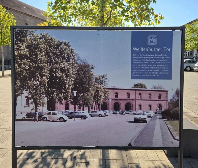
1. Weißenburger Tor / Paradeplatz Marker - Front Side

Blick von der Einmündung der Orffstraße in die Hauptstraße in Richtung des Weißenburger Tors in der Zeit um 1970. Das Aussehen des Paradeplatzes blieb lange Jahre – bis zur Umgestaltung in den Jahren 2016–2018 – weitgehend unverändert. Er diente den Lehrkräften der Berufsschule und den Bediensteten der im Weißenburger Tor und in der „Stadtkaserne“ untergebrachten Dienststellen der Bundeswehr lange Zeit als Parkplatz.
Paradeplatz
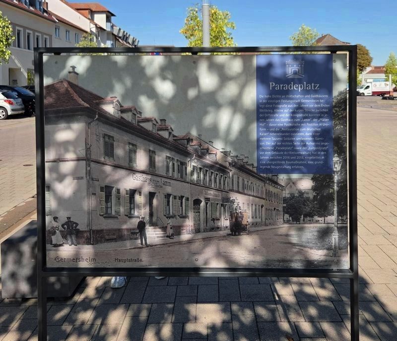
Die hohe Dichte an Wirtschaften und Gasthäusern in der einstigen Festungsstadt Germersheim belegt diese Fotografie aus den Jahren vor dem Ersten Weltkrieg. Alleine auf der kurzen Strecke zwischen der Orffstraße und der Königsstraße konnten in jenen Jahren das Gasthaus zum „Lamm“, der „Pfälzer Hof“ – davor eine Postkutsche mit Postillion in Uniform – und die „Restauration zum deutschen Kaiser“ nebeneinander existieren, dank einer mehrere Tausend Soldaten umfassenden Garnison. Der auf der rechten Seite der Aufnahme angeschnittene „Paradeplatz“ sowie der „Luitpoldplatz“ vor dem Gebäude der Kreisverwaltung hat in den Jahren zwischen 2016 und 2018, eingebettet in eine übergreifende Baumaßnahme, eine grundlegende Neugestaltung erfahren.
Weißenburger Tor
This view from the junction of Orffstraße and Hauptstraße looks toward the Weißenburg Gate around 1970. The appearance of the Parade Ground remained largely unchanged for many years until its redesign between 2016 and 2018. For a long time, it served as a parking lot for teachers at the vocational school and employees of the German Armed Forces offices housed in the Weißenburg Gate and
this page online
Paradeplatz
This photograph from the years before the First World War shows the large number of taverns and inns in the former fortress city of Germersheim. Along the short section between Orffstraße and Königsstraße, the ‘Lamm’ Inn, the ‘Pfälzer Hof’—with a stagecoach and uniformed postilion standing in front—and the ‘Restauration zum deutschen Kaiser’ could all operate beside one another because the city had a garrison of several thousand soldiers. The Parade Ground, partly visible on the right side of the photograph, and Luitpoldplatz, in front of the district administration building, were completely redesigned between 2016 and 2018 as part of a larger construction project.
Erected by City of Germersheim.
Topics. This historical marker is listed in this topic list: Notable Places. A significant historical year for this entry is 1970.
Location. 49° 13.028′ N, 8° 22.518′ E. Marker is in Germersheim, Rheinland-Pfalz (Rhineland-Palatinate). It is in Sondernheim. It is at the intersection of Paradeplatz and Orffstraße, on the right when traveling north on Paradeplatz. Touch for map. Marker is at or near this postal address: Paradepl 1, Germersheim RP 76726, Germany. Touch for directions.

Regionally, this marker is on the German Upper Rhine. Globally, it is in Europe, the European Union, Atlantic Europe, Central Europe, the Schengen Area, Western Europe, and the Western World. Historically, it finds itself in what was once the Roman Empire, the Holy Roman Empire, and the former West Germany.
Other nearby markers. At least 8 other markers are within walking distance of this marker: Weißenburger Tor / Weißenburg Gate
Photographed by James Hulse, September 15, 2026
2. Weißenburger Tor / Paradeplatz Marker - Reverse
Photographed by James Hulse
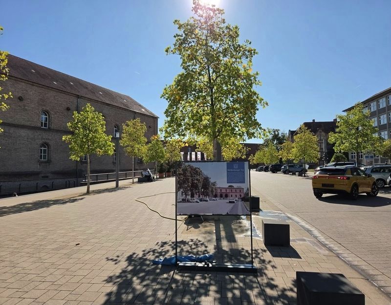
3. Weißenburger Tor / Paradeplatz Marker
The view of the front side of the marker.
Photographed by James Hulse, September 15, 2026
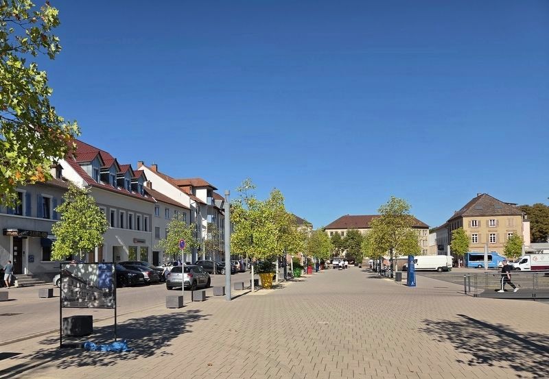
4. Weißenburger Tor / Paradeplatz Marker
The marker (Reverse side) is located on the far left side by the street.
Credits. This page was last revised on September 30, 2026. It was originally submitted on September 24, 2026, by James Hulse of Medina, Texas. This page has been viewed 11 times since then. Photos: 1, 2, 3, 4. submitted on September 25, 2026, by James Hulse of Medina, Texas.
