Sondernheim in Germersheim, Rhineland-Palatinate, Germany — Central Europe
Weißenburger Tor
⎯⎯⎯
Weißenburg Gate
Photographed by James Hulse, September 15, 2026
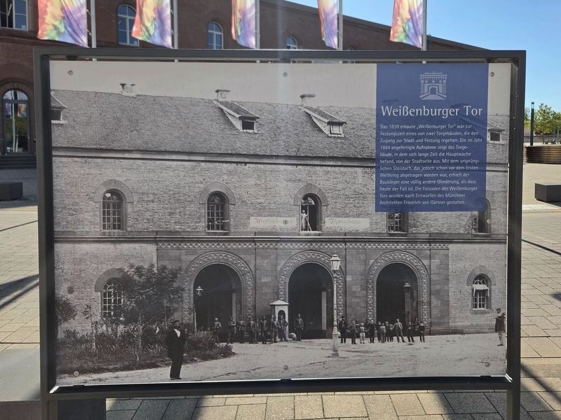
1. Weißenburger Tor / Weißenburg Gate Marker - Front Side

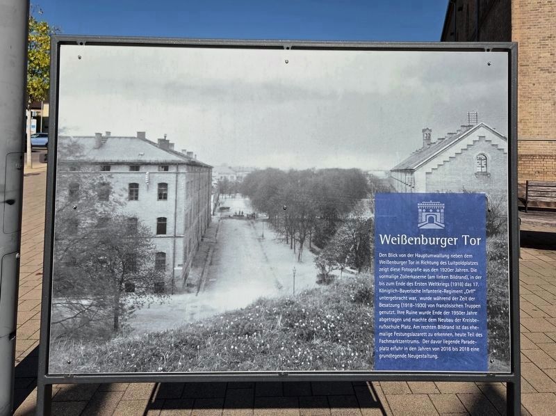
Den Blick von der Hauptumwallung neben dem Weißenburger Tor in Richtung des Luitpoldplatzes zeigt diese Fotografie aus den 1920er Jahren. Die vormalige Zollerkaserne (am linken Bildrand), in der bis zum Ende des Ersten Weltkriegs (1918) das 17. Königlich-Bayerische Infanterie-Regiment „Orff“ untergebracht war, wurde während der Zeit der Besatzung (1918–1930) von französischen Truppen genutzt. Ihre Ruine wurde Ende der 1950er Jahre abgetragen und machte dem Neubau der Kreisberufsschule Platz. Am rechten Bildrand ist das ehemalige Festungslazarett zu erkennen, heute Teil des Fachmarktzentrums. Der davor liegende
this page online
Built in 1839, the Weißenburg Gate was one of two gate buildings that controlled access to the town and fortress. The photograph taken in 1884 shows the gate from the town side. The main guardhouse was located in the building for many years. Its original steep roof, which was removed before the First World War, gave the building a very different appearance from the one it has today. The façades of the Weißenburg Gate were designed by the Munich architect Friedrich von Gärtner.
This photograph from the 1920s shows the view from the main fortifications beside the Weißenburg Gate toward Luitpoldplatz. The former Zoller Barracks, visible on the left, housed the 17th Royal Bavarian Infantry Regiment “Orff” until the end of the First World War in 1918. French troops used the barracks during the occupation from 1918 to 1930. Its ruins were demolished in the late 1950s to make room for the new district vocational school. The former fortress hospital can be seen on the right and is now part of the retail center. The Parade Ground in front of it was completely redesigned between 2016
Photographed by James Hulse, September 15, 2026
2. Weißenburger Tor / Weißenburg Gate Marker - Reverse
Erected by City of Germersheim.
Topics. This historical marker is listed in this topic list: Forts and Castles. A significant historical year for this entry is 1839.
Location. 49° 13.001′ N, 8° 22.572′ E. Marker is in Germersheim, Rheinland-Pfalz (Rhineland-Palatinate). It is in Sondernheim. It is at the intersection of Europaplatz and Paradepl., on the right when traveling west on Europaplatz. Touch for map. Marker is at or near this postal address: Europapl 1, Germersheim RP 76726, Germany. Touch for directions.

Regionally, this marker is on the German Upper Rhine. Globally, it is in Europe, the European Union, Atlantic Europe, Central Europe, the Schengen Area, Western Europe, and the Western World. Historically, it finds itself in what was once the Roman Empire, the Holy Roman Empire, and the former West Germany.
Other nearby markers. At least 8 other markers are within walking distance of this marker: A different marker also named Weißenburger Tor / Weißenburg Gate (within shouting distance of this marker); Weißenburger Tor / Paradeplatz (about 90 meters away, measured in a direct line); Wessenburger Tor / Weissenburg Gate (about 120 meters away); Luitpoldplatz / Hauptstraße/Königstraße
Photographed by James Hulse, September 15, 2026
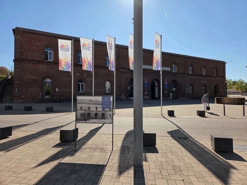
3. Weißenburger Tor / Weißenburg Gate and Marker
The view of the front side of the marker.
Photographed by James Hulse, September 15, 2026
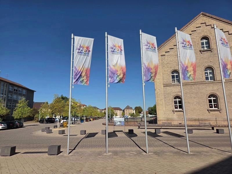
4. Weißenburger Tor / Weißenburg Gate and Marker
The view of the reverse side of the marker.
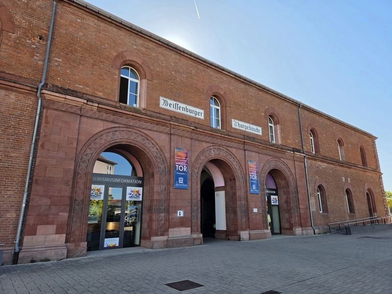
Photographed by James Hulse, September 15, 2026
5. Weißenburger Tor / Weißenburg Gate Marker
The town side of the Weißenburg Gate.
Credits. This page was last revised on September 27, 2026. It was originally submitted on September 24, 2026, by James Hulse of Medina, Texas. This page has been viewed 5 times since then. Photos: 1, 2, 3, 4, 5. submitted on September 25, 2026, by James Hulse of Medina, Texas.
