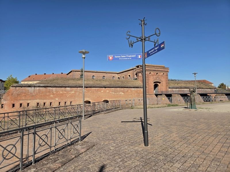
Sondernheim in Germersheim, Rhineland-Palatinate, Germany — Central Europe
Wessenburger Tor ⎯⎯⎯ Weissenburg Gate
Photographed by James Hulse, September 15, 2026
1. Weissenburger Tor / Weissenburg Gate Marker
Inscription.
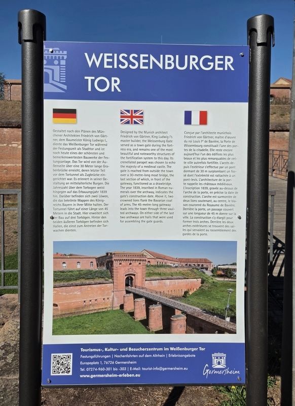
Gestaltet nach den Plänen des Münchener Architekten Friedrich von Gärtner, dem Baumeister König Ludwigs I., diente das Weißenburger Tor während der Festungszeit als Stadttor und ist noch heute eines der schönsten und bemerkenswertesten Bauwerke der Festungsanlage. Das Tor wird von der Außenseite über eine 30 Meter lange Grabenbrücke erreicht, deren letzter Teil vor dem Tortunnel als Zugbrücke eingerichtet war. Es erinnert in seiner Gestaltung an mittelalterliche Burgen. Die Jahreszahl über dem Torbogen weist hingegen auf das Erbauungsjahr 1839 hin. Darüber befinden sich zwei Löwen, die das bekrönte Wappen des Königreichs Bayern in ihrer Mitte halten. Der Tortunnel führt auf einer Länge von 45 Metern in die Stadt. Hier erweitert sich der Bau auf drei Torbögen. Hinter den beiden äußeren Torbögen befinden sich Hallen, die einst zum Antreten der Torwachen dienten.
Designed by the Munich architect Friedrich von Gärtner, King Ludwig I’s master builder, the Weissenburg Gate served as a town gate during the fortress era, and remains one of the most beautiful and noteworthy structures of the fortification system to this day. Its crenellated parapet was chosen to echo the majesty of a medieval castle. The gate is reached from outside the town over a 30-metre-long moat bridge, the last section of which, in front of the gateway, functioned as a drawbridge. The year 1839, inscribed in Roman numerals over the archway, indicates the gate’s construction date. Above it, two crowned lions flank the Bavarian coat of arms. The 45-metre-long gateway leads into the town through three vaulted archways. On either side of
Click or scan to see this page online
the last two archways are halls that were used for assembling the gate guards.
Conçue par l’architecte munichois Friedrich von Gärtner, maître d’œuvre du roi Louis Ier de Bavière, la Porte de Wissembourg constituait l’une des portes de la citadelle. Elle reste encore aujourd’hui l’un des édifices les plus beaux et les plus remarquables de cette ville autrefois fortifiée. L’accès depuis l’extérieur s’effectue par un pont dormant de 30 m surplombant un fossé dont l’extrémité est rattachée à un pont-levis. L’architecture de la porte rappelle les châteaux médiévaux. L’inscription 1839, gravée au-dessus de l’arche de la porte, en précise la date de construction. L’arche est surmontée de deux lions soutenant, au centre, le blason couronné du Royaume de Bavière. Derrière la porte, un passage couvert sur une longueur de 45 m donne sur la ville. La construction s’y élargit pour former trois arches. Derrière les deux arches extérieures se trouvent des salles qui servaient au rassemblement des gardes de la porte.
Erected by City of Germersheim.
Topics. This historical marker is listed in this topic list: Forts and Castles. A significant historical year for this entry is 1839.
Location. 49° 12.976′ N, 8° 22.654′ E. Marker is in Germersheim, Rheinland-Pfalz (Rhineland-Palatinate). It is in Sondernheim. It is on Paradeplatz just west of August-Keiler-Straße, on the left when traveling west. Touch for map. Marker is at or near this postal address: Paradepl 10, Germersheim RP 76726, Germany. Touch for directions.
Regionally, this marker is on the German Upper Rhine. Globally, it is in Europe, the European Union, Atlantic Europe,
Photographed by James Hulse, September 15, 2026
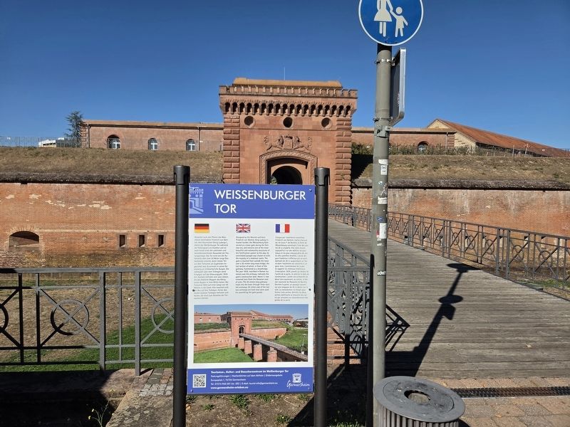
2. Wessenburger Tor / Weissenburg Gate and Marker
Central Europe, the Schengen Area, Western Europe, and the Western World. Historically, it finds itself in what was once the Roman Empire, the Holy Roman Empire, and the former West Germany.
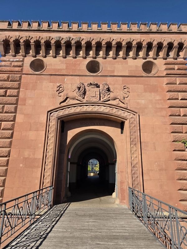
The view of the entrance gate which at one time had a draw bridge at the entrance.
Photographed by James Hulse, September 15, 2026
4. Wessenburger Tor / Weissenburg Gate Marker
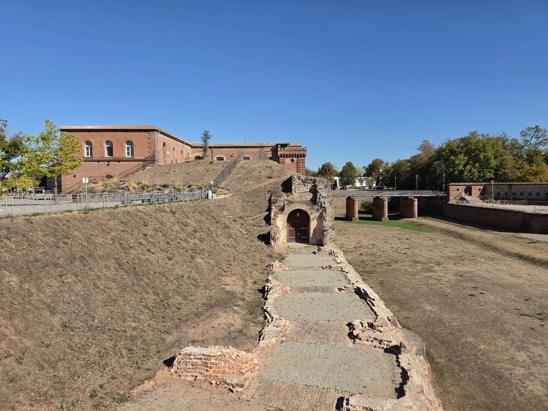
A section of the fortress wall that been destroyed over the years.
Photographed by James Hulse, September 15, 2026
5. Wessenburger Tor / Weissenburg Gate Marker
The view of the Weissenburg Gate from the side.
Credits. This page was last revised on September 25, 2026. It was originally submitted on September 24, 2026, by James Hulse of Medina, Texas. This page has been viewed 4 times since then. Photos:1, 2, 3, 4, 5. submitted on September 25, 2026, by James Hulse of Medina, Texas.