Sondernheim in Germersheim, Rhineland-Palatinate, Germany — Central Europe
Luitpoldplatz
⎯⎯⎯
Hauptstraße/Königstraße
Photographed by James Hulse, September 15, 2026
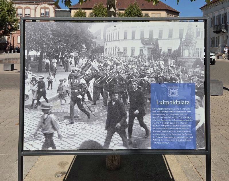
1. Luitpoldplatz / Hauptstraße/Königstraße Marker - Front Side

Ein vielbeachtetes Ereignis stellte in einer Garnisons- und Festungsstadt der Vorbeimarsch einer Militärabteilung mit „klingendem Spiel“ dar: Dieses Foto aus der Zeit vor dem Ersten Weltkrieg zeigt eine Abteilung der in Germersheim liegenden „17er“ (17. Königlich-Bayerisches Infanterie-Regiment „Orff“) mit der Regimentskapelle unter der Leitung von Militärmusikmeister Weiß auf Höhe des Kriegerdenkmals im Bereich des heutigen Luitpoldplatzes. Im Hintergrund das Gebäude des Festungs-Gouvernements, damals Dienst- und Wohnsitz des im Rang eines Generals stehenden Festungsgouverneurs.
Hauptstraße/Königstraße
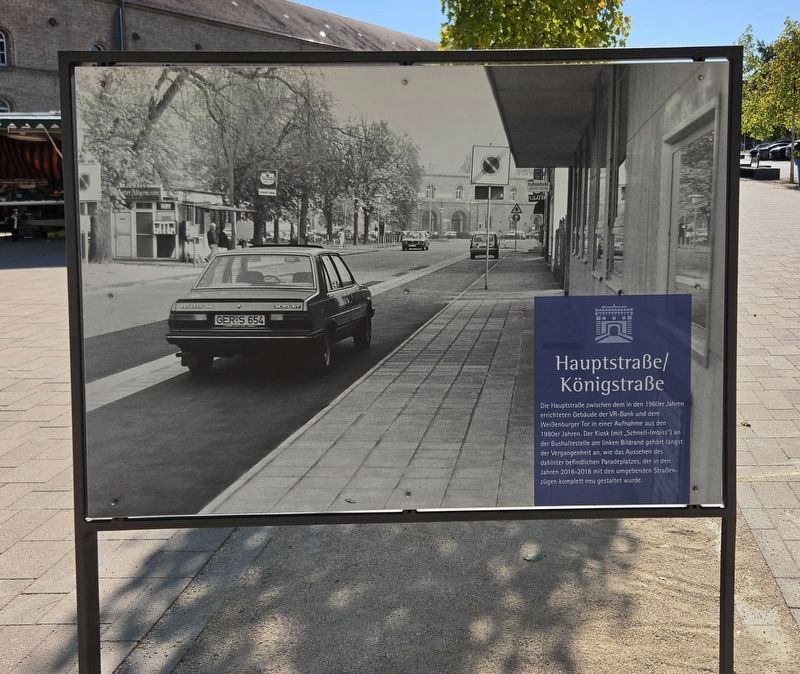
Die Hauptstraße zwischen dem in den 1960er Jahren errichteten Gebäude der VR-Bank und dem Weißenburger Tor in einer Aufnahme aus den 1980er Jahren. Der Kiosk (mit „Schnell-Imbiss“) an der Bushaltestelle am linken Bildrand gehört längst der Vergangenheit an, wie das Aussehen des dahinter befindlichen Paradeplatzes, der in den Jahren 2016-2018 mit den umgebenden Straßenzügen komplett neu gestaltet wurde.
Luitpoldplatz
An important public event in a garrison and fortress city was the parade of a military unit with its band playing. This photograph from before the First World War shows a unit of Germersheim’s ‘17th’—the 17th Royal Bavarian Infantry Regiment ‘Orff’—with its regimental band led by military bandmaster Weiß. The soldiers are passing the war memorial near today’s Luitpoldplatz. In the background is the fortress government building, which served as the office and residence of the fortress governor, who held the rank of general.
Hauptstraße/Königstraße
This
this page online
Erected by City of Germersheim.
Topics. This historical marker is listed in this topic list: Notable Places. A significant historical year for this entry is 2016.
Location. 49° 13.063′ N, 8° 22.472′ E. Marker is in Germersheim, Rheinland-Pfalz (Rhineland-Palatinate). It is in Sondernheim. It is at the intersection of Paradeplatz and Königstraße, on the right when traveling north on Paradeplatz. Touch for map. Marker is at or near this postal address: Paradepl 4, Germersheim RP 76726, Germany. Touch for directions.

Regionally, this marker is on the German Upper Rhine. Globally, it is in Europe, the European Union, Atlantic Europe, Central Europe, the Schengen Area, Western Europe, and the Western World. Historically, it finds itself in what was once the Roman Empire, the Holy Roman Empire, and the former West Germany.
Other nearby markers. At least 8 other markers are within walking distance of this marker: Kriegerdenkmal / Franco-Prussian War Memorial (a few steps from this marker); Luitpoldplatz / Kriegerdenkmal (within shouting distance of this marker); Weißenburger Tor / Paradeplatz (about 90 meters away, measured in a direct line); Isabella 'Bella' Kahn (about 120 meters away); Ferdinand Kahn (about 120 meters away); Sophie Ebert
Photographed by James Hulse, September 15, 2026
2. Luitpoldplatz / Hauptstraße/Königstraße Marker - Reverse
Photographed by James Hulse
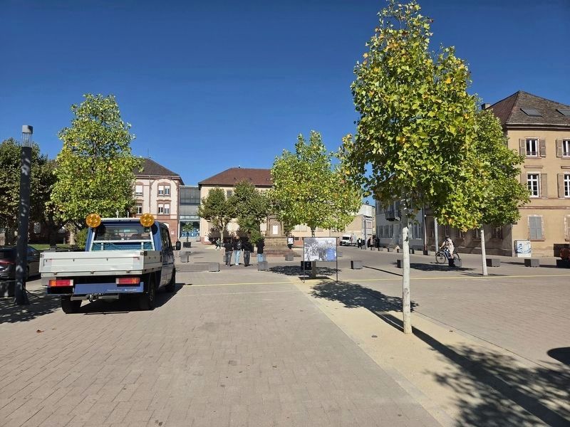
3. Luitpoldplatz / Hauptstraße/Königstraße Marker
The view of the front side of the marker.
Photographed by James Hulse, September 15, 2026
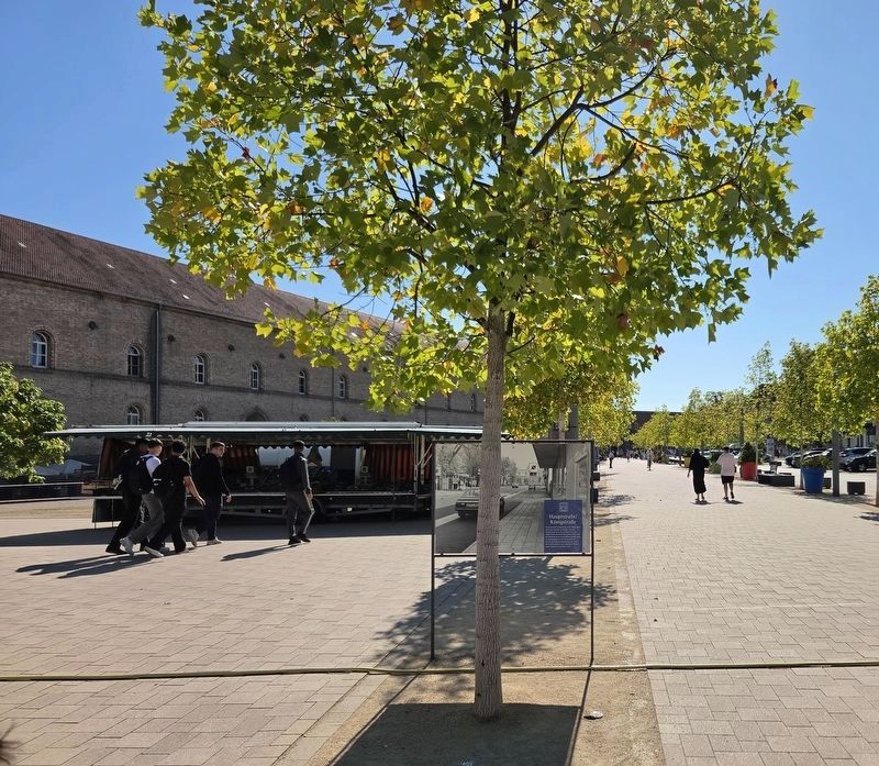
4. Luitpoldplatz / Hauptstraße/Königstraße Marker
The view of the reverse side of the marker.
Credits. This page was last revised on September 27, 2026. It was originally submitted on September 24, 2026, by James Hulse of Medina, Texas. This page has been viewed 4 times since then. Photos: 1, 2, 3, 4. submitted on September 25, 2026, by James Hulse of Medina, Texas.
