Sondernheim in Germersheim, Rhineland-Palatinate, Germany — Central Europe
Luitpoldplatz
⎯⎯⎯
Kriegerdenkmal
Photographed by James Hulse, September 15, 2026
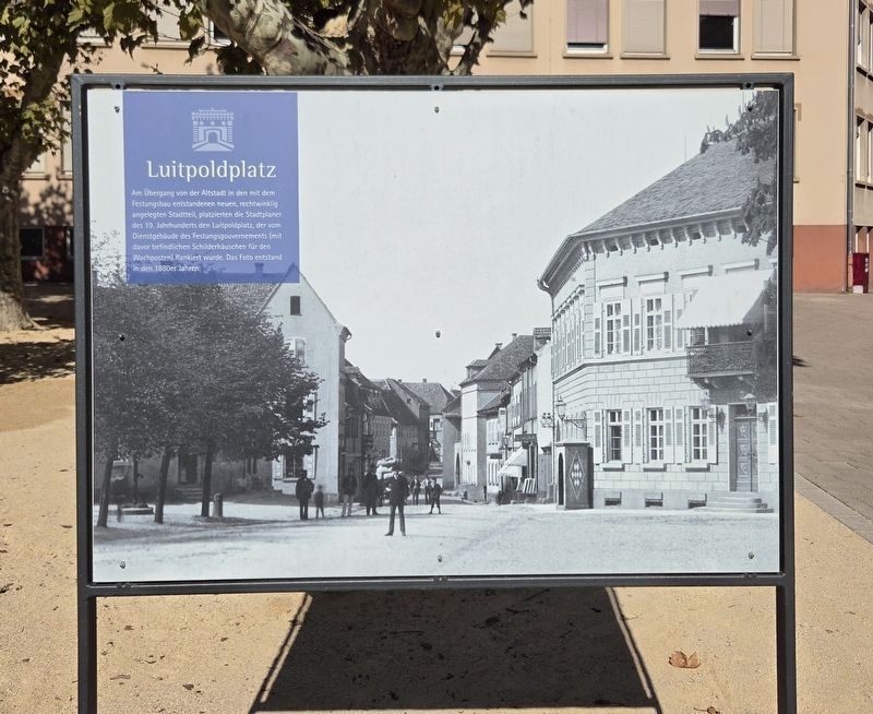
1. Luitpoldplatz / Kriegerdenkmal Marker - Front Side

Am Übergang von der Altstadt in den mit dem Festungsbau entstandenen neuen, rechtwinklig angelegten Stadtteil, platzierten die Stadtplaner des 19. Jahrhunderts den Luitpoldplatz, der vom Dienstgebäude des Festungsgouvernements (mit davor befindlichen Schilderhäuschen für den Wachposten) flankiert wurde. Das Foto entstand in den 1880er Jahren.
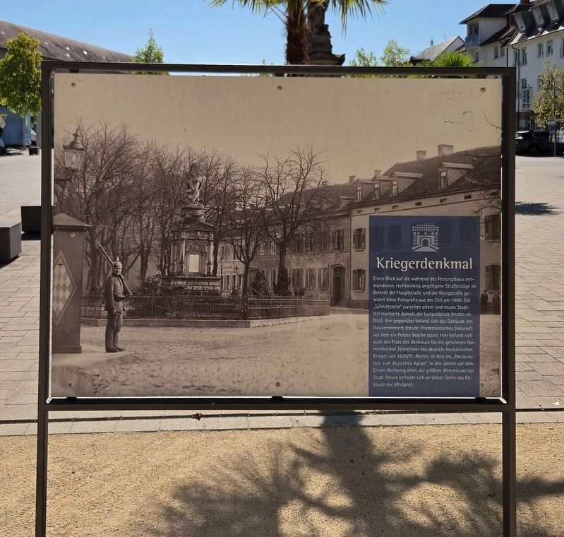
Kriegerdenkmal
Einen Blick auf die während des Festungsbaus entstandenen, rechtwinklig angelegten Straßenzüge im Bereich der Hauptstraße und der Königstraße gewährt diese Fotografie aus der Zeit um 1900. Die „Schnittstelle“ zwischen altem und neuem Stadtteil markierte damals der Luitpoldplatz (rechts im Bild). Ihm gegenüber befand sich das Gebäude des Gouvernements (heute: Protestantisches Dekanat), vor dem ein Posten Wache stand. Hier befand sich auch der Platz des Denkmals für die gefallenen Germersheimer Teilnehmer des deutsch-französischen Krieges von 1870/71. Rechts im Bild die „Restauration zum deutschen Kaiser“, in den Jahren vor dem Ersten Weltkrieg eines der größten Wirtshäuser der Stadt (heute befindet sich an dieser Stelle das Gebäude der VR-Bank).
Luitpoldplatz
At the transition from the old town to the new, rectangularly laid-out district created during the construction of the fortress, 19th-century city planners placed Luitpold Square. It was bordered by the fortress governor’s official building, with sentry boxes for the guard in front of it. The photograph was taken in the 1880s.
Kriegerdenkmal
This photograph from around 1900 shows the rectangular street layout created during the construction of the
this page online
Erected by City of Germersheim.
Topics. This historical marker is listed in this topic list: Notable Places. A significant historical year for this entry is 1900.
Location. 49° 13.085′ N, 8° 22.443′ E. Marker is in Germersheim, Rheinland-Pfalz (Rhineland-Palatinate). It is in Sondernheim. It is on Hauptstraße 0.1 kilometers north of Königstraße, on the left when traveling north. Touch for map. Marker is at or near this postal address: Hauptstraße 1, Germersheim RP 76726, Germany. Touch for directions.

Regionally, this marker is on the German Upper Rhine. Globally, it is in Europe, the European Union, Atlantic Europe, Central Europe, the Schengen Area, Western Europe, and the Western World. Historically, it finds itself in what was once the Roman Empire, the Holy Roman Empire, and the former West Germany.
Other nearby markers. At least 8 other markers are within walking distance of this marker: Kriegerdenkmal / Franco-Prussian War Memorial (within shouting distance of this marker); Luitpoldplatz / Hauptstraße/Königstraße (within shouting distance
Photographed by James Hulse, September 15, 2026
2. Luitpoldplatz / Kriegerdenkmal Marker - Reverse
Photographed by James Hulse, September 15, 2026
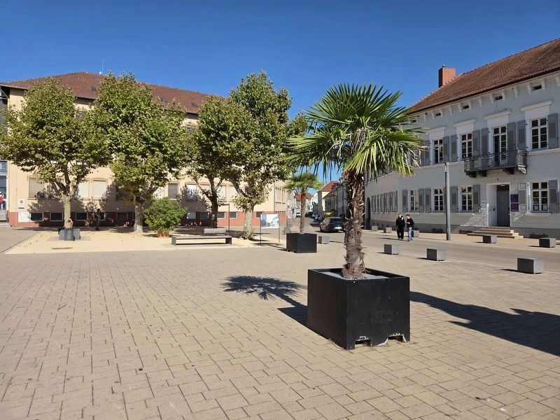
3. Luitpoldplatz / Kriegerdenkmal Marker
The view of the front side of the marker.
Photographed by James Hulse, September 15, 2026
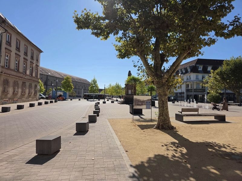
4. Luitpoldplatz / Kriegerdenkmal Marker
The view of the reverse side of the marker.
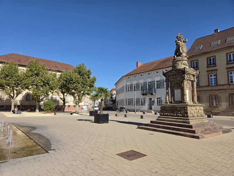
Photographed by James Hulse, September 15, 2026
5. Kriegerdenkmal
Credits. This page was last revised on September 27, 2026. It was originally submitted on September 24, 2026, by James Hulse of Medina, Texas. This page has been viewed 8 times since then. Photos: 1, 2, 3, 4, 5. submitted on September 25, 2026, by James Hulse of Medina, Texas.
