
St Katharine's & Wapping in Tower Hamlets in Greater London, England, United Kingdom — Northwestern Europe (the British Isles)
London’s Roman Wall
| — | London Wall | — |
Photographed by Ian Lefkowitz, September 11, 2026
1. London’s Roman Wall Marker
London’s Roman Wall
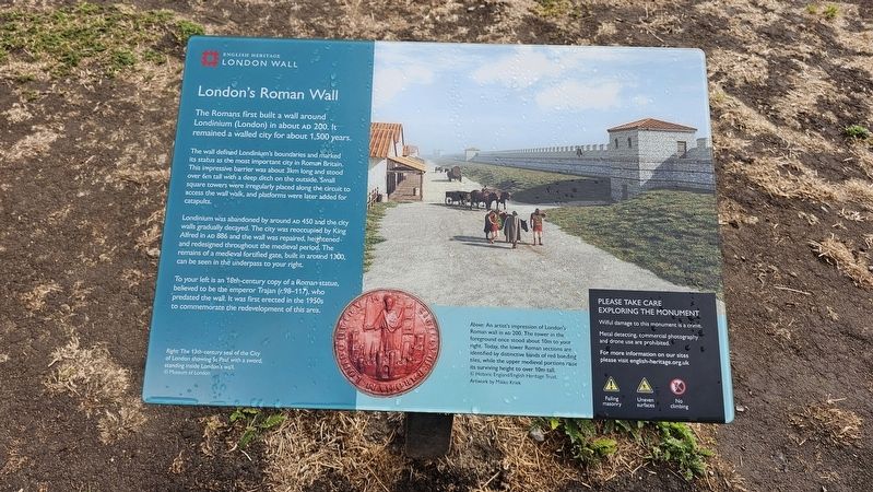
The Romans first built a wall around Londinium (London) in about AD 200. It remained a walled city for about 1,500 years.
The wall defined Londinium’s boundaries and marked its status as the most important city in Roman Britain. This impressive barrier was about 3km long and stood over 6m tall with a deep ditch on the outside. Small square towers were irregularly placed along the circuit to access the wall walk, and platforms were later added for catapults.
Londinium was abandoned by around AD 450 and the city walls gradually decayed. The city was reoccupied by King Alfred in AD 886 and the wall was repaired, heightened and redesigned throughout the medieval period. The remains of a medieval fortified gate, built in around 1300, can be seen in the underpass to your right.
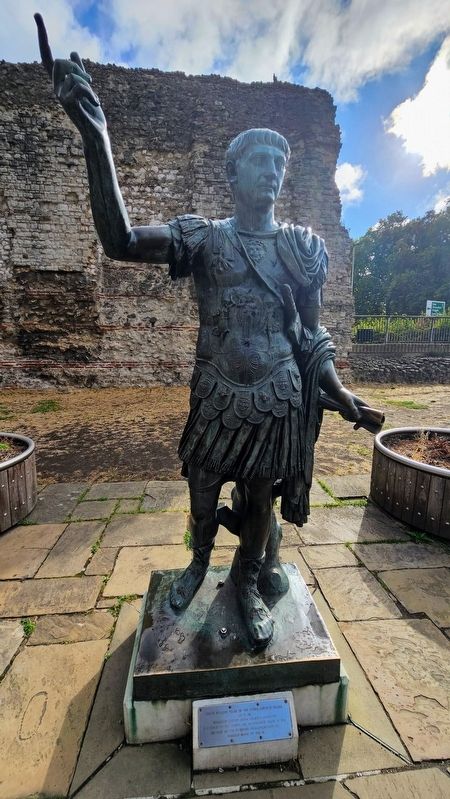
To your left is an 18th-century copy of a Roman statue, believed to be the emperor Trajan (r.98–117), who predated the wall. It was first erected in the 1950s to commemorate the redevelopment of this area.
(Captions)
Above: An artist’s impression of London’s Roman wall in AD 200. The tower in the foreground once stood about 10m to your right. Today, the lower Roman sections are identified by distinctive bands of red bonding tiles, while the upper medieval portions raise its surviving height to over 10m tall. © Historic England/English Heritage Trust. Artwork by Mikko Kriek.
Right: The 13th-century seal of the City of London showing St Paul with a sword, standing inside London’s wall. © Museum of London.
Erected by English
this page online
Topics. This historical marker is listed in this topic list: Forts and Castles. A significant historical year for this entry is 886 CE.
Location. 51° 30.591′ N, 0° 4.566′ W. Marker is in Tower Hamlets, England, in Greater London. It is in St Katharine's & Wapping. It can be reached from Tower Hill east of Trinity Square, on the left when traveling east. Touch for map. Marker is at or near this postal address: 40 Tower Hill, Tower Hamlets, England EC3N 2LY, United Kingdom. Touch for directions.

Regionally, this marker is in London and in the Greater South East. Globally, it is on the Atlantic Ocean, in the North Atlantic Region, in Europe, in Atlantic Europe, on one of the British Isles, in the Western World, and in the Anglosphere. Historically, it finds itself in what was once the Roman Empire.
Other nearby markers. At least 8 other markers are within walking distance of this marker: Tower Hill, City Wall (a few steps from this marker); The Pool of London (a few steps from this marker); Tower Hill Passageway: Yeoman Warders (a few steps from this marker); Tower Hill Passageway: Crown Jewels – Imperial State Crown
Photographed by Ian Lefkowitz, September 11, 2026
2. London’s Roman Wall Marker
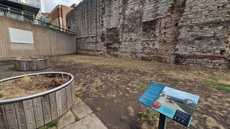
The marker is set in front of the historic London Wall. The Roman wall can be clearly distinguished from the medieval wall erected on top of it.
Another marker is no longer nearby. London Wall (was here, next to this marker but has been replaced with another marker now near it).
Also see . . . History of London Wall (English Heritage).
The section of wall preserved at Tower Hill shows not only its imposing height in the medieval period, but also its Roman origins. At 10.7 metres above present ground level, it is one of the tallest surviving parts of the circuit. The upper portions and many of the facing stones are medieval, but the lower 4 metres are easily identified as originally Roman by the characteristic horizontal bands of red tiles.(Submitted on September 24, 2026, by Ian Lefkowitz of New York, New York.)
Photographed by Ian Lefkowitz, September 11, 2026
3. Statue of Emperor Trajan
This replica statue of Emperor Trajan was placed here in the 1950s.
Photographed by Ian Lefkowitz, September 11, 2026
4. Statue of Emperor Trajan
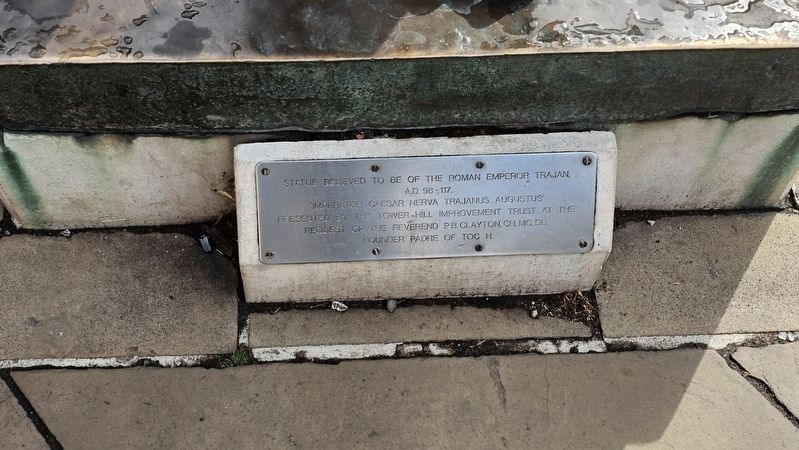
An inscription reads:
Statue believed to be of the Roman Emperor Trajan, A.D. 98-117. 'Imperator Caesar Nerva Trajanus Augustus' Presented by the Tower Hill improvement trust at the request of the Reverend P.B. Clayton, CH, MC, DD. Founder Padre of TOC H.
Credits. This page was last revised on October 13, 2026. It was originally submitted on September 24, 2026, by Ian Lefkowitz of New York, New York. This page has been viewed 18 times since then. Photos: 1, 2, 3, 4. submitted on September 24, 2026, by Ian Lefkowitz of New York, New York. • Andrew Ruppenstein was the editor who published this page.
