Gouda, South Holland, Netherlands — Northwestern Europe
Een Historische Plek
⎯⎯⎯
A Historic Location
Photographed by Andrew Ruppenstein, September 2, 2026
1. Een Historische Plek / A Historic Location Marker

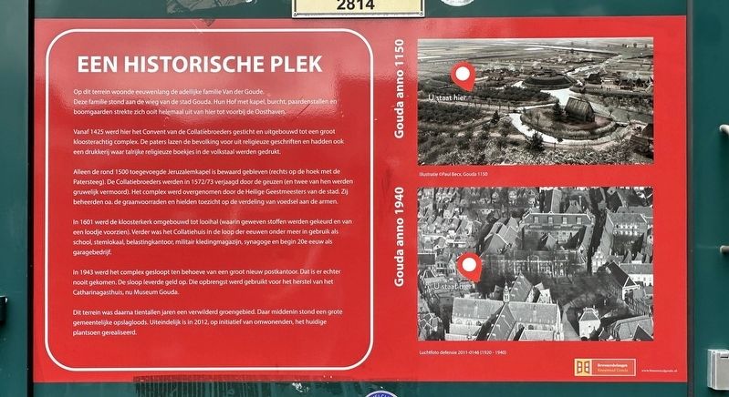
Op dit terrein woonde eeuwenlang de adellijke familie Van der Goude. Deze familie stond aan de wieg van de stad Gouda. Hun Hof met kapel, burcht, paardenstallen en boomgaarden strekte zich ooit helemaal uit van hier tot voorbij de Oosthaven.
Vanaf 1425 werd hier het Convent van de Collatiebroeders gesticht en uitgebouwd tot een groot kloosterachtig complex. De paters lazen de bevolking voor uit religieuze geschriften en hadden ook een drukkerij waar talrijke religieuze boekjes in de volkstaal werden gedrukt.
Alleen de rond 1500 toegevoegde Jeruzalemkapel is bewaard gebleven (rechts op de hoek met de Patersteeg). De Collatiebroeders werden in 1572/73 verjaagd door de geuzen (en twee van hen werden gruwelijk vermoord). Het complex werd overgenomen door de Heilige Geestmeesters van de stad. Zij beheerden oa. de graanvoorraden en hielden toezicht op de verdeling van voedsel aan de armen.
In 1601 werd de kloosterkerk omgebouwd tot looihal (waarin geweven stoffen werden gekeurd en van een loodje voorzien). Verder was het Collatiehuis in de loop der eeuwen onder meer in gebruik als school,
this page online
In 1943 werd het complex gesloopt ten behoeve van een groot nieuw postkantoor. Dat is er echter nooit gekomen. De sloop leverde geld op. Die opbrengst werd gebruikt voor het herstel van het Catharinagasthuis, nu Museum Gouda.
Dit terrein was daarna tientallen jaren een verwilderd groengebied. Daar middenin stond een grote gemeentelijke opslagloods. Uiteindelijk is in 2012, op initiatief van omwonenden, het huidige plantsoen gerealiseerd.
A Historic Location
For centuries, the noble Van der Goude family lived on this site. This family played a pivotal role in the founding of the city of Gouda. Their estate—comprising a chapel, a fortified residence, stables, and orchards—once extended all the way from here to beyond the Oosthaven.
From 1425 onwards, the Monastery of the Collatiebroeders (Brothers of the Collatie) was established here and expanded into a large, monastery-like complex. The friars read religious texts aloud to the local population and operated a printing press that produced numerous
Photographed by Andrew Ruppenstein, September 2, 2026
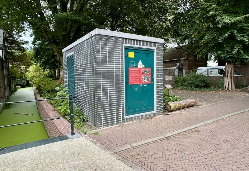
2. Een Historische Plek / A Historic Location Marker - wide view
Only the Jerusalem Chapel, added around 1500, has survived (on the right, at the corner of Patersteeg). The Collatie Brothers were driven out by the Geuzen in 1572–73 (and two of them were brutally murdered). The complex was taken over by the city's Masters of the Holy Spirit, who managed the grain stocks and oversaw the distribution of food to the poor, among other duties.
In 1601, the monastery church was converted into a cloth hall (where woven fabrics were inspected and sealed with a lead tag). Over the centuries, the Collatie House also served various other purposes, including use as a school, polling station, tax office, military clothing depot, and synagogue, and—in the early 20th century—as a garage.
In 1943, the complex was demolished to make way for a large new post office; however, that project never materialized. The demolition generated funds, which were used to restore the Catharinagasthuis—now Museum Gouda.
For decades thereafter, the site remained an overgrown green area, with a large municipal storage shed standing in its midst. Finally, in 2012, the current public garden
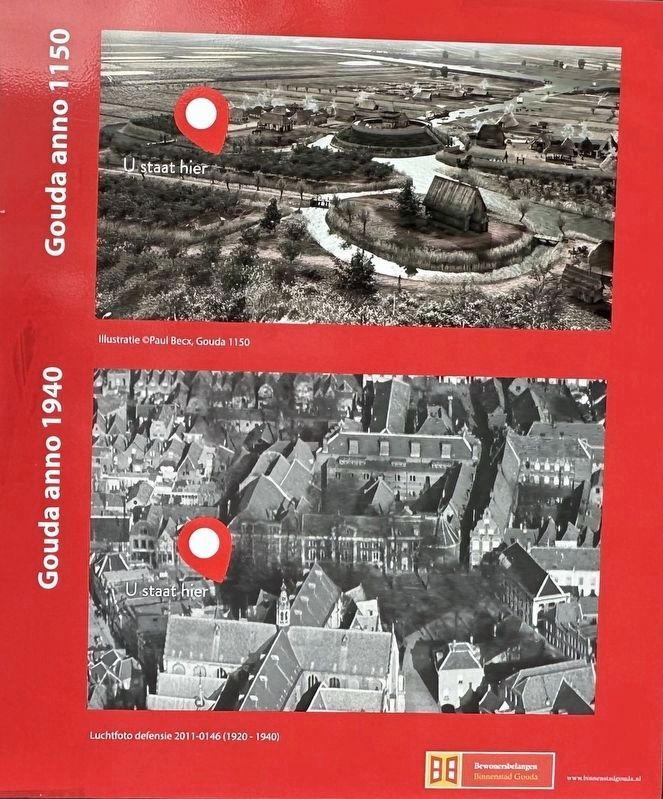
3. Marker photo, with you-are-here pins showing the location ca. 1150 and 1940
Topics. This historical marker is listed in these topic lists: Notable Places • Religion & Religious Structures. A significant historical year for this entry is 1425.
Location. 52° 0.667′ N, 4° 42.776′ E. Marker is in Gouda, Zuid-Holland (South Holland). It is at the intersection of Jeruzalemstraat and Raoul Wallenbergplantsoen, on the right when traveling north on Jeruzalemstraat. Touch for map. Marker is in this post office area: Gouda, Zuid-Holland 2806 CA, Netherlands. Touch for directions.

Regionally, it is in Europe, the European Union, Atlantic Europe, the Benelux Low Countries, the Schengen Area, Western Europe, and the Western World. Historically, it finds itself in what was once the Roman Empire and specifically also the Holy Roman Empire.
Other nearby markers. At least 8 other markers are within walking distance of this marker: Joods Poortje/Raoul Wallenbergplantsoen / Jewish Gate/Raoul Wallenberg Garden (here, next to this marker); Het Joodse Poort - Gouda Holocaust Memorial (a few steps from this marker); Ubi Bene, Ibi Patria (within shouting distance of this marker); Willem Vroesenhuis / William Vroesen House (within shouting distance of this marker); Weeshuis / Orphanage (within shouting distance of this marker); Arti Legi (about 150 meters away, measured in a direct line); De Sint-Jorisdoelen / The St. George Guildhall (about 150 meters away); Achter de Kerk / “Behind the Church” (about 150 meters away). Touch for a list and map of all markers in Gouda.
Credits. This page was last revised on September 25, 2026. It was originally submitted on September 25, 2026, by Andrew Ruppenstein of Lamorinda, California. This page has been viewed 9 times since then. Photos: 1, 2, 3. submitted on September 25, 2026, by Andrew Ruppenstein of Lamorinda, California.
