Sondernheim in Germersheim, Rhineland-Palatinate, Germany — Central Europe
Marktstraße
Photographed by James Hulse, September 15, 2026
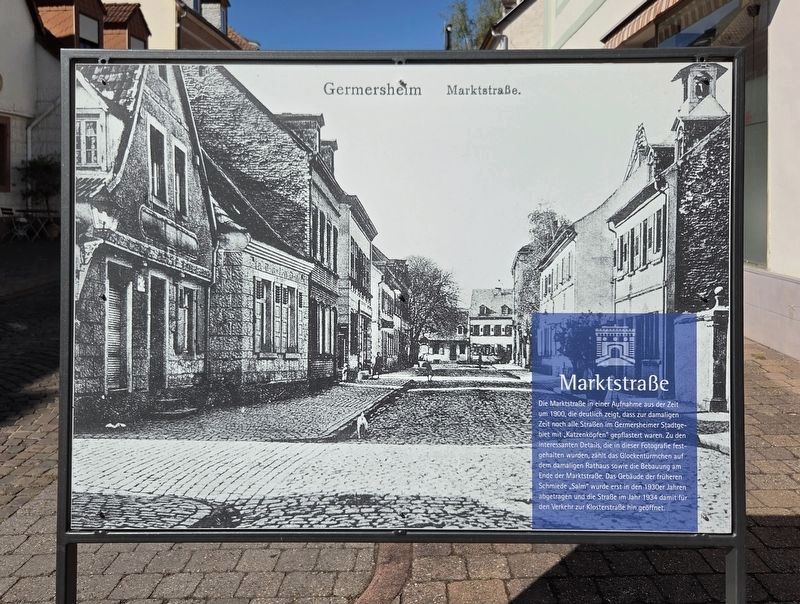
1. Marktstraße Marker - Front

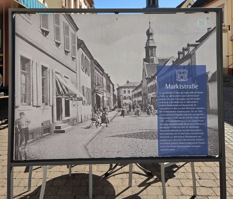
Zu den ältesten Straßen der Stadt zählt die Marktstraße, vor Jahrhunderten auch „Breite Gasse“ genannt. Bis zum Festungsbau und der Stadterweiterung in der Mitte des 19. Jahrhunderts bildeten Marktstraße und Hauptstraße die Hauptachsen in dem aus dem Mittelalter stammenden Germersheimer Straßensystem. Die um 1910 aufgenommene Fotografie zeigt eine von Geschäften gesäumte Straße, aus der sich die in den Jahren 1782–1784 erbaute Protestantische Kirche (heute: Versöhnungskirche) erhebt. An der Einmündung zur Hauptstraße ist das aus dem 18. Jahrhundert stammende Gebäude des heutigen Gesundheitsamts
this page online
This photograph of Market Street from around 1900 clearly shows that all the streets in Germersheim were still paved with rounded cobblestones known as “Katzenköpfe” at that time. Interesting details preserved in the photograph include the small bell tower on the former town hall and the buildings at the end of Market Street. The building that housed the former “Salm” blacksmith shop was not demolished until the 1930s. Its removal allowed the street to be opened to traffic toward Klosterstraße in 1934.
Market Street is one of the city’s oldest streets and was also known centuries ago as “Broad Lane.” Until the construction of the fortress and the expansion of the city in the mid-19th century, Market Street and Main Street formed the principal routes through Germersheim’s medieval street system. The photograph, taken around 1910, shows a street lined with businesses
Photographed by James Hulse, September 15, 2026
2. Marktstraße Marker - Reverse
Erected by City of Germersheim.
Topics. This historical marker is listed in this topic list: Notable Places. A significant historical year for this entry is 1900.
Location. 49° 13.207′ N, 8° 22.319′ E. Marker is in Germersheim, Rheinland-Pfalz (Rhineland-Palatinate). It is in Sondernheim. It is at the intersection of Marktstraße and Jakobstraße, on the right when traveling east on Marktstraße. Touch for map. Marker is at or near this postal address: Marktstraße 10, Germersheim RP 76726, Germany. Touch for directions.

Regionally, this marker is on the German Upper Rhine. Globally, it is in Europe, the European Union, Atlantic Europe, Central Europe, the Schengen Area, Western
Photographed by James Hulse
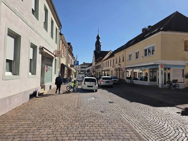
3. Marktstraße Marker
Looking towards the reverse side of the marker.
Other nearby markers. At least 8 other markers are within walking distance of this marker: Ehemaliges Rathaus / Former Town Hall (within shouting distance of this marker); Ludwigstor / Ludwig Gate (within shouting distance of this marker); Marktstraße und Schlossstraße (about 90 meters away, measured in a direct line); Elisabeth Mohr (about 120 meters away); Antonie 'Toni' Mohr (about 120 meters away); Otto Mohr (about 120 meters away); Wilhelmina Mohr (about 120 meters away); Octroi-Häuschen / Octroi Toll House (about 150 meters away). Touch for a list and map of all markers in Germersheim.
Photographed by James Hulse
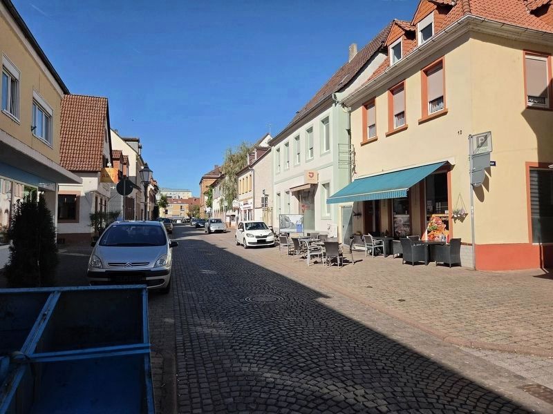
4. Marktstraße Marker
Looking at the front side of the marker.
Credits. This page was last revised on September 26, 2026. It was originally submitted on September 25, 2026, by James Hulse of Medina, Texas. This page has been viewed 5 times since then. Photos: 1, 2, 3, 4. submitted on September 26, 2026, by James Hulse of Medina, Texas.
