Sondernheim in Germersheim, Rhineland-Palatinate, Germany — Central Europe
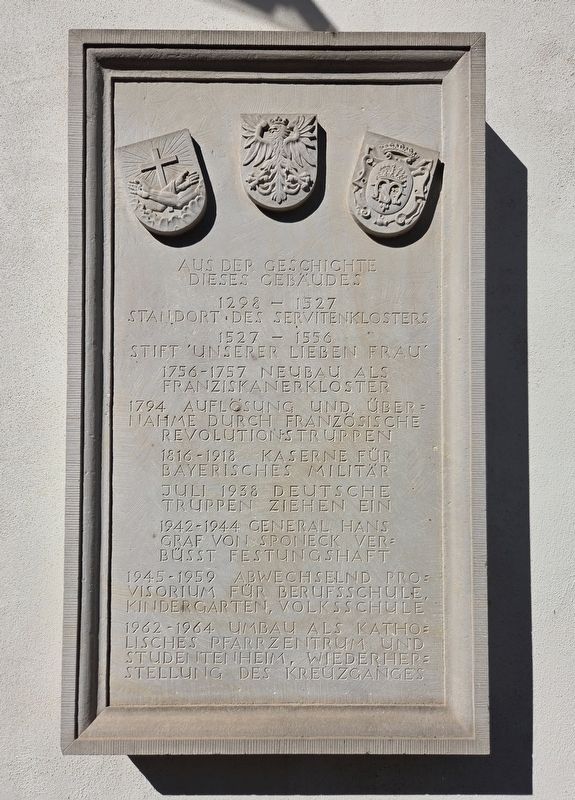
Aus der Geschichte dieses Gebäudes
⎯⎯⎯
History of this Building
Photographed by James Hulse, September 15, 2026
1. Aus der Geschichte dieses Gebäudes / History of This Buildin Marker

1527–1556 Stift 'Unserer Lieben Frau'.
1756–1757 Neubau als Franziskanerkloster.
1794 Auflösung und Übernahme durch französische Revolutionstruppen.
1816–1918 Kaserne für bayerisches Militär.
Juli 1938 Deutsche Truppen ziehen ein.
1942–1944 General Hans Graf von Sponeck verbüsst Festungshaft.
1945–1959 abwechselnd Provisorium für Berufsschule, Kindergarten, Volksschule.
1962–1964 Umbau als katholisches Pfarrzentrum und Studentenheim, Wiederherstellung des Kreuzganges.
From 1298 to 1527, this was the site of a Servite monastery. From 1527 to 1556, it housed the 'Our Lady' religious foundation. It was rebuilt as a Franciscan monastery in 1756–1757. In 1794, the monastery was dissolved and taken over by French Revolutionary troops. It served as barracks for Bavarian troops from 1816 to 1918, and German troops moved in during July 1938. General Hans Graf von Sponeck was held here as a military prisoner from 1942 to 1944. Between 1945 and 1959, the building served at various times as temporary accommodation for a vocational school, kindergarten, and primary school. From 1962 to 1964, it was converted into a Catholic parish center and student residence, and the cloister was restored.
Topics. This historical marker is listed in this topic list: Notable Buildings. A significant historical month for this entry is July 1938.
Location. 49° 13.15′ N, 8° 22.237′ E. Marker is in Germersheim, Rheinland-Pfalz (Rhineland-Palatinate). It is in Sondernheim. It is at the intersection of Eugen-Sauer-Straße and Kirchenpl., on the right when traveling east on
this page online

Regionally, this marker is on the German Upper Rhine. Globally, it is in Europe, the European Union, Atlantic Europe, Central Europe, the Schengen Area, Western Europe, and the Western World. Historically, it finds itself in what was once the Roman Empire, the Holy Roman Empire, and the former West Germany.
Other nearby markers. At least 8 other markers are within walking distance of this marker: Ehemaliges Rathaus / Former Town Hall (about 120 meters away, measured in a direct line); Rue de la Poste / Oberamtstraße (about 120 meters away); Jüdische Synagoge / Jewish Synagogue (about 150 meters away); Marktstraße (about 150 meters away); Stadthaus / Municipal Building (about 150 meters away); Ludwigstor / Ludwig Gate (about 180 meters away); Marktstraße und Schlossstraße (about 210 meters away); Wilhelmina Mohr (about 210 meters away). Touch for a list and map of all markers in Germersheim.
Photographed by James Hulse
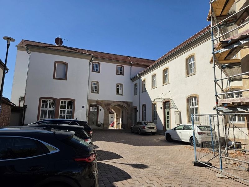
2. Aus der Geschichte dieses Gebäudes / History of this Building Marker
The marker is located on the right side of the front dooor.
Credits. This page was last revised on September 26, 2026. It was originally submitted on September 25, 2026, by James Hulse of Medina, Texas. This page has been viewed 6 times since then. Photos: 1, 2. submitted on September 26, 2026, by James Hulse of Medina, Texas.
