Downtown South in Las Vegas in Clark County, Nevada — The American Mountains (Southwest)
Green Shack
Photographed by Bill Kirchner, September 26, 2011
1. Green Shack Marker
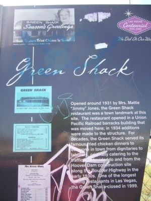
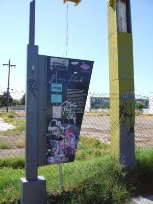
Opened around 1931 by Mrs. Mattie "Jimmy" Jones, the Green Shack restaurant was a town landmark at this site. The restaurant opened in a Union Pacific Railroad barracks building that was moved here; in 1934 additions were made to the structure. For decades, the Green Shack served its famous fried chicken dinners to everyone in town from dignitaries to laborers, originally catering to the traffic that headed to and from the Hoover Dam construction site along the Boulder Highway in the early 1930s. One of the longest lasting restaurants in Las Vegas, the Green Shack closed in 1999.
Erected 2005 by The Commission for the Las Vegas Centennial.
Topics. This historical marker is listed in these topic lists: Food & Drink • Industry & Commerce • Landmarks. A significant historical year for this entry is 1931.
Location. 36° 9.462′ N, 115° 6.922′ W. Marker is in Las Vegas, Nevada, in Clark County. It is in Downtown South. It is on East Fremont Street 0.1 miles east of East Charleston Boulevard, on the right when traveling east. Touch for map. Marker is at or near this postal address: 2512 E Fremont St, Las Vegas
this page online

Regionally, this marker is in the Mojave Desert. It is also in the American Southwest and in the Mountain West. Globally, it is in North America, the Western Hemisphere, the Western World, and the Anglosphere. Historically, it finds itself in what was once New Spain and also Mexico’s Alta California.
Other nearby markers. At least 8 other markers are within 2 miles of this marker, measured as the crow flies: The Huntridge Neighborhood (approx. 1.2 miles away); The Morelli House (approx. 1.4 miles away); Las Vegas High School (approx. 1½ miles away); History of the "Senior Squares" (approx. 1½ miles away); Las Vegas High School / Las Vegas High School Neighborhood (approx. 1½ miles away); Original Homesite of a Las Vegas Pioneer: Charles 'Pop’ Squires (approx. 1½ miles away); Mary Dutton Park (approx. 1.6 miles away); Birth of Downtown Las Vegas (approx. 1.6 miles away). Touch for a list and map of all markers in Las Vegas.
Photographed by Bill Kirchner, September 26, 2011
2. Green Shack Marker
Photographed by Bill Kirchner, September 26, 2011
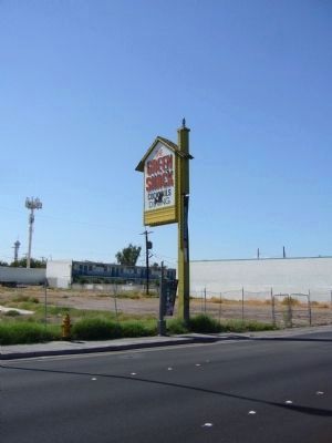
3. Green Shack Marker and Sign
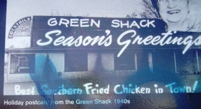
circa 1940s
4. Photo on Green Shack Marker
Photo Caption: Holiday postcard from the Green Shack 1940s
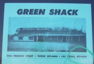
5. Photo on Green Shack Marker
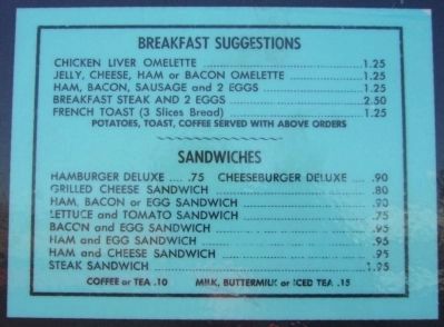
6. Photo on Green Shack Marker
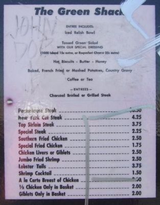
7. Photo on Green Shack Marker
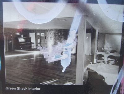
8. Photo on Green Shack Marker
Credits. This page was last revised on September 28, 2026. It was originally submitted on October 5, 2011, by Bill Kirchner of Tucson, Arizona. This page has been viewed 1,316 times since then and 35 times this year. Last updated on September 26, 2026, by Trudi Jacobson of Slingerlands, New York. Photos: 1, 2, 3, 4, 5, 6, 7, 8. submitted on October 5, 2011, by Bill Kirchner of Tucson, Arizona. • Devry Becker Jones was the editor who published this page.
