Charles City in Charles City County, Virginia — The American South (Mid-Atlantic)
Westover
What am I but an American?
| — | Road to Revolution | — |
Photographed by Evan Dwyer, September 26, 2026
1. Westover Marker
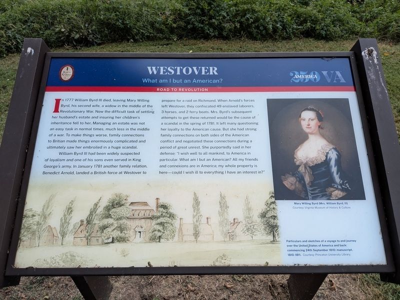
William Byrd III had been widely suspected of loyalism and one of his sons even served in King George's army. In January 1781 another family relation, Benedict Arnold, landed a British force at Westover to prepare for a raid on Richmond. When Arnold's forces left Westover, they confiscated 49 enslaved laborers, 3 horses, and 2 ferry boats. Mrs. Byrd's subsequent attempts to get these returned would be the cause of a scandal in the spring of 1781. It left many questioning her loyalty to the American cause. But she had strong family connections on both sides of the American conflict and negotiated these connections during a period of great unrest. She purportedly said
this page online
Photo Captions:
Mary Willing Byrd (Mrs. William Byrd, III)
Courtesy Virginia Museum of History & Culture
Particulars and sketches of a voyage to and journey over the United States of America and back: commencing 24th September 1810: manuscript, 1810-1811. Courtesy Princeton University Library.
Erected by Road to Revolution Heritage Trail (Civil War Trails, Inc.).
Topics and series. This historical marker is listed in these topic lists: Patriots & Patriotism • War, US Revolutionary. In addition, it is included in the Road to Revolution Heritage Trail series list. A significant historical year for this entry is 1781.
Location. 37° 18.652′ N, 77° 9.068′ W. Marker is in Charles City, Virginia, in Charles City County. It is on Westover Road (Virginia Route 633) 1.9 miles east of Harrison Landing Road, on the left when traveling south. Marker is at the visitor's entrance to the grounds of Westover Plantation/Farm.
Photographed by Evan Dwyer, September 26, 2026
2. Westover Marker
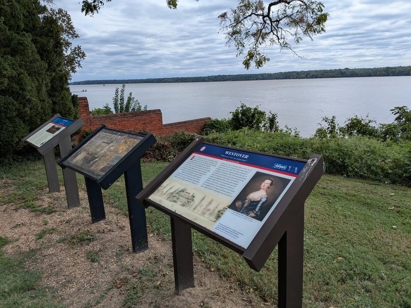
Context view. It is the newest of the three markers placed at Westover's west gate. The brick wall beyond marks the beginning of the home's front yard.

Regionally, this marker is in Coastal Virginia. It is also in the American South, specifically in the Upper South, in the Tidewater, and on the Eastern Seaboard. Globally, it is in the North Atlantic Region, North America, the Western Hemisphere, the Western World, and the Anglosphere. Historically, it finds itself in what was once the territory of the Mississippian Culture, one of the original Thirteen Colonies, one of the Confederate States of America, and the Antebellum South.
Other nearby markers. At least 8 other markers are within 2 miles of this marker, measured as the crow flies: Westover Plantation (here, next to this marker); a different marker also named Westover (here, next to this marker); Richmond Condita (about 300 feet away, measured in a direct line); Westover Church (approx. 1½ miles away); Benjamin Harrison (approx. 1½ miles away); Col. Benjamin Harrison V (approx. 1½ miles away); Signer Monument (approx. 1½ miles away); Willie Johnston (approx. 1.6 miles
Photographed by Evan Dwyer, September 26, 2026
3. Westover Marker
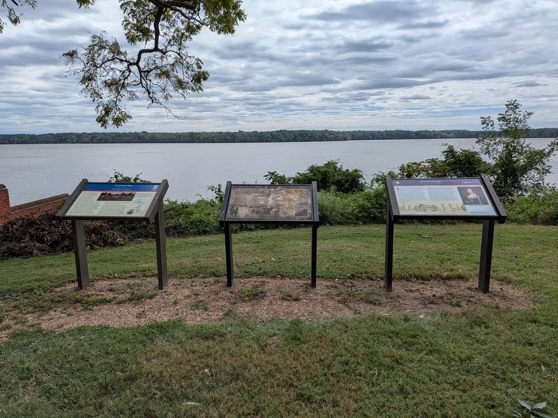
At far right. The James River is beyond, with Maycox in the background across the river (now a wildlife preserve rather than a plantation). In traveling from Petersburg to Richmond, the British force under General Charles Cornwallis ferried across the James River to Westover from the base of the bluffs at Maycox (also known as Maycock's Point) in late May 1781.
Another marker is no longer nearby. Evelynton (was approx. 1.4 miles away but has been replaced with another marker now near it).
More about this marker. The second caption seems to be entirely a source attribution - the image it accompanies is a drawing of the Byrd's house at Westover in the period 1810-11.
Regarding Westover. Of note, Arnold was not the only British General to visit Westover. General William Phillips, who later died in Petersburg, landed at the site on his way to City Point in April 1781. General Charles Cornwallis also made the grounds his camp after crossing from Maycox on 25-26 May 1781.
Photographed by Evan Dwyer, September 26, 2026
4. Westover
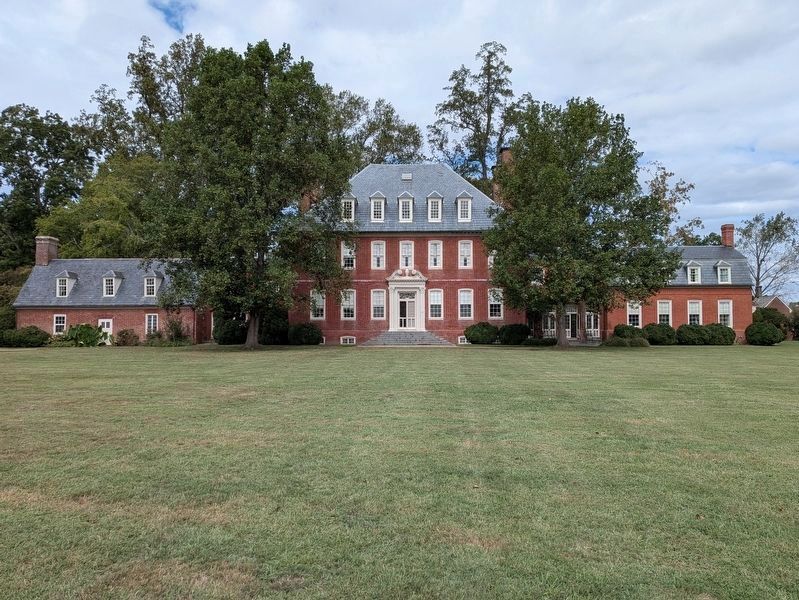
The center and west (left) wing predate the Revolutionary period described in the marker. The east wing and the two hyphens connecting the wings to the original main house were constructed between the end of the Civil War and the 1920s. The east wing (at right) replaced an outbuilding that was originally identical to the west wing, which burned down due to Confederate artillery during the Civil War.
Credits. This page was last revised on September 26, 2026. It was originally submitted on September 26, 2026, by Evan Dwyer of Richmond, Virginia. This page has been viewed 7 times since then. Photos: 1, 2, 3, 4. submitted on September 26, 2026, by Evan Dwyer of Richmond, Virginia.
