Harrisonville in Cass County, Missouri — The American Midwest (Upper Plains)
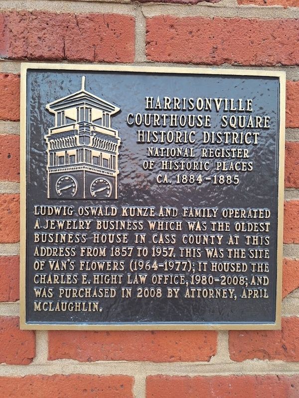
Harrisonville Courthouse Square Historic District
National Register of Historic Places
| — | Ca. 1884-1885 | — |
Photographed by Jason Voigt, September 20, 2026
1. Harrisonville Courthouse Square Historic District Marker
Ludwig Oswald Kunze and family operated a jewelry business which was the oldest business house in Cass County at this address from 1857 to 1957. This was the site of Van's Flowers (1964-1977); it housed the Charles E. Hight law office, 1980-2008; and was purchased in 2008 by attorney, April McLaughlin.
Topics. This historical marker is listed in this topic list: Industry & Commerce. A significant historical year for this entry is 1857.
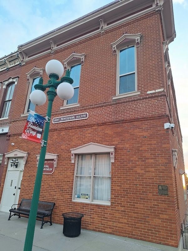
Location. 38° 39.29′ N, 94° 20.931′ W. Marker is in Harrisonville, Missouri, in Cass County. It is on South Independence Street. Touch for map. Marker is at or near this postal address: 100 S Independence St, Harrisonville MO 64701, United States of America. Touch for directions.

Regionally, this marker is in Greater Kansas City. It is also in the American Midwest, in the Lewis & Clark Corridor, in the Corn Belt, and on the Santa Fe Trail Corridor. Globally, it is in North America, the Western Hemisphere, the Western World, and the Anglosphere. Historically, it finds itself in what was once the territory of the Mississippian Culture, the Louisiana Purchase, and the Antebellum
this page online
Other nearby markers. At least 8 other markers are within 2 miles of this marker, measured as the crow flies: Cass County (within shouting distance of this marker); Harrisonville WWI Memorial (within shouting distance of this marker); General Order No. 11 (within shouting distance of this marker); United We Stand Divided We Fall (within shouting distance of this marker); Jennison’s Jayhawks raid Harrisonville Square (about 300 feet away, measured in a direct line); Jefferson Highway (approx. half a mile away); Lest We Forget (approx. 0.9 miles away); The Burnt District Monument (approx. 1.1 miles away). Touch for a list and map of all markers in Harrisonville.
Also see . . . Harrisonville Courthouse State Historic District. (Submitted on September 27, 2026, by Jason Voigt of Glen Carbon, Illinois.)
Photographed by Jason Voigt, September 20, 2026
2. Harrisonville Courthouse Square Historic District Marker
Credits. This page was last revised on September 27, 2026. It was originally submitted on September 27, 2026, by Jason Voigt of Glen Carbon, Illinois. This page has been viewed 7 times since then. Photos: 1, 2. submitted on September 27, 2026, by Jason Voigt of Glen Carbon, Illinois.
