Whitchurch in Shropshire, England, United Kingdom — Northwestern Europe (the British Isles)
Walks around Whitchurch
Photographed by Ray Gurganus, May 18, 2026
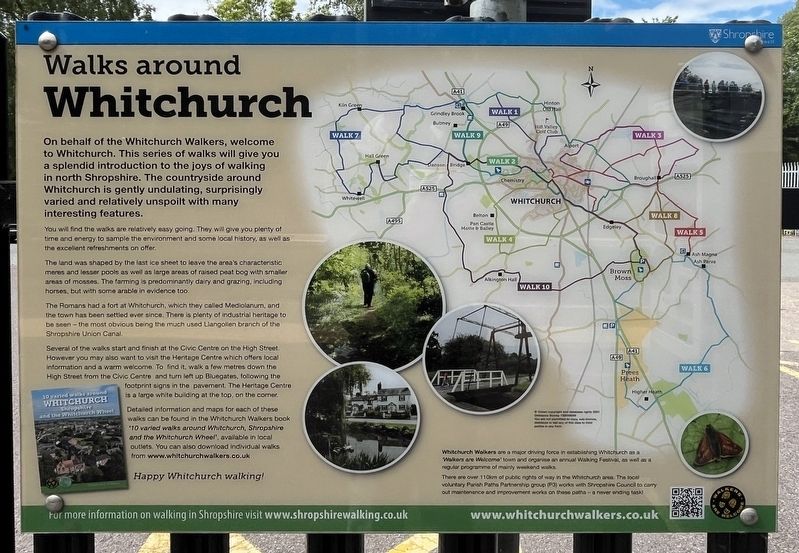
1. Walks around Whitchurch Marker
You will find the walks are relatively easy going. They will give you plenty of time and energy to sample the environment and some local history, as well as the excellent refreshments on offer.
The land was shaped by the last ice sheet to leave the area's characteristic meres and lesser pools as well as large areas of raised peat bog with smaller areas of mosses. The farming is predominantly dairy and grazing, including horses, but with some arable in evidence too.
The Romans had a fort at Whitchurch, which they called Mediolanum, and the town has been settled ever since. There is plenty of industrial heritage to be seen the most obvious being the much used Llangollen branch of the Shropshire Union Canal.
Several of the walks start and finish at the Civic Centre on the High Street. However you may also want to visit the
this page online
Detailed information and maps for each of these walks can be found in the Whitchurch Walkers book 10 varied walks around Whitchurch, Shropshire and the Whitchurch Wheel, available in local outlets. You can also download individual walks from.www.whitchurchwalkers.co.uk
Happy Whitchurch walking!
Erected by Whitchurch Walkers.
Topics. This historical marker is listed in this topic list: Notable Places.
Location. 52° 58.08′ N, 2° 40.307′ W. Marker is in Whitchurch, England, in Shropshire. It is on Station Road. The marker is located at the Whitchurch railway station. Touch for map. Marker is at or near this postal address: 32 Station Road, Whitchurch, England SY13 1RL, United Kingdom. Touch for directions.

Regionally, this marker is in the Midlands. It is also on the British Marches. Globally, it is on the Atlantic Ocean, in the North Atlantic Region, in Europe, in Atlantic Europe, on one of the British Isles, in the Western World, and in the Anglosphere. Historically, it finds itself in what was once the Roman Empire.
Other nearby markers. At least 6 other markers are within 16 kilometers of this marker, measured as the crow flies: Welcome to Whitchurch (within shouting distance of this marker); History on the Spot (approx. 0.8 kilometers away); Life in 18th & 19th century Whitchurch (approx. 0.8 kilometers away); a different marker also named History on the Spot (approx. 0.9 kilometers away); Whitchurch Road Cemetery (approx. 12.3 kilometers away); The Great Church of St Mary's (approx. 14.9 kilometers away).
Credits. This page was last revised on September 28, 2026. It was originally submitted on September 27, 2026, by Ray Gurganus of Washington, District of Columbia. This page has been viewed 4 times since then. Photo 1. submitted on September 27, 2026, by Ray Gurganus of Washington, District of Columbia. • Andrew Ruppenstein was the editor who published this page.
Editor’s want-list for this marker. photo of the marker within its surroundings • Can you help?
